Rain/Snow mix starts late tonight and goes into the beginning of the work week
TONIGHT: Snow showers will be scattered throughout the region late tonight starting around 9/10pm and should continue into the overnight hours. Winds will be mostly light between 5-15 mph for most of the region with some gusts up to 30 mph. Low temperatures get down to the 20's.
TOMORROW: Snow showers will be present throughout the mountains for most of the day. We will see most of the snow showers become rain showers by lunch time and those should continue into the afternoon. High temperatures get into the upper 30's and lower 40's.
LONG TERM: Scattered valley rain showers and mountain snow showers carry over into Tuesday before we have more mountain and valley snow showers on Wednesday. By the end of Wednesday, we should see less than an inch of snow in the Magic Valley, about an inch or two of snow in the lower Snake River Plain, 2 to 6 inches of snow for the Upper Snake River Plain, and about a foot to a foot and a half of snow across the mountains of western WY, the Continental Divide, and central ID. Isolated and stray bits of snow showers are left for Thursday and Friday before we look to dry up in time for next weekend. Winds should be slightly breezy between 10-25 mph on Wednesday and Thursday, but overall, winds look to be light. High temperatures stay in the upper 30's and lower 40's for one more day on Tuesday before dropping back into the low 30's for the second half of the week and into next weekend.
WATCHES/WARNINGS:
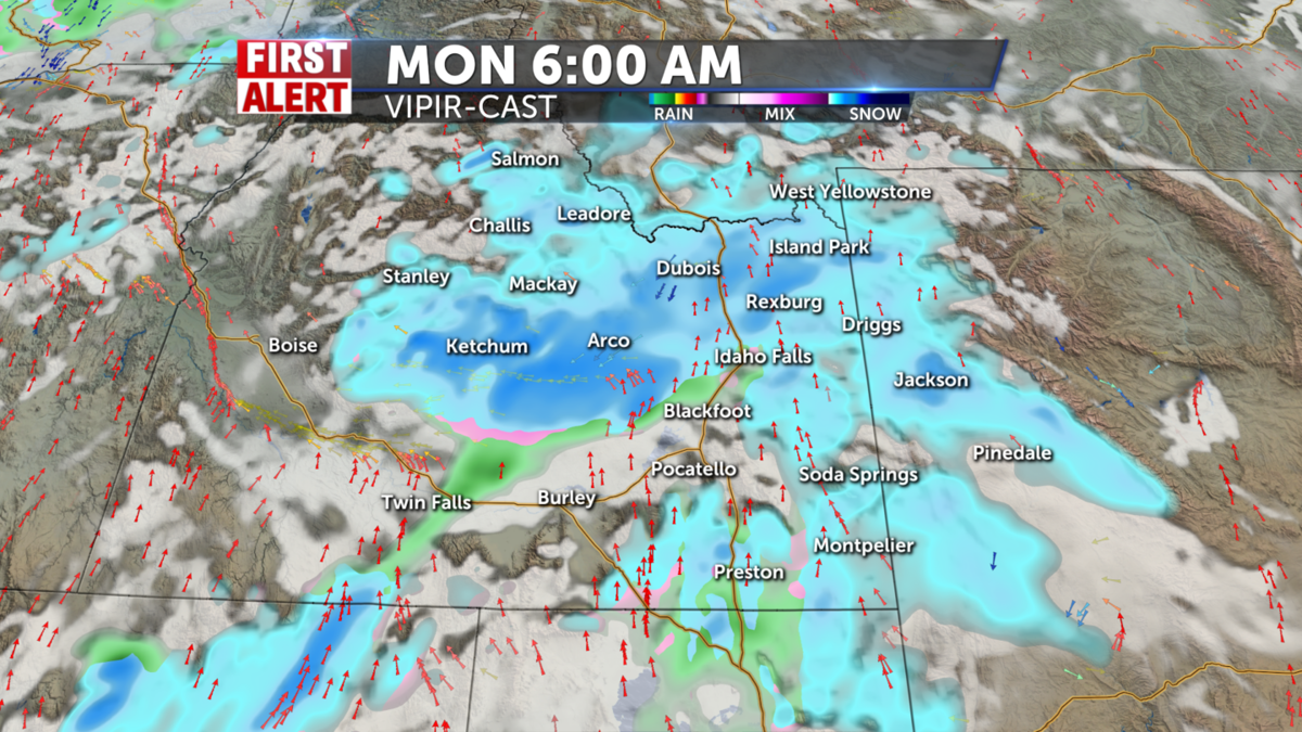
WINTER STORM WARNING REMAINS IN EFFECT FROM 8 PM THIS EVENING TO 11 AM MST MONDAY for Sun Valley Region, Wood River Foothills, and Big Lost Highlands.
WINTER WEATHER ADVISORY IN EFFECT FROM 11 PM THIS EVENING TO 5 PM MST MONDAY for The Bear River Range and Big Hole Mountains, Arco/Mud Lake Desert and Lost River Range/Valley, Centennial Mountains, including but not limited to Mud Lake, INL, Craters of the Moon NM, Howe, Arco, Mackay, Chilly, Island Park, Dubois, Spencer, and Small.
WINTER WEATHER ADVISORY IN EFFECT FROM 11 PM THIS EVENING TO 11 PM MST MONDAY for Jackson Hole.
WINTER WEATHER ADVISORY IN EFFECT FROM 5 AM MONDAY TO 5 AM MST TUESDAY for Teton mountains and Yellowstone National Park.
BACKCOUNTRY AVALANCHE WARNING which is in effect until 5:30 AM MST Monday for Centennial mountains in Island Park.
BACKCOUNTRY AVALANCHE WATCH which is in effect until 4 AM MST Monday for The Pioneer, Boulder, Smoky, and Soldier Mountains, including the mountains near Galena Summit, Trail Creek Summit, Smiley Creek, Ketchum, Hailey, Bellevue, Carey, and Fairfield.
WIND ADVISORY IN EFFECT FROM 3 PM THIS AFTERNOON TO 11 AM MST MONDAY for The Southern Hills, Albion Hills, and Raft River region including but not limited to the cities of Albion, Almo, Malta, Rockland, and Holbrook.


