Severe storms threaten to bring more damage to the Ohio and Mississippi valleys today

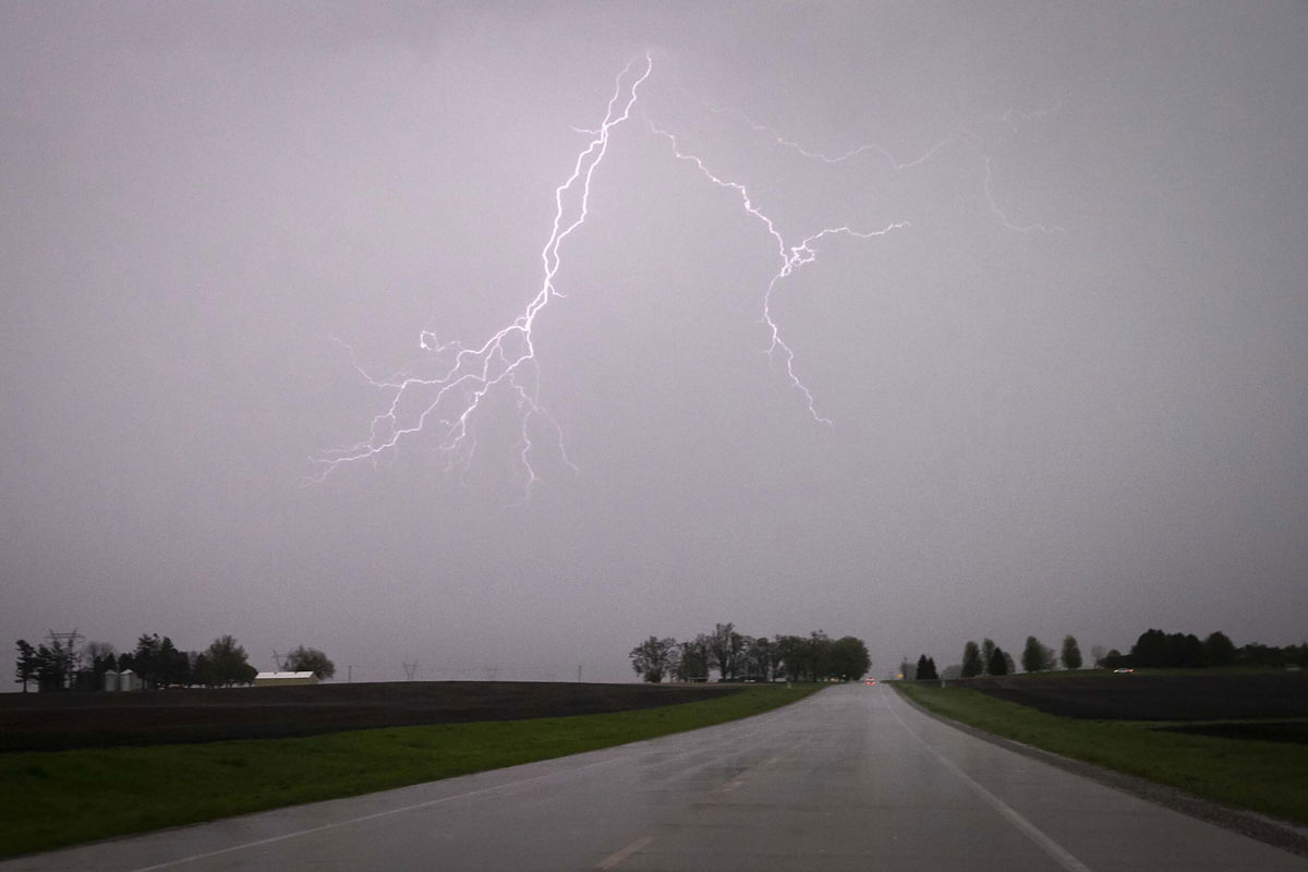
Lightning streaks across the sky Sunday during a severe thunderstorm near Lone Tree
By Haley Brink, CNN Meteorologist
Spring’s severe weather season is in full bloom across the Midwest and Southern and Central Plains.
Over the weekend, more than 400 severe storm reports were recorded across the region, including hurricane-force wind gusts, hail the size of softballs, and a few tornadoes.
Thousands of people lost power Sunday morning after severe thunderstorms, which spawned two EF-1 tornadoes across southern Indiana, moved through the region. Duke Energy reported 17 poles were broken in Floyd and Clark counties during the storm.
Some of the same areas are at risk of seeing intense severe storms again today.
A Level 2 of 5 risk for severe storms has been issued across portions of the Mississippi and Ohio valleys where the main threats will be damaging winds and large hail. Some cities under threat today include St. Louis; Indianapolis; Cincinnati; Nashville, Tennessee; and Louisville, Kentucky.
Severe storms were already ongoing across this morning, causing more than 10,000 customers to lose power across Illinois, according to PowerOutage.us. More rounds of severe weather are expected later today.
This afternoon, storms will initially bring the threat of large hail the size of golf balls or greater, before transitioning into a damaging wind threat through the evening.
And although the severe storm environment is not favorable for tornado development, “there may still be an opportunity for a tornado or two with any supercell that can be sustained,” the Storm Prediction Center warned.
Ridge-riding storms
The storms on Monday are following a similar path to storms over the weekend.
An upper-level ridge of high pressure has settled in over the Gulf of Mexico and portions of the southern US. Under the area of high pressure, storms have trouble developing or sustaining severe levels due to sinking air, which inhibits thunderstorm growth. So instead, thunderstorms tend to “ride” or travel along the edges of the ridge, in this case impacting the Midwest and Ohio Valley.
Ridge-riding storms tend to affect the same areas over and over until the high pressure weakens or moves. And unfortunately for some areas where the stubborn pattern has been in place for the last few days, it is not expected to shift until the middle of the week or later.
“Training storms,” as meteorologists call them, bring the threat of flooding as heavy rain falls over already saturated soils.
The Weather Prediction Center has highlighted a large portion of the Midwest and Ohio Valley for flooding Monday, as they expect hourly rainfall totals of two inches per hour, with localized rainfall rates as high as 4 inches possible.
A flash flood watch is currently in effect for the city of Springfield, Illinois, until Tuesday morning due to flooding caused by an upstream dam release after heavy rain fell over the weekend.
Heavy rainfall of 3 to 7 inches fell Sunday across western and southern portions of Sangamon County, across the Lake Springfield watershed, which caused rapid rises on the lake, according to the National Weather Service office in Lincoln, Illinois.
Widespread additional rainfall totals of 1 to 2 inches are forecast across the Midwest and Ohio Valley through Tuesday.
Summerlike heat
Another byproduct of the high-pressure ridge is heat, building across the southern and central states.
“Temperature-wise, the warmest temperatures compared to normal will be most commonly found in the Nation’s Heartland and across the South,” the Weather Prediction Center said. “It will feel more like June from the southern High Plains to the Southeast coast through Tuesday as daytime high temperatures between 5 to 15 degrees above normal.”
High temperatures in the 90s will be felt across portions of Texas today and widespread 80-degree high temperatures will spread from the central Plains, across the Gulf Coast and into the mid-Atlantic.
By Tuesday, 90-degree temperatures will continue across portions of Texas and expand into Florida, Georgia, and the Carolinas.
The heat will ease slightly by Wednesday, but above normal temperatures will persist across much of the eastern US through the end of the week.
The-CNN-Wire
™ & © 2023 Cable News Network, Inc., a Warner Bros. Discovery Company. All rights reserved.
