Dry and Cool Weekend Conditions
High pressure will dominate this weekend, bringing a slight warming trend, light winds, and dry weather.
Early Saturday will have low stratus clouds in the atmosphere, allowing patchy fog to develop, along with light snow and flurries from the low stratus. The temperature in the Snake River Plain will drop to around 20°, with light winds. Average temperatures will peak in the 20s for the Eastern Idaho region.
Saturday morning may continue to have fog, but skies will clear to mostly sunny by afternoon. Highs will be in the lower 30s, with southwest winds of 5-10 mph. Overnight lows will return to the mid-teens.

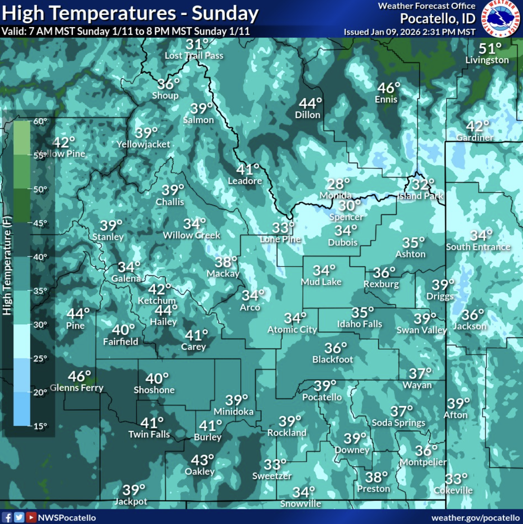
Sunday will be mostly sunny with highs around 35°, and winds will be calm or up to 5 mph from the north. Monday and Tuesday are expected to be warmer than usual for this time of year, with highs in the upper 30s to low 40s, mostly sunny.
A high-pressure system has moved inland from the west coast, and its ridge will sit near us moving into the bulk of next week. Wet weather will wrap around our region and move north past us. We will continue to experience above-average temperatures this week while a high-pressure dome remains over our area. We will also have drier weather, with no major snowstorms on the horizon.


