Windy Winter storm conditions expected through Tuesday morning
Scattered snow showers are expected to pass through the region with very windy conditions starting in the late evening hours tonight, continuing into the entire day on Monday, and finally disappearing during the day on Tuesday. This could create dangerous blowing snow conditions across the region during that span which could cause road closures.
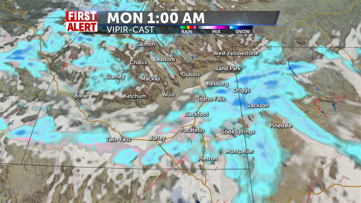
We are already starting to see some snow showers Sunday afternoon in the highlands east of the Snake River Plain and around Salmon by the Lost Trail Pass. Snow showers are expected to start around more towards the Continental Divide and the Upper Snake River Plain in the evening before it spreads to most of the region for the late evening hours. Rounds of moderate and heavy snow showers continue to roll into the region well into the overnight hours. Monday will look to be a whiteout day as more snow showers continue especially across Teton Valley, Jackson Hole, the Upper Snake River Plain, SE Idaho, central ID and the highlands to the east of the Snake River Plain. The only areas we could see a lack of snow could be the Magic Valley and the Snake River Plain desert over to I-15 by Idaho Falls and Blackfoot. Isolated and stray snow showers are left on Tuesday morning before snow should be finally gone by Tuesday afternoon.
Snowfall accumulation looks to be a couple of inches for most of eastern ID and western WY. Over the next 48 hours up until Tuesday afternoon, the greatest snow totals will be likely across the Tetons, Jackson Hole, and Yellowstone with about 4 to 8 inches. Sun Valley, Lemhi County, Island Park, the southern highlands, and SE Idaho are looking at about 2 to 4 inches. The biggest question mark for snowfall accumulation looks to be for the Snake River Plain. In this area, some models are calling for only a half an inch of snow while others are looking at the Snake River Plain getting 4 inches. The Snake River Plain desert and Magic Valley are projected to only get about a half an inch of snow if that.
Gusty winds are expected across the region during this entire time up into Tuesday. Winds on Sunday have already ramped up to be between 15-25 mph and are expected to stay that way until Tuesday morning. Wind gusts could get as high as 45 mph especially in the Upper Snake River Plain. This is what could create blowing snow across the region and reduce visibility a lot along our roadways. Road closures COULD happen along the Teton Pass and roads east of the Snake River Plain. Regardless, please drive carefully through the region for the next few days!
WATCHES/WARNINGS:
WINTER STORM WARNING REMAINS IN EFFECT UNTIL 11 AM MST TUESDAY for the eastern and southeastern highlands, from the Montana border to north of Bear Lake Basin. This includes the towns of Wayan,Swan Valley, Victor, Ashton, Tetonia, Driggs, Island Park, Kilgore, and the Bear River Range of mountains, including Emigration Summit.
WINTER STORM WARNING REMAINS IN EFFECT UNTIL 5 PM MST MONDAY for Teton and Gros Ventre Mountains, and Yellowstone National Park.
WINTER WEATHER ADVISORY REMAINS IN EFFECT UNTIL 5 AM MST TUESDAY for the central Idaho mountains surrounding Stanley basin and the Wood River Valley. This includes the towns of Stanley, Ketchum, Sun Valley, and Galena.
WINTER WEATHER ADVISORY REMAINS IN EFFECT UNTIL 9 AM MST MONDAY for Shoup, Bannock Pass, Highway 28 Tendoy to Lone Pine, Highway 93 Lost Trail Pass to Gibbonsville, Lemhi Pass, and Salmon.
WINTER WEATHER ADVISORY IN EFFECT UNTIL 5 PM MST MONDAY for Jackson Hole.


