FIRE WATCH: Latest information on area wildfires
LATEST INFORMATION
The information below comes from fire managers daily updates.
RED ROCK FIRE
(UPDATED 10/18/2024)
Fire Size: 77,879 acres
Containment: 19%
Personnel: 616
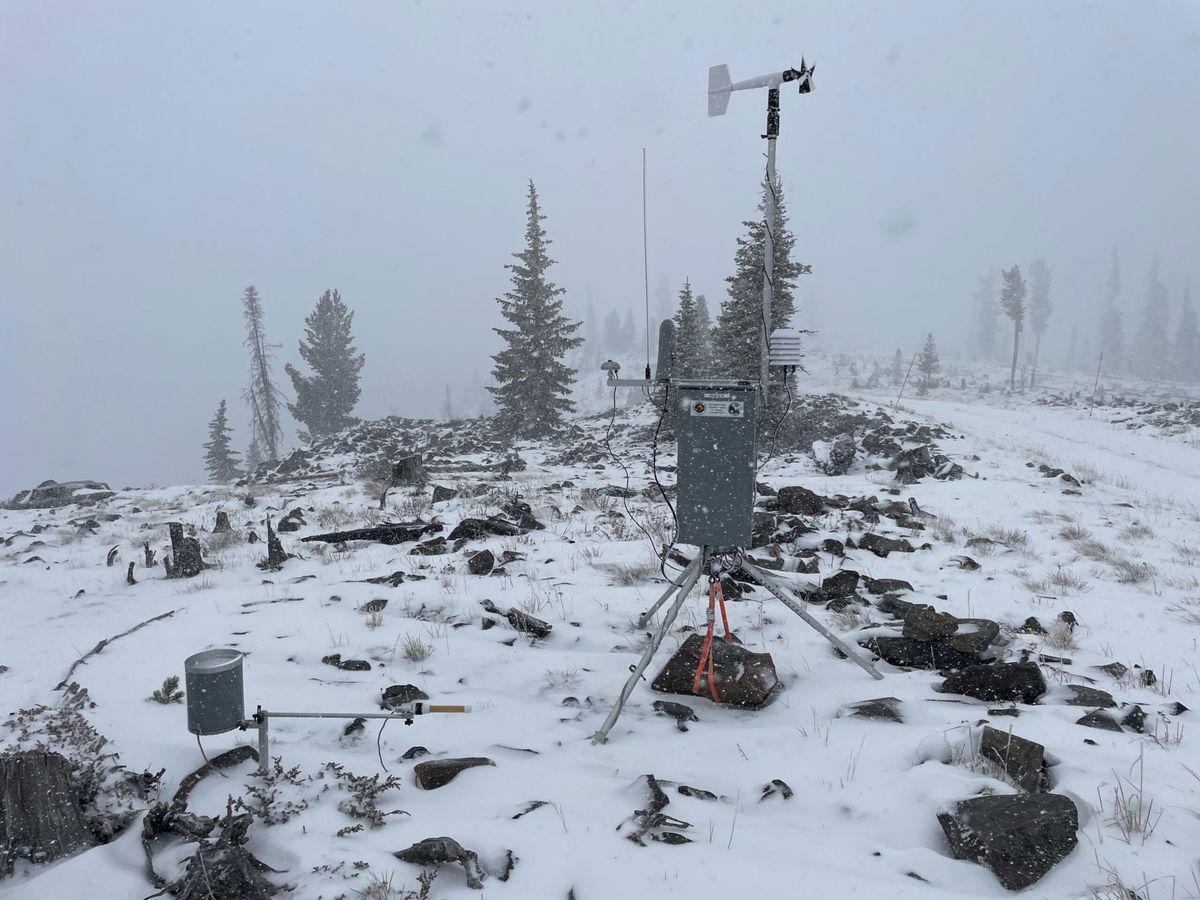
Operations: Precipitation significantly reduced fire behavior, although heat remains in heavy fuels like logs, stumps, and trees, with flames still showing in some areas. Salt Creek is currently the area of most concern as it didn’t get much rain before the snow and smoke remained visible. Due to snow over the fire areas, firefighters assessed and monitored the fire yesterday but did not actively engage. Today, access will remain limited due to snow, rain, and freezing temperatures, but crews will engage the fire where they can safely do so. They’ll continue to patrol and monitor the activity in Salt Creek and scout for additional secondary containment lines to the south. Fire managers will continue to assess needs on the Napias Creek Fire.
GARDEN FIRE
(Reported 10/18/2024)
Size: 10,716 acres
Containment: 1%
Personnel: 76
Operations: Precipitation significantly reduced fire behavior on the Garden Fire. Yesterday, crews patrolled the fire’s edge along the Salmon River and Panther Creek corridors. The spike camp along the Salmon River Road was dismantled, and crews will now operate from the Salmon Incident Command Post. Today, crews will continue to patrol, monitor, and act if necessary and safe. Fire managers will begin assessing repair work that needs to be done on handlines.
Evacuations: Lemhi County Law Enforcement, Emergency Management, and the Salmon-Challis National Forest have established three (3) evacuation zones for the Garden Fire.
Zone 1: From Cove Creek to Ebeneezer Bar, downriver along the Salmon River Road #030.
Zone 2: On Panther Creek Rd #055, a half mile south of Beaver Creek Rd #057 to the Salmon River Rd #030 confluence.
Zone 3: Panther Creek to Spring Creek to include private land up Spring Creek
- ZONE 1 is in “GO” status
- ZONE 2 is in “GO” status
- ZONE 3 IS IN "SET" STATUS
Information on evacuation status can be found on Lemhi County’s website, https://www.lemhicountyidaho.org/, under ‘News and Notices.’
PACK TRAIL FIRE
(Reported 10/18/2024)
Size: 89,186 acres
Containment: 62%
Personnel: 535
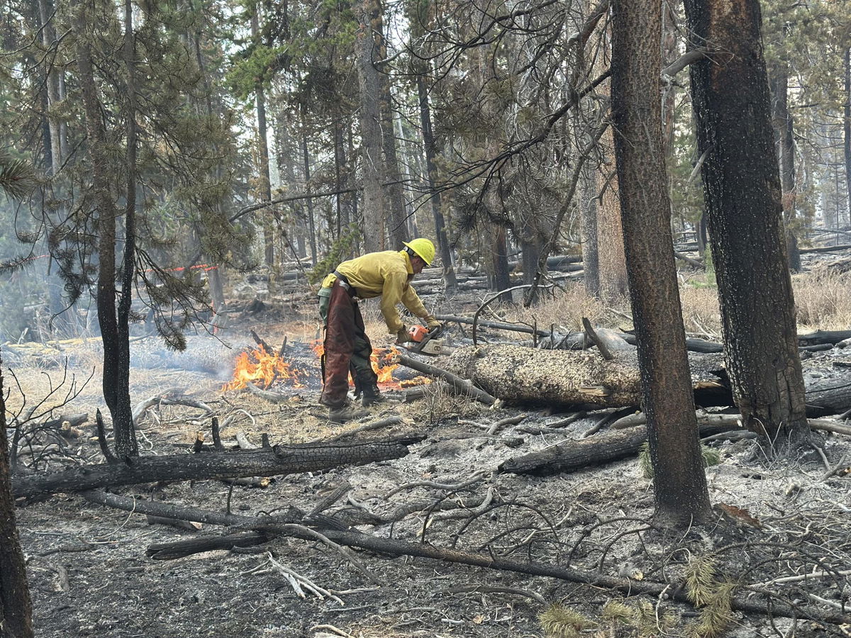
Operations – Thursday, the Pack Trail Fire received precipitation which greatly moderated fire behavior. The fire activity is minimal, however large diameter dead and down logs, stumps, and slash will continue to smolder within the interior of the fire. On the south side, crews accessed Union Pass Road utilizing Utility Task Vehicles (UTV) to scout and contain the fire’s edge. On the west flank, firefighters removed pumps and gas from the field to prevent freezing. These items are being staged nearby and can be reimplemented quickly if the fire situation changes. Due to the precipitation and hazards associated with driving on icy and muddy roads, most crews will stay at camp today to complete preventative maintenance on their equipment. Crews with UTVs will patrol the fire area, mopping up around the perimeter, focusing on areas with fine fuels, such as meadows and sagebrush.
Evacuations – Brooks Lake Lodge, Pinnacle Cabins, Falls Camp, and Long Creek have been reduced to a Level 2 “Set” Evacuation Warning. Level 3 “Go” evacuation orders remain in effect for Lava Mountain Lodge and McKenzie Highland Ranch. The Dunoir Road Corridor has been reduced to a Level 1 “Ready” Evacuation Warning. See theFremont County Emergency Management Facebook Page for alerts and updates. See the Teton County Emergency Management website updates and to sign up for emergency alerts through Everbridge.
Road Closures – The Union Pass Road is closed on the Pinedale District (BTNF) from Mosquito Lake to the DuNoir on the Wind River District (SHO).
Forest Closures - Closure Order #04-03-24-316 is in effect from October 9, 2024 at 12:00 p.m. through November 1, 2024 at 6:00 a.m. unless rescinded. This order supersedes previous orders, including #04-03-24-315, prohibiting the same or similar acts in the same described area.
(Reported 10/17/2024 6:48 p.m.)
Size: 3,900 acres
Containment:
Personnel: 74
Located: Approximately 10 miles southwest of Lyons Bridge on HWY 287 in the Meridian Creek Drainage of the Beaverhead-Deerlodge National Forest.
*** This will be the last formal update for the Meridian Fire; future updates will be dictated by fire activity. ***
The fire received rain and a small amount of snow overnight, preventing any fire growth today. Resources spent the day securing sections of the fire along the east flank, specifically along FS 1209 (Jack Pine) and the very northern end of the fire closest to Cliff and Wade Lakes.
Fire managers coordinated with the Madison County Sheriff’s Office, who lifted the evacuation order that was issued yesterday afternoon.
Tomorrow’s plan will be situational, depending on the amount of snow received overnight. If minimal moisture is received, similar operations will occur. If conditions associated with the predicted winter storm warning materialize, then crews will shift to removing equipment from the fire area.
“Do Not Report” signs remain in place at Raynolds Pass and the junction of HWY 87 and HWY 287 by Three Dollar Bridge to minimize 911 calls impacting Madison County Dispatch. Information boards are still in place at the MT DOT Rest Area at Lyons Bridge and Cliff/Wade Lake Campground.
All barriers into the fire area have been removed. The fire is not completely extinguished, and fire behavior is expected to be smoldering and creeping for the foreseeable future. The public should be aware that smoke and small amounts of flames may be visible until the fire area is fully covered in snow.
These actions are designed to allow fire personnel to protect the identified values at risk while operating in areas that have much better access and egress to safety.
To see the latest on other fires, visit inciweb.wildfires.gov


