Winter Weather Advisory and Winter Storm Warning in effect until Monday night
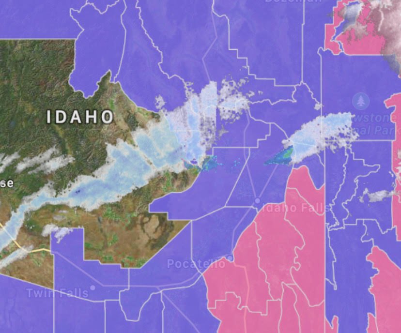
A winter storm arrives Sunday afternoon and continues into Monday. The National Weather Service in Pocatello has issued a Winter Weather Advisory for the Snake River Plain until 8PM Monday. A Winter Storm Warning has been issued for the higher elevations east of the Plain and for Southeast Idaho, along HWY 30 and Interstate 15 south of Pocatello.
WINTER WEATHER ADVISORY NOW IN EFFECT FROM 10 AM THIS MORNING
TO 8 PM MONDAY EVENING:
Upper Snake River Plain-Teton Valley-Centennial Mountains -
Island Park-
Including the cities of Idaho Falls, Rexburg, St. Anthony,
Ashton, Tetonia, Driggs, Island Park, and Kilgore
- WHAT…A possible flash freeze on roadways Sunday afternoon,
along with total snow accumulations of 2 to 5 inches across the
Upper Snake Plain, 3 to 7 inches in the Teton Valley, and 6 to
12 inches north of Ashton, with localized higher amounts. Winds
could gust as high as 40 MPH. - WHERE…The Upper Snake Plain, Upper Snake Highlands, and Teton
Valley area, including but not limited to Idaho Falls, Roberts,
Rigby, Rexburg, Ashton, Driggs, Island Park, Raynolds Pass, and
Targhee Pass. - WHEN…From 10 AM this morning to 8 PM Monday evening.
- IMPACTS…Travel could be difficult due to a combination of
snow, icy roads, and blowing and drifting, especially from
Sunday evening through Monday evening. Areas of blowing snow
could significantly reduce visibility. The hazardous conditions
could impact the morning and evening commutes Monday.
Lower Snake River Plain-Eastern Magic Valley-
Southern Hills/Albion Mountains-Raft River Region-
Including the cities of Pocatello, Blackfoot, American Falls,
Shelley, Fort Hall, Burley, Rupert, Heyburn, Oakley, Albion,
Almo, Malta, Rockland, and Holbrook
- WHAT…A possible flash freeze on roadways Sunday afternoon or
evening, along with total snow accumulations of 2 to 5 inches,
except 6 to 12 inches above 5,500 feet, with localized higher
amounts. Winds could gust as high as 40 MPH. - WHERE…The eastern Magic Valley, Raft River region, and lower
Snake Plain, including but not limited to Burley, Oakley,
Albion, Malta, Sweetzer Summit, Holbrook, Rockland, American
Falls, Aberdeen, Pocatello, Chubbuck, Fort Hall, and Blackfoot. - WHEN…From 3 PM this afternoon to 8 PM Monday evening.
- IMPACTS…Travel could be difficult due to a combination of
snow, icy roads, and blowing and drifting, especially from
Sunday evening through Monday evening. Areas of blowing snow
could significantly reduce visibility. The hazardous conditions
could impact the morning and evening commutes Monday.
WINTER STORM WARNING NOW IN EFFECT FROM 3 PM THIS AFTERNOON TO
8 PM MONDAY EVENING:
Including the cities of Inkom, McCammon, Downey,
Lava Hot Springs, Malad, Preston, Thatcher, Emigration Summit,
St. Charles, Montpelier, Georgetown, Grace, Soda Springs, Henry,
Bone, Wayan, and Swan Valley
357 AM MST Sun Feb 2 2020
- WHAT…A possible flash freeze on roadways Sunday evening, along
with total snow accumulations of 4 to 9 inches across the south
central highlands, Bear Lake, and Caribou Highlands, and 7 to 14
inches in the Bear River Range and east of Georgetown Summit,
with localized higher amounts. Winds could gust as high as 35
MPH. - WHERE…The south central highlands, Bear Lake region, and
Caribou Highlands, including but not limited to Swan Valley,
Inkom, McCammon, Malad, Preston, Lava Hot Springs, Fish Creek
Summit, Soda Springs, Georgetown Summit, Montpelier, Geneva
Summit, Border Summit, and Emigration Summit. - WHEN…From 3 PM this afternoon to 8 PM Monday evening.
- IMPACTS…Travel could be very difficult due to a combination
of snow, icy roads, and blowing and drifting, especially from
Sunday evening through Monday evening. Areas of blowing snow
could significantly reduce visibility. The hazardous conditions
could impact the morning and evening commutes Monday.

