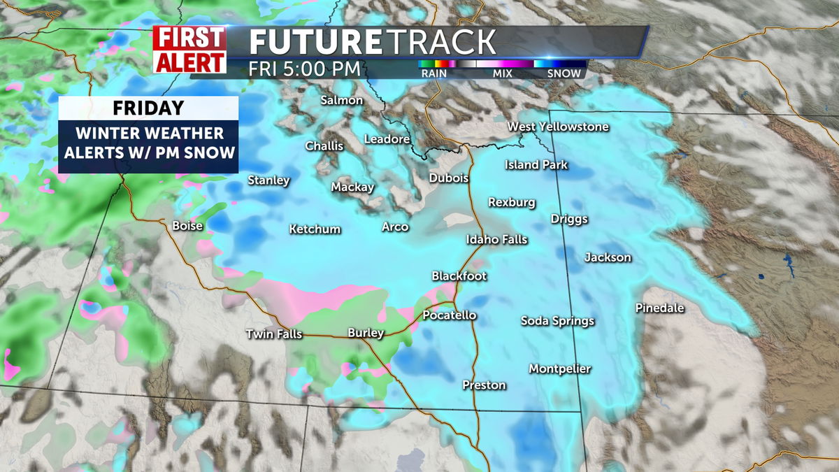
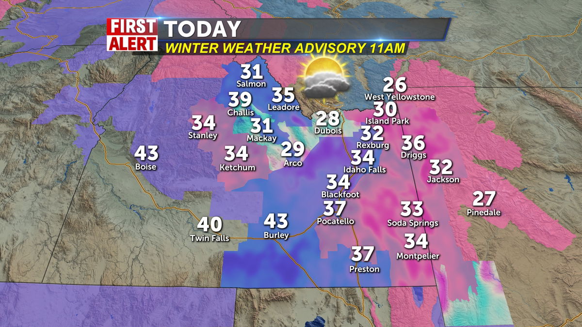
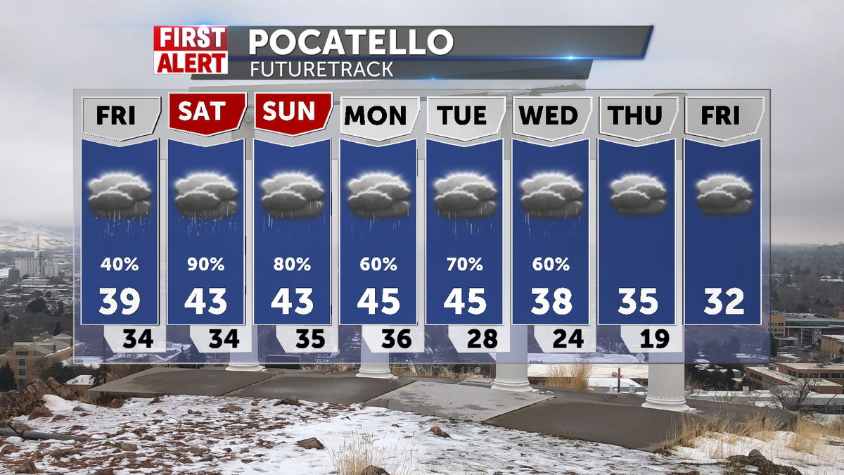
Winter weather moving in with advisories and warnings today and the weekend
Winter weather advisories for the main viewing area of the Snake River Plain including metro areas along I-15 beginning today at 11am through Sunday morning. Potentially several inches of snow through the period for the valley floor and as much as 6-8" for some spots, with gusty 30-45 mph winds. Winter storm warnings in place for the mountains and estimates of closer to a foot of new snow are possible,
Temperatures will be warmer with the insulation of the clouds and snow/rain with highs in the 30's and warming toward 40 further south. So any moistures in the day, will fly as rain after early morning snow, and then refreeze at night. This makes for hazardous, if not impossible travel, considering slick conditions and countryside accumulations. Prepare appropriately and be cautious and smart about travel.
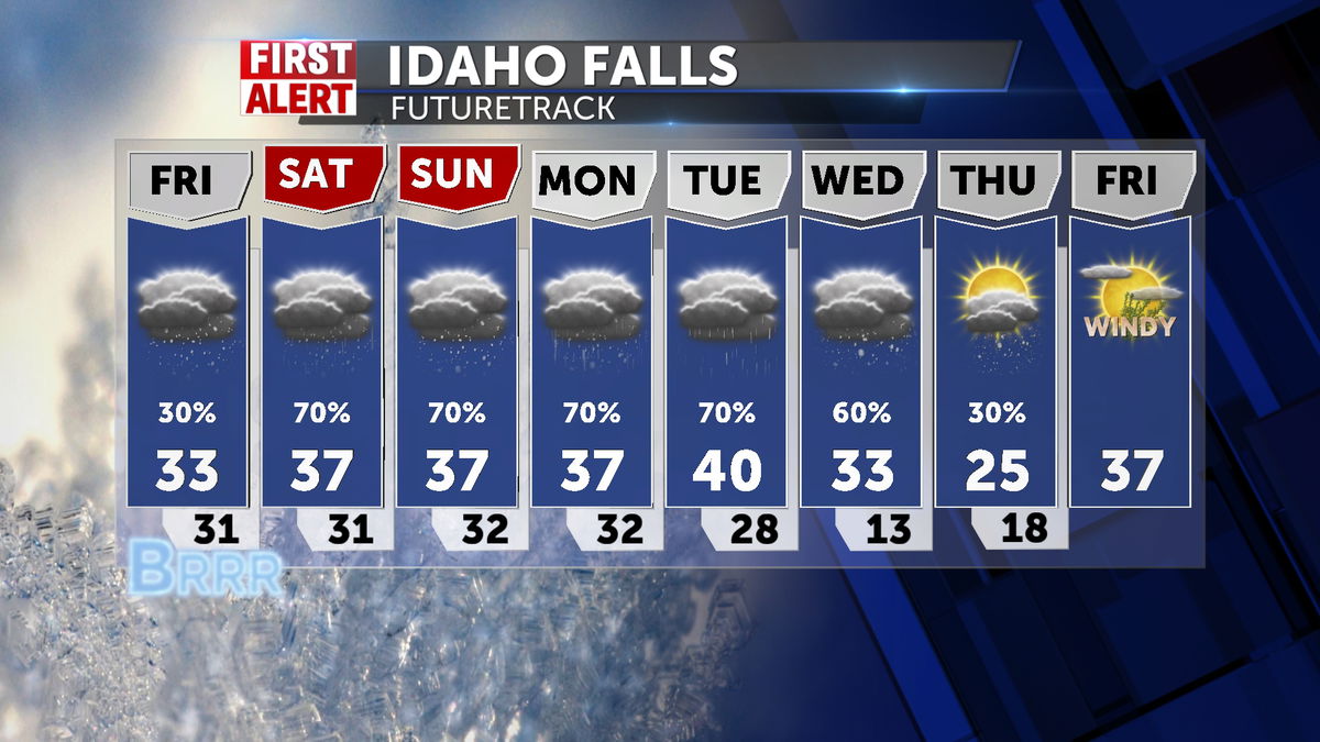
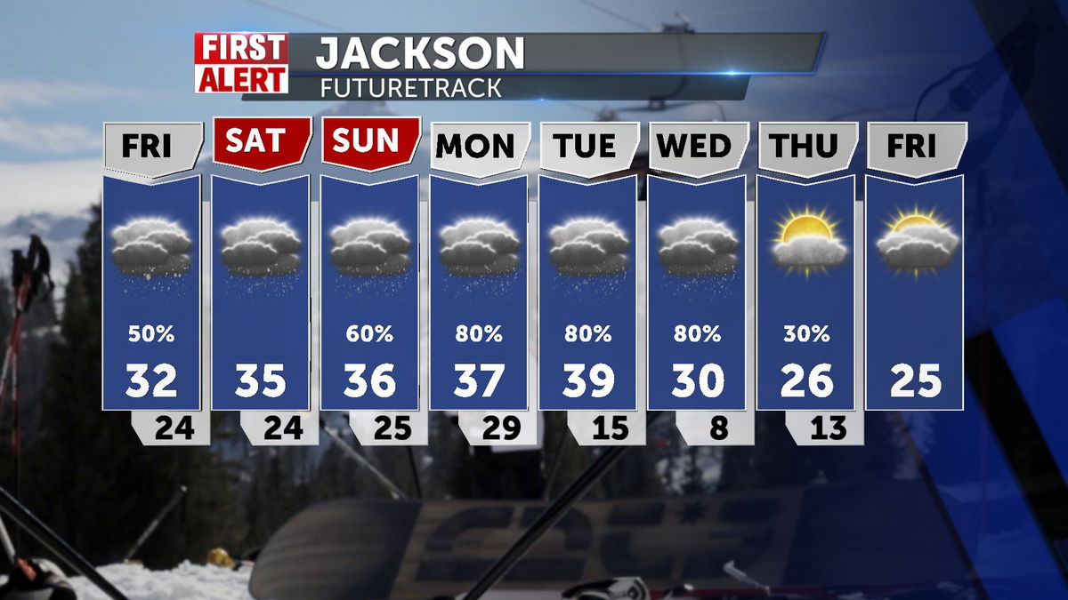
Friday: Cloudy and warmer with snow beginning in the afternoon 32 SSW 20-40mph gusts
Friday night: Cloudy with rain and snow mix and lows in the 20's.
Saturday: Snow in the early morning and a rain/snow mix into the afternoon 38
Saturday night: Back to snow late and continued showers and lows below freezing, meaning freezing of what has flown 24
Sunday: Scattered showers with early frozen precip and snow and slick conditions 38
Monday: Chances of snow with rain and brisk 39