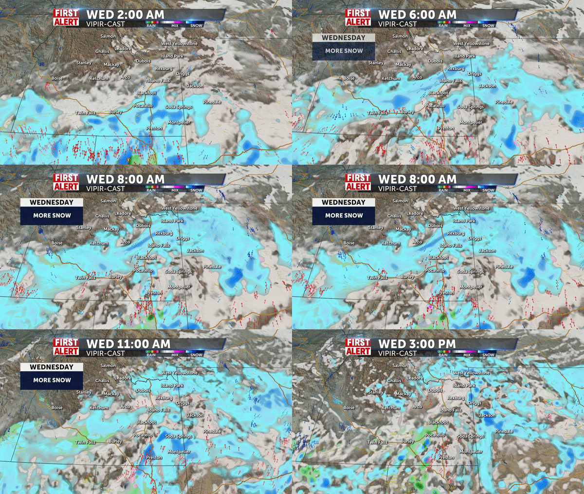
Another round of snow for early Wednesday

A system from the south arrives Tuesday night through Wednesday morning. We’re expecting more snow, rain showers for SE Idaho, the Snake River Plain and western Wyoming.
Overnight lows around the lower to mid 20’s. Snow with winds at 5-10 mph. Accumulating snowfall for late Tuesday night and early Wednesday.
Snow for Wednesday morning, with drier weather in the afternoon. Highs in the upper 30’s for the Snake River Plain.
More snow for Wednesday night, with gusty winds at 15-25 mph. New snow accumulation of less than one inch possible. Overnight lows around 20°.
Thursday, A chance of snow, mostly cloudy, with a high in the upper 30’s. Winds 15 to 20 mph, with gusts as high as 25 mph. New snow accumulation of less than a half inch possible.
Gusty winds for Friday as a cold front approaches, blowing snow with those gusty winds. A high near 30°, with lowering temperatures for the weekend behind this cold front.
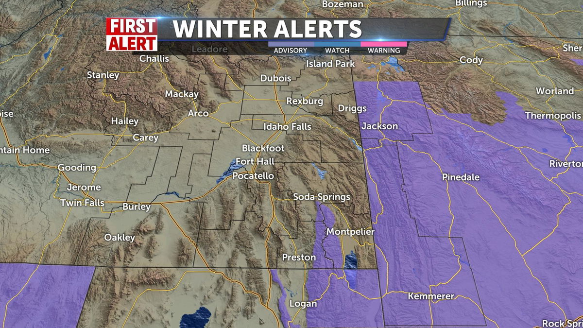
WINTER WEATHER ADVISORY IN EFFECT FROM 3 AM WEDNESDAY TO 6 AM MDT THURSDAY:
- WHAT…Snow expected. Total snow accumulations of 3 to 5 inches are expected in the lower elevations, with 2 to 3 inches from Farson to Big Piney. The mountain are expected to receive 6 to 10 inches of snow through Thursday morning. Winds gusting as high as 35 mph.
- WHERE…The west-central mountains and valleys of Wyoming,
including the Upper Green River Basin. - WHEN…From 3 AM Wednesday to 6 AM MDT Thursday.
- IMPACTS…Travel could be very difficult. Patchy blowing snow
could significantly reduce visibility. The hazardous
conditions could impact the morning or evening commute. - ADDITIONAL DETAILS…The heaviest snow is expected Wednesday
morning, and again from Wednesday evening into early Thursday
morning.

