Forest Service to burn slash piles in Ashton-Island Park Ranger District

The following is a news release from Caribou-Targhee National Forest.
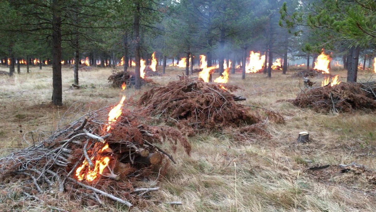
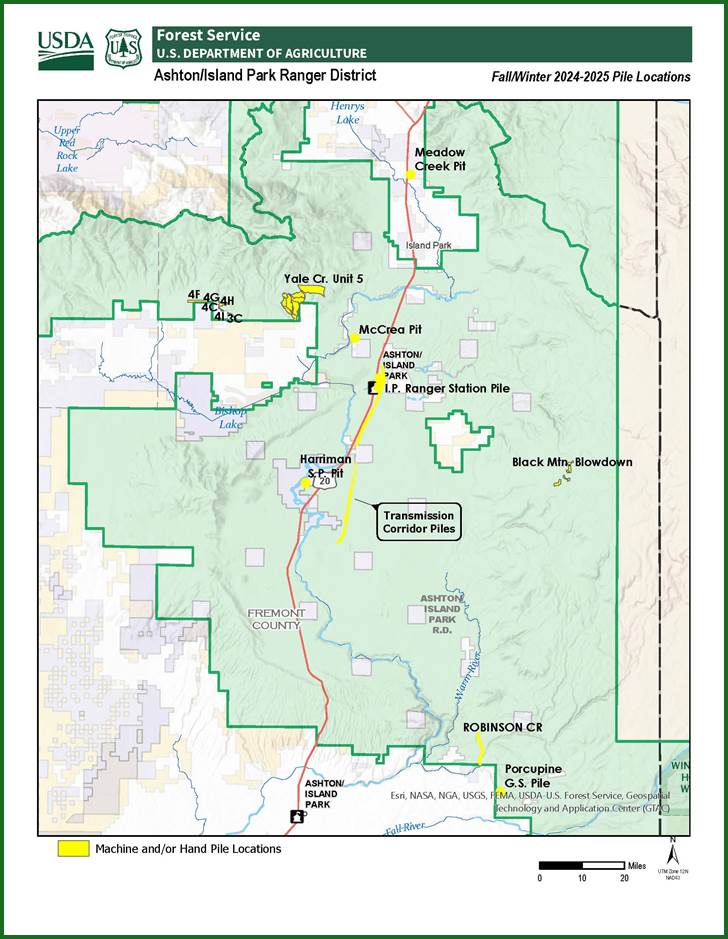
FREMONT COUNTY, Idaho (Caribou-Targhee National Forest News Release) – Caribou-Targhee fire personnel plan to implement controlled burns of slash piles in various locations within the Ashton/Island Park District, commencing as early as October 28, 2024. These burns are expected to continue through the end of December, contingent upon favorable ignition conditions. Please refer to the attached map for specific pile burn locations.
To enhance the defensibility and protection of private residences and roadsides from wildfire, hazardous fuels reduction has been completed along the Yale-Kilgore Road near the Old West and Yale Creek Subdivisions, as well as Forest Service Administrative sites. The controlled burns will contribute significantly to these efforts. Approximately 800 acres have been treated, with a portion of these acres slated for pile burning. Additionally, forest service personnel annually assist private and state entities in burning large machine piles to achieve fuels reduction in areas where slash has been transported to central collection points. Smoke may be visible in these areas for several weeks as the material is consumed. Additional large machine piles will be ignited when there is consistent snow cover, in areas west of the Yale Creek Subdivision and along the Electric Transmission line upgrade project from Phillips Loop Road to Mesa Falls Scenic Byway.
Fire management personnel prioritize burning piles during periods of snow presence or after an area has received substantial moisture to minimize heat production and mitigate potential impacts on surrounding trees. The moisture provides increased security against the fire spreading beyond the ignited piles.
Due to the variability of weather and fuel conditions, predicting the exact day of a prescribed fire is challenging. Moreover, approval from Idaho/Montana smoke monitoring agencies is necessary to minimize the impact of smoke on air quality. Consequently, on the actual day of ignition, orange highway information signs will be posted along Forest roads or Highway 20 to notify residents and visitors of the planned burn. Smoke may be visible from Highway 20 and nearby areas. Updates will be shared on the Forest's Facebook page at USFSCaribouTarghee.
For further information, please contact the Ashton Ranger District Office at (208) 652-7442.


