FIRE WATCH: Red Rock grows to over 62,000 acres
LATEST INFORMATION
The information below comes from fire managers daily updates.
RED ROCK FIRE - BLACK EAGLE FIRE
(Reporter 10/9/2024)
Fire Size: 62,431 acres
Containment: 15%
Tuesday was another day of assessment and planning after high winds from a few days ago spread fire in multiple directions. Crews continued to remove dead trees along 112 road. Sprinkler systems were being installed around structures near Cobalt and other communities. Dozer line along the 055 road was completed.
Wednesday, gusty winds are expected with red flag conditions. Firefighters are looking at options to hold the east side of the fire on the 020 road. Structure protection efforts will continue on the north and south sides of the fire and crews are working to construct both direct containment line on along the fire’s edge as well as indirect line with hand tools and dozers. Heavy air tankers will work with ground crews to lay retardant lines to reinforce the protection of the fire camp in Yellowjacket Campground.
Closures (Oct. 7th)
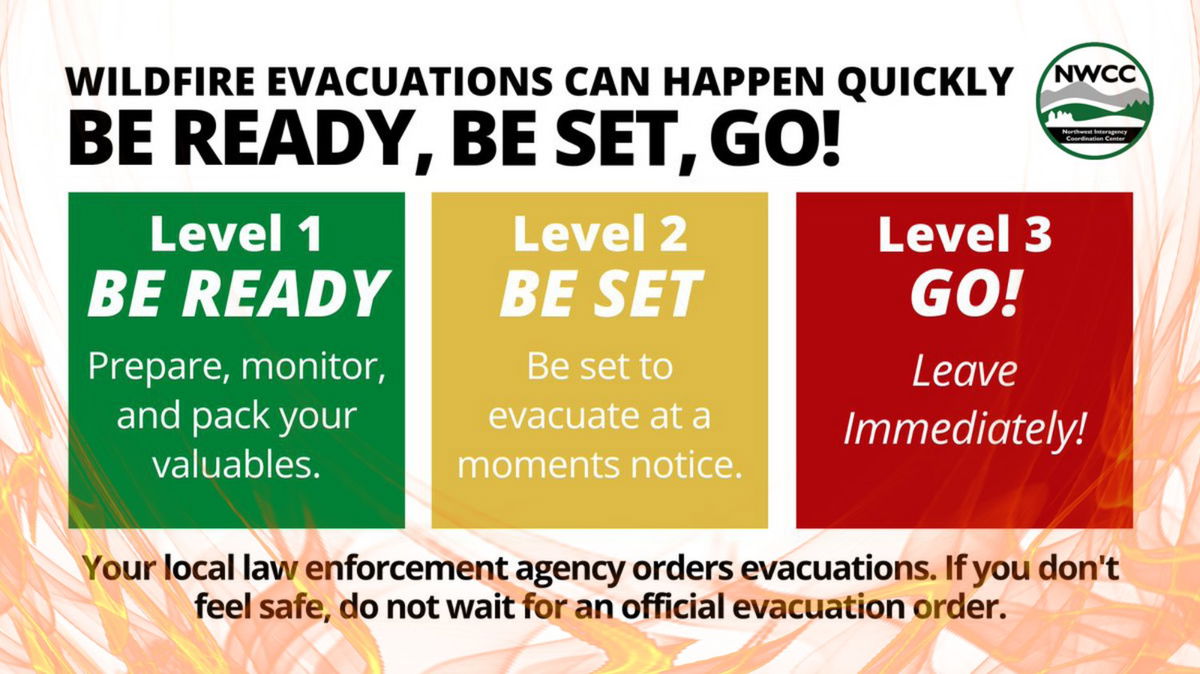
EVACUATIONS ISSUED BY THE LEMHI COUNTY SHERIFF'S OFFICE:
ZONE 1 - REMAINS IN “GO” STATUS
ZONE 2 – REMAINS IN “GO” STATUS
ZONE 3 – REMAINS IN “GO” STATUS
ZONE 4 – REMAINS IN "GO" STATUS
ZONE 5 – REMAINS IN “GO” STATUS
ZONE 6 – REMAINS IN “READY” STATUS
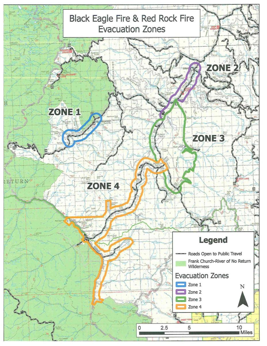
Zone 1: Yellowjacket drainage
Zone 2: Cobalt to Forney
Zone 3: Forney to road #252 to road #103 and back to Moyer
Zone 4: Silver Creek, Rams Creek, and Camas Creek from Hammer
Creek to White Goat Creek
Zone 5: Cobalt to Blackbird and Leesburg.
Zone 6: US-93 corridor from Williams Creek to Elk Bend.
GARDEN FIRE
(Reported 10/9/2024)
Size: 8,379 acres
Containment:
Firefighter and public safety is the number one priority for the Garden Fire. Fire managers are using a combination of full suppression and a point protection strategy (a wildfire response strategy, which protects specific assets or highly valued resources from the wildfire without directly halting the continued spread of the wildfire) to minimize exposure to fire personnel while protecting identified values, including private property and Forest Service infrastructure.
The fire continues to grow in the Garden Creek drainage and to the ridge to the north, towards the Salmon River. Fire is currently holding in the upper reaches of Clear Creek, however between lower Clear Creek and Dry to Bear Gulch, the fire is backing down towards Panther Creek. Fire managers were able to use an Unmanned Aircraft System (UAS) for small scale fire operations yesterday to help secure the fire’s edges. While visibility is improving, use of the UAS continues for infrared flights so fire managers can continue to monitor fire movement.
Presence of firefighters, primarily in the Panther Creek and Salmon River areas on both a day and night shift, will continue today. Crews are preparing for the anticipated winds and are strategically placed to respond in case the fire spots over the Salmon River. Aircraft, both fixed wing and helicopters, will be used if weather and smoke conditions allow. Fire managers are continuing to look for opportunities to engage the fire direct as fuels and weather conditions change and it is safe to do so.
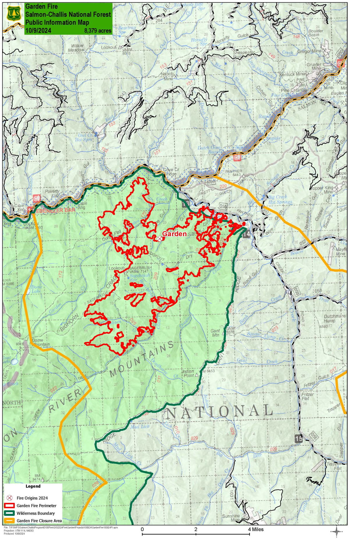
Evacuations: Lemhi County Law Enforcement, Emergency Management, and the Salmon-Challis National Forest have established three (3) evacuation zones for the Garden Fire.
Zone 1: From Cove Creek to Ebeneezer Bar, downriver along the Salmon River Road #030.
Zone 2: On Panther Creek Rd #055, a half mile south of Beaver Creek Rd #057 to the Salmon River Rd #030 confluence.
Zone 3: Panther Creek to Spring Creek to include private land up Spring Creek
ZONE 1 is in “GO” status
ZONE 2 is in “GO” status
ZONE 3 IS IN "READY" STATUS
PACK TRAIL FIRE and FISH CREEK FIRE
(Reported 10/9/2024)
Fish Creek Fire
Size: 25,371 acres
Containment: 95%
Personnel: 312
Pack Trail Fire
Size: 60,676 acres
Containment: 60%
Personnel: 571
Yesterday, the Pack Trail Fire pushed southeast into Leeds Creek. Last night, fire crews implemented structure protection in the Cowboy Camp area. Today crews will continue to scout for natural and indirect holding features and build an indirect line along 553 Road. Road crews are beginning work on Union Pass to improve road safety for firefighter vehicles and enhance the fuel break. The west side continues to back down Burnt Ridge. Firefighters will implement structure protection at Elk Track Ranch and Gros Ventre area. Last night, firefighters accomplished a small tactical firing operation to improve control lines and reduce dry, flammable fuels near the 540 Road on the east side. Crews continue to improve indirect holding lines in this area. Sprinklers and structure protection are being implemented in the Long Valley, Teton Youth Camp and Union Pass Subdivision areas. On the north side, there was no new fire activity, but some heat remains in the interior and smoke may be visible. Road crews completed repairs and grading on Flagstaff Road, where crews will continue to patrol.
Safety - Drivers on US-26 may experience periods of smoke today due to high winds. Please use caution while driving, use headlights, and expect to encounter fire vehicles along the road. If planning travel on US-26 across the Continental Divide monitor WY-DOT for possible closures due to fire activity.
Teton Interagency Fire managers are maintaining the Very High Fire Danger Rating for Grand Teton National Park, the Bridger-Teton National Forest, and the National Elk Refuge. Due to excessively dry fuels, any spark can ignite fire which can spread rapidly, becoming a large fire and exhibit extreme fire intensity. Residents and visitors are urged to exercise extreme caution with fire or possible ignition sources. Always build your campfires away from dry grass, leaves, and overhanging branches to reduce the risk of spreading wildfire. Clear at least a 10-foot perimeter around your fire, removing any flammable material, and make sure your fire is dead out and cool to touch before you go to sleep, or leave the area.
WAPITI FIRE
(Reported 10/9/2014)
Size: 127,261 acres
Completion: 80%
Total Personnel: 175
Great Basin IMT 3 will be transitioning the incidents back to the local unit for management this evening at 6 P.M, and the fact sheet that you received yesterday will be updated based on fire activity.
FROG FIRE
(Reporter 10/9/2024)
Size: 3,020 acres
Containment: 100%
Total Personnel: 28 (firefighting resources will be removed this evening and the incident will be placed into monitor status)
Great Basin IMT 3 will be transitioning the incidents back to the local unit for management this evening at 6 P.M, and the fact sheet that you received yesterday will be updated based on fire activity.
COMMISSARY FIRE:
(Reported 10/9/2024)
Size: 6,700
Location: Fourteen miles south of Swan Valley, Idaho on Commissary Ridge
Fire resources – 1 Helicopter, 2 engines, 3 crews, and miscellaneous overhead
Fire managers continue to actively engage on the Commissary Fire, which is burning within the Fall Creek Prescribed fire project area on the Palisades Ranger District. Starting today, efforts will be concentrated along Skyline Ridge Road to keep the fire within its designated boundaries. Please be mindful of increased fire traffic and drive slowly in the area.
The Commissary fire is burning at a low intensity resulting in several benefits including improving forest health, minimizing the spread of insects and disease, removing and reducing invasive species that threaten native species in an ecosystem, improving habitat for numerous species, recycling nutrients back into the soil and promoting the growth of aspen in the area.
While there are no current trail or area closures in place, forest visitors are encouraged to stay informed and exercise caution if recreating and hunting in the vicinity of the Commissary Fire area. Continue to be aware of fire spread, rolling debris, falling snags or trees, and periods of heavy smoke. Additionally, there will be an increase in traffic along the Skyline Ridge Road. Please slow down and use caution when driving.
To see the latest on other fires, visit inciweb.wildfires.gov


