Boundary Fire grows to 84,138 acres
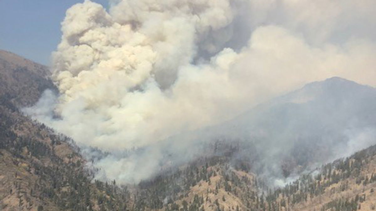
SALMON, Idaho (KIFI) - The lightning caused Boundary Fire that started on August 10 has burned 84,138 acres and is 58% contained.
It is burning 24 miles northwest of Stanley, ID, in the Frank Church – River of No Return Wilderness.
A point protection strategy is being applied to the Boundary Creek Fire, which is burning in the Frank Church River of No Return Wilderness. The desired end state for this incident is that the fire will have taken its natural course while values-at-risk and firefighters have been protected.
The Incident Command Post has relocated to the Cape Horn Guard Station. Warm and dry weather continued to stir up some heat across the fire yesterday, but cooler temperatures and moisture are expected to slow activity today.
In Sulphur Group, firefighters have been implementing a silviculture prescription to create a shaded fuel break along the 579 Road, and they expect to wrap up this work soon. Firefighters continued to see fire backing toward the 568 Road and meadows south of Blue Bunch Mountain, but movement was slowed by opposing winds. Fire activity south of Sulphur Creek Ranch also continues, and crews stand ready to protect the value.
Crews in the Seafoam Group removed hazard trees along the travel corridor to Greyhound Mine, and they will continue this work today. Winds stirred up some smoke in the Lime Creek area, and creeping and smoldering continue in the Sheep Mountain Road area.
In the area of Scarface Group, fire continued backing on Little Soldier Mountain and reached the Cabin Creek drainage. Crews have been scouting in steep and rocky terrain for the best vantage points to observe fire activity so they can quickly respond should the fire threaten values.
The Salmon‐Challis National Forest has reduced the Boundary Fire Emergency Area, Road, and Trail Closure, Order Number: 04‐13‐21‐116.
Description of Closed Area, Roads, and Trails (#04-13-21-116):
Closed Area: All NFS lands in the Middle Fork District of the Salmon-Challis National Forest in the area bounded at the junction of the Frank Church River of No Return Wilderness Area (FCNOR Wilderness Area) boundary and National Forest System Road (NFSR) #550 Artillery Dome Road, then following the FCNOR Wilderness Area boundary south to the junction of National Forest System Trail (NFST) #4231 West Fork of Elk Creek Trail, then following NFST #4231 West Fork of Elk Creek Trail to its junction with the FCNOR Wilderness Boundary, then following the FCNOR Wilderness Boundary east to the junction of National Forest System Trail (NFST) #4028 Mountain Meadows Trail and NFSR #583 Bear Valley Mountain Lookout Road, then following a straight line southeast to NFSR #568 Dagger Falls Road, then following east and north along the FCNOR Wilderness Area boundary to its junction with NFSR #172 Beaver-Loon Road, then following the west side of NFSR #172 Beaver Loon Road to its junction with NFST #4011 Blue Lake Trail, the following NFST #4011 Blue Lake Trail and NFST #4004 Little Loon Trail to its junction with the Middle Fork of the Salmon River, then following the Middle Fork of the Salmon River to its junction with Elkhorn Creek, then following west on Elkhorn Creek to the point of origin at the junction of the FCNOR Wilderness Area boundary and NFSR#550 Artillery Dome Road.
Closed Roads and Trails: All NFS roads (NFSR) and trails (NFST) within the Closed Area
Note: National Forest System Road #172 Beaver Loon Road is open.
The purpose of this order is to protect public health and safety from the effects of the Boundary Fire. Public and firefighter safety is the number one priority for the Boundary Fire.
This Order will be in effect when signed and shall remain in effect until rescinded.
Boise National Forest Area and Road Closure Order #0402-05-88 is in effect for Fir Creek Campground, Blue Bunch Trailhead, and the areas surrounding Forest Service Roads 579A and 579A1. Visit https://www.fs.usda.gov/alerts/boise/alerts-notices to view the closure area and map.
A temporary flight restriction (TFR) is in effect over the fire for public and firefighter safety. The surrounding backcountry airstrips are open to general aviation. Pilots should coordinate with Central Idaho Dispatch, and monitor both the TFR and backcountry frequencies.


