
Old Boy Scouts of America building now the home for Community Youth in Action
Over the weekend teens in the group had a chance to check out their new home.
Continue Reading Over the weekend teens in the group had a chance to check out their new home.
Continue Reading
Childhood chatter rang out over the blacktop, masked students queued up for school buses, and street signs blinked a warning to slow down outside of Park Elementary.
Continue Reading
A U.S. Department of Energy-State of Wyoming study indicates carbon capture utilization and storage (CUUS) retrofits of existing coal-fired power plants could provide significant benefits.
Continue Reading
Idaho State Police say an Infiniti SUV was pulled from the South Fork of the Snake River Saturday.
Continue Reading
The Caribou-Targhee National Forest plans to resume the next component of its Teton Canyon Hazardous Fuels Reduction Project on Tuesday.
Continue Reading
Idaho Falls and Idaho Transportation Department crews will begin the next phase of an Americans with Disabilities Act sidewalk and pedestrian marking improvement project Tuesday.
Continue Reading
A back-door cold front rams through Idaho this afternoon, bringing high winds, cold air, some possible winter-like showers and mayhem for the night-time hours. Temperatures will hit normal highs around 80 for IF and Pocatello, lows dip into the 30’s. The main problem, besides some rain blowing, are northerly winds up to 50 mph gusting
Continue Reading
Firefights updated at Gibson Jack, Yellowstone, and Idaho-Wyoming border.
Continue Reading
COVID-19 has played a role in the lives of everyone in this country, whether it be directly or indirectly.
Continue Reading
With help from the Bureau of Land Management and Central Fire District, the Madison Fire Department fought down a wild fire that threatened several nearby properties Sunday.
Continue Reading
Marco Leal, 23, faces multiple felony charges after a robbery, crash and foot chase in Idaho Falls Sunday.
Continue Reading
Teton County, Wyoming Emergency Managers have ordered immediate evacuation of several areas due to wildfire.
Continue Reading
Idaho officials reported 190 new COVID-19 cases and 1 new death on Sunday.
Continue Reading
A back-door cold front slides in from the Northeast, Monday. A high wind warning is in place for the Snake River Plane. Expect sustained winds above 30 mph with gusts beyond 55 mph. Tuesday night will usher in a frost for much of the Snake River Plane.
Continue Reading
Residents of the Gibson Jack and Wildhorse subdivisions have been asked to evacuate the area ahead of the Wild Mountain Fire.
Continue Reading
Firefighters are working to protect structures near Old Faithful.
Continue Reading
Several subdivisions were evacuated Saturday ahead of the Bridger Foothills fire.
Continue Reading
The Idaho Department of Correction is investigating the apparent suicide of man who was incarcerated at Idaho Maximum Security Institution.
Continue Reading
INKOM, Idaho (KIFI/KIDK) – The ski area in Inkom is currently working on some new renovations. “We’re expanding our snowmaking down the south part of the beginner area on our mountain to better accommodate beginner and intermediate skiers,” said Business of Operations Stefan Berkel. “So, we’re putting in four new hydrant locations, as well as
Continue Reading
POCATELLO, Idaho – Highland’s 2-1 win over Sugar-Salem in the Gold Bracket Final helped the Rams go undefeated in the Peg Peterson Tournament. 24 teams traveled to Pocatello to play in the tournament. Middleton beat Fruitland in the Silver Bracket.
Continue Reading
Authorities in Idaho have discovered the body of a missing 2-year-old boy after crews spent all day Friday draining a pond near where the child went missing.
Continue Reading Idaho officials reported 281 new COVID-19 cases and 2 new deaths on Saturday.
Continue Reading
ARIMO, Idaho (KIFI/KIDK) – Teton scored on their first two possessions of the game and were in control throughout, defeating Marsh Valley 28-18 The Timberwolves head back home to Driggs next week in a game against West Jefferson on Sept. 11 The Eagles travel to Dayton next week in a matchup with West Side.
Continue Reading
BANCROFT, Idaho (KIFI/KIDK) – After trailing by two scores early in the second half, Camas County comes back to defeat North Gem 16-14. The victory was the first on the year for Camas County. The Mushers have a bye next week and then will play in Fairfield against the Richfield Tigers on Sept. 18. The
Continue Reading
IDAHO FALLS, Idaho (KIFI/KIDK) – The Watersprings Warriors claimed their first win of the year with a 52-8 victory over Richfield on Friday. Watersprings (1-1) will hit the road to face Raft River on Thursday, September 17. Richfield (1-1) travels to Camas County on September 18.
Continue Reading
DIETRICH, Idaho (KIFI/KIDK) – Butte County suffered its first loss of season 36-14 at Dietrich on Friday. Next up for the Pirates (1-1) is a home game against Challis on September 25. Dietrich (2-0) hosts Hansen on September 18.
Continue Reading
IDAHO FALLS, Idaho (KIFI/KIDK) – The Hillcrest Knights fell in their home opener 28-14 to Vallivue on Friday. It was the first loss of the year for Knights. Hillcrest (1-1) will host Madison in a non-conference next Friday. Vallivue (2-0) visits Columbia.
Continue Reading
IDAHO FALLS, Idaho (KIFI/KIDK) – Skyline defeats Thunder Ridge 55-21 in high school football on Friday. The Grizzlies have scored 88 points in their first two games. Skyline (2-0) will go to Rigby next Friday for a big time show down of two of the top teams in the state. Thunder Ridge (0-3) will host
Continue Reading
POCATELLO, Idaho (KIFI/KIDK) – Pocatello continues their hot start to the season with a 27-14 win over Twin Falls. The Indians erased a 14 point deficit to beat the Bruins at their first home game of the year at Iron Horse Stadium. Pocatello travels North to Wyoming to play Jackson Hole on September 11.
Continue Reading
POCATELLO, Idaho (KIFI/KIDK) – After a overtime loss to Sugar-Salem, Century opened up their home schedule with a 56-0 win over Bonneville. The Homecoming game was Century’s first ever Varsity football game on campus. The Diamondbacks host rival Highland on September 11. Bonneville travels South to Preston.
Continue Reading
SHELLEY, Idaho (KIFI/KIDK) – Sugar-Salem beat 4A’s Shelley, 24-6 on Friday night. The Diggers beat 4A’s Century last Friday in overtime. Sugar-Salem hosts Star Valley of Wyoming on September 11. Shelley travels to Jerome next Friday.
Continue Reading
High school football scores
Continue Reading
The 2020 AWPC-WPC World Cup even in Idaho Falls is drawing powerlifters from around the region to Idaho Falls.
Continue Reading
Idaho State Police reports northbound traffic on Interstate 15 between mileposts 73-93 is currently at a standstill.
Continue Reading Idaho officials reported 269 new COVID-19 cases and 10 new deaths on Friday.
Continue Reading
An approaching cold front will drive in hot temperatures for Saturday, before the front passes. By Labor Day, we’ll see dropping temps and some scattered thunderstorms to get us trough the week. HEAT ADVISORY NOW IN EFFECT FROM 8 AM TO 9 PM MDT SATURDAY… WHAT…High temperatures of 96 to 101 degrees.WHERE…The Eastern Magic Valley,
Continue Reading
Idaho State Police worked to get ahead of the Labor Day traffic Friday.
Continue Reading
Local health officials reported 59 new COVID-19 cases in the area Friday.
Continue Reading
The intent of the East Idaho State Fair this year is to keep the fairgrounds as localized as possible to prevent the risk of people from all over Idaho, as well as other states, congregating at the fair and potentially spreading the virus back home in their own communities.
Continue Reading
Southeastern Idaho Public Health (SIPH) has confirmed two more deaths associated with COVID-19 in southeast Idaho.
Continue Reading
The Pocatello/Chubbuck School District 25 Board of Trustees approved PCSD 25 administration’s recommendation to continue the current instructional model for at least two more weeks during Friday’s special meeting.
Continue Reading
Governors from 22 Western states and Pacific territories want a bigger say in how the Trump administration defines habitat for wildlife protected under the Endangered Species Act.
Continue Reading
A Yellowstone National Park guide is facing criminal charges for violating park rules.
Continue Reading
Chad Daybell’s attorney has filed a motion to change the venue of his pending court trial.
Continue Reading
Labor Day gas prices stand to be the lowest since 2004 and Idahoans work hardest to fill the tank.
Continue Reading
Gov. Gary Herbert says Utah will aim to be prepared to distribute a coronavirus vaccine once it becomes available, a week after the federal government told states to be ready for distribution by Nov. 1.
Continue Reading
A new review of teacher salaries shows Idaho educators’ pay is 33rd in the nation, while Wyoming is rated at 15th.
Continue Reading
A heat advisory for the lower SRP tomorrow as high pressure pushes into east Idaho. Locations into Pocatello and the eastern Magic Valley will reach into the 100 degree range and it will be dry. A fire watch also in effect for all of the viewing area. Highs today from 91-96 and upper 80’s for
Continue Reading
St. John Health has acquired a Jackson clinic and plans to implement a separate virtual health app this fall.
Continue Reading
A Rexburg man was killed in a motorcycle accident north of Island Park at around 9:07 p.m. Thursday.
Continue Reading
IDAHO FALLS, Idaho (KIFI/KIDK) – The Bonneville Bees picked a home win over Madison in volleyball Thursday. The Bees won the match 3-1. Bonneville won the first set 25-22. The Bees then took a 2-0 lead by taking the second set 27-25. Madison got back in the match but taking the third set 25-22. Bonneville
Continue Reading
Boys and girls soccer, volleyball
Continue Reading
IDAHO FALLS, Idaho (KIFI/KIDK) – US Senate candidate (D) Paulette Jordan is making her trip across Idaho to campaign for a Senate seat against (R) Jim Risch. To register to vote, click here, to update your voter registration, register to vote, request a ballot, and/or find a polling place. “We have so many people all
Continue Reading Idaho officials reported 263 new COVID-19 cases and zero new deaths on Thursday.
Continue Reading
Thieves have stolen electrical circuit breakers from at least 43 Idaho Power customers who have businesses in Twin Falls and Ada Counties over the past three weeks.
Continue Reading
Bonneville School District 93 Superintendent Scott Woolstenhulme announced Thursday schools will be open in Phase 2 (Yellow Phase) Sept. 7 – Sept. 11.
Continue Reading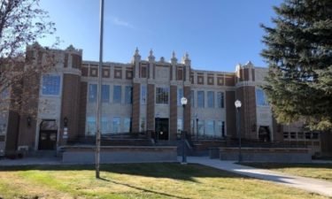
After meeting with members of the Fort Hall Business Council Thursday, the Pocatello-Chubbuck School Board has agreed to consider an administrative recommendation to retire the Pocatello High School Indians mascot.
Continue Reading
High pressure over the west, delivering warming temperatures and smoke from the fires burning in California. A cold front approaches from the north for this weekend. As this front moves in, we’ll see really warm temperatures with highs into the 90’s and low 100’s. Behind the front, look for dropping temperatures for Sunday and Monday.HEAT
Continue Reading Southeastern Idaho Public Health (SIPH) has confirmed another death associated with COVID-19 in Bingham County.
Continue Reading Local health officials reported 106 new COVID-19 cases in the area Thursday.
Continue Reading
A 30-year-old man was arrested for felony aggravated battery with a deadly weapon Thursday.
Continue Reading
Governor Brad Little says he has taken action that will avoid a tax increase for Idaho business owners and employers.
Continue Reading
An Idaho Falls man faces over 5 years in federal prison after pleading guilty on February 25 to possession of child pornography in U.S. District Court in Pocatello.
Continue Reading
daho Falls Power is investigating a power outage that is affecting most of the west side of the city.
Continue Reading
Prosecutors have charged an Idaho stepmom with murder and her husband with felony injury to a child after police say emergency responders found a 9-year-old boy who wasn’t breathing in the family’s Meridian home Tuesday night.
Continue Reading
The Bannock County Commissioners rescinded the COVID-19 emergency declarations during its regular business meeting Tuesday.
Continue Reading
Mountain Valley Construction will begin work on a new Roundabout at the intersection of East Lincoln Road and Crowley Road after Labor Day.
Continue Reading Authorities are still searching for a 2-year-old boy who went missing near Boise Wednesday, the Ada County Sheriff’s Office said Thursday.
Continue Reading
The Eastern Idaho Public Health Board voted Thursday morning to issue an Order for Mandatory Face Coverings and other restrictions for Custer County.
Continue Reading
Target has confirmed it plans to open a store in Jackson, Wyoming “in the coming years.”
Continue Reading
The Headwaters District Boy Scout Antler Auction will go online this year.
Continue Reading
Nationwide, states are facing a shortage of poll workers to assist with elections in November. Some areas in East Idaho are experiencing the hit.
Continue Reading
The Idaho Department of Labor reports Idahoans filed 3% fewer initial claims for unemployment insurance benefits in the past week.
Continue Reading
Governor Little announced Thursday Idaho will remain in Stage 4 for at least another two weeks.
Continue Reading
Clear, dry, and warm today thanks to high pressure. Winds WSW-5-10 and light. Some haze into Treasure Valley and lower plain and Jackson. Upper 70’s for parks and Jackson. Mid to upper 80’s for most and 90 for Pocatello. High pressure ridges pushes into the region from California to take temps to record highs for
Continue Reading
The Idaho Falls Police SWAT team was called to the Rescue Mission apartments in the 3100 block of South Yellowstone at around 3 a.m. Thursday.
Continue Reading
IDAHO FALLS, Idaho (KIFI/KIDK) – A goal in the 80th minute lifted the Idaho Falls over Thunder Ridge 2-1 in boys soccer Wednesday. The game was the conference opener for both the Tigers and the Titans. It was Thunder Ridge’s first loss of the season. Idaho Falls (3-2, 1-0) will continue league play at Madison
Continue Reading
The Eastern Idaho State Fair kicks off on Friday, but it will look a little different than we are used to.
Continue Reading
Southeast Idaho Public Health reported 140 confirmed new COVID-19 cases on September 1.
Continue Reading
During a tour through southern Idaho, Idaho senate candidate Paulette Jordan stopped in Pocatello Wednesday.
Continue Reading
Members of the scientific community are voicing concern after the NuScale Small Modular Reactor (SMR) project received design approval from the U.S. Nuclear Regulatory Commission (NRC) last week.
Continue Reading Idaho officials reported 296 new COVID-19 cases and 4 new deaths on Wednesday.
Continue Reading
The Idaho Falls Police Department is partnering with the Idaho Department of Corrections Re-Entry Program on a Hygiene Kit Donation Drive.
Continue Reading
The School District 25 Education Foundation announced Wednesday its Board of Directors has decided to suspend the 2020 Festival of Trees.
Continue Reading
IDAHO FALLS, Idaho (KIFI/KIDK) – Sugar-Salem and West Side retain top spots in this week’s state media football poll. Friday night wins propelled Hillcrest and Marsh Valley to the status of ranked this week. Rigby and Highland swapped spots in the 5A poll after their performances in the Rocky Mountain Rumble on Saturday. The Trojans
Continue Reading
High pressure delivering dry and overall warm conditions. A dry front is passing through northern Idaho and Montana, bringing breezy winds late Wednesday. We’ll see lower wind speeds for Thursday with sunny skies with highs into the mid to upper 80’s. High pressure ridging continues to build in across the western states this weekend, with
Continue Reading Southeastern Idaho Public Health has 108 new confirmed cases of COVID-19.
Continue Reading
A woman who says she suffered a life-threatening infection after Idaho’s prison staffers denied her antibiotics following dental surgery is suing state officials and Corizon Health, claiming she was subjected to cruel and unusual punishment.
Continue Reading
Madison County Prosecutor Rob Wood has filed a “motion for joinder” aimed at consolidating the prosecution of Lori Vallow Daybell and her husband Chad Daybell.
Continue Reading Southeastern Idaho Public Health has confirmed another death associated with COVID-19 in Bannock County.
Continue Reading
The Jefferson County Sheriff’s Office reports phone scammers are targeting local county residents.
Continue Reading
Officials in a Wyoming city have decided not to prohibit feeding feral cats and dogs.
Continue Reading The countdown to Labor Day is on and warmer temperatures will take us to possible record highs on Saturday. 84-87 today with gusty winds from the WSW 15-20 gusting to 30 and then cool overnight in the upper 40’s to mid 50’s. Close to 90 by Friday and dry with 95 for Saturday in Pocatello.
Continue Reading
More than 75% of Idaho’s wastewater treatment plants complied with their Clean Water Act permits last year, according to a new, three-year review by the Idaho Conservation League (ICL).
Continue Reading
Idaho State Police say 26 drivers were stopped during the 8-hour Operation Lifesaver enforcement effort between Pocatello and Idaho Falls August 27.
Continue Reading A Tetonia woman was killed in a single vehicle crash on Highway 32, south of Ashton.
Continue Reading
IDAHO FALLS, Idaho (KIFI/KIDK) – Skyline High School has a new tool at its gym to help keep the community safer from COVID-19 during sporting events. The facial recognition temperature kiosk is a gift from Evo Automation out of Rexburg. Evo CEO Chet Taylor made the donation as part of the CEO Pay it Forward
Continue Reading
Boys and girls soccer, High school volleyball
Continue Reading
While the pandemic hit the economy pretty hard in 2020, one aspect that has changed is the buying power of the consumer.
Continue Reading
Idaho State University has hired Paula Renae Scott as its new chief information officer following a national search that launched in early 2020.
Continue Reading