
No injuries after severe storm causes ‘catastrophic damage’ to two schools in Texas
By Joe Sutton and Claudia Dominguez, CNN A severe storm that slammed a Texas city caused significant damage to two schools on Monday.…
Continue Reading
By Joe Sutton and Claudia Dominguez, CNN A severe storm that slammed a Texas city caused significant damage to two schools on Monday.…
Continue Reading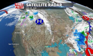
Temperatures begin to warm up this week with 50’s by mid week, and mid-60’s by weekend. High pressure drifts over the gem State and we’ll see light…
Continue Reading
By Judson Jones, CNN meteorologist The Storm Prediction Center (SPC) chooses its words carefully. And when they say, “A regional severe weather…
Continue Reading
Temperatures begin to warm up this week with 50’s by mid-week, and mid-60’s by the weekend.…
Continue Reading
By Caitlin Kaiser and Allison Chinchar, CNN Earlier this year an underwater volcano erupted in Tonga, triggering a widespread tsunami. While…
Continue Reading
By Allison Chinchar, CNN Meteorologist A “substantial severe weather event — including potential for significant tornadoes —…
Continue Reading
By Allison Chinchar, CNN Meteorologist A “substantial severe weather event — including potential for significant tornadoes —…
Continue Reading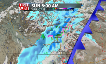
We will see rain showers in the valleys and snow showers in the mountains in the early morning hours. We will then see those showers turn quickly to…
Continue Reading
By Allison Chinchar, CNN Meteorologist The same damaging storm system that rolled across the Southeast on Friday will continue this weekend,…
Continue Reading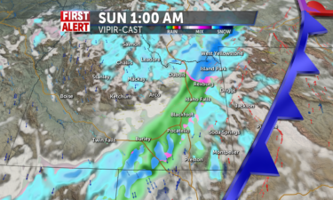
We have sunshine with partly cloudy skies for tomorrow with no chances of snow or rain for most of the day. We are expecting snow showers to start on…
Continue Reading
By Aya Elamroussi, Monica Garrett and Judson Jones, CNN Severe storms across the Southeast are causing injuries and damage with strong winds, hail…
Continue Reading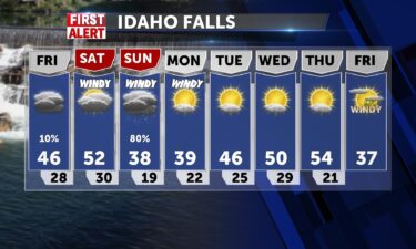
OVERNIGHT: Mostly cloudy with a low into the mid 20’s and winds at 5-10 MPH.A disturbance moving through tonight, will deliver a few snow showers…
Continue Reading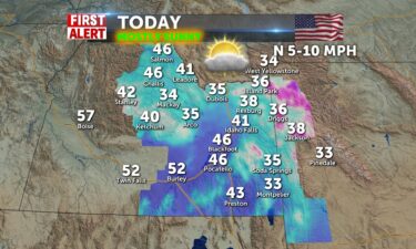
High pressure makes for dry and stable conditions today. Highs will be slightly cooler and in the upper 30’s to lower 40’s. Winds 5-10mph from the…
Continue Reading
By Monica Garrett Parts of Texas are under an extreme fire threat on Thursday, according to the Storm Prediction Center (SPC). Winds of 25-35 mph and…
Continue Reading
By Pedram Javaheri A powerful storm system with clashing cold and warm, moist air is setting up a multiday severe weather threat for the Southeast…
Continue Reading
By Pedram Javaheri A powerful storm system with clashing cold and warm, moist air is setting up a multiday severe weather threat for the Southeast…
Continue Reading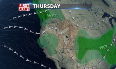
Tonight, we’ll still have some showers with a mix of snow and rain. Overnight lows will drop into the lower 20’s and upper teens. Winds will still be…
Continue Reading
By Caitlin Kaiser and Monica Garrett, CNN Ski resorts that look like deserts, skies colored brilliant hues of orange, and air quality five times…
Continue Reading
Socked in with clouds today and remaining mountains showers scattered for the rest of the day. Winds from the SW 10-15+ mph and highs from 39 in…
Continue Reading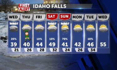
OVERNIGHT: Scattered rain and snow with mostly cloudy skies. Lows into the lower 30’s with SW winds at 10-15 MPH, gusts around 25 MPH. WEDNESDAY: A…
Continue Reading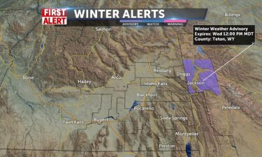
A Pacific system is on the way for Tuesday and Wednesday, with scattered rain and snow showers for Tuesday afternoon and evening. OVERNIGHT: Partly…
Continue Reading
By Jennifer Gray and Rachel Ramirez, CNN With 61% of the contiguous US in drought, wouldn’t it be nice if we could just “make it…
Continue Reading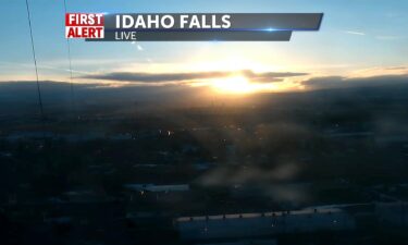
A weak system bringing snow and rain into tomorrow will override the ridge keeping things dry for us today as we head toward 40-50 this afternoon.…
Continue Reading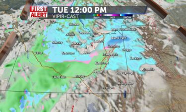
Partly to mostly cloudy skies will be present for the region tomorrow with only a slim chance for a snow shower or snow flurries in central ID and…
Continue Reading
By Aya Elamroussi, CNN A winter storm will continue to deliver strong winds and blistering freezing temperatures as it exits the eastern region…
Continue Reading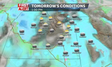
We will expect snow showers for the mountains with a mix of rain and snow for the valleys for the morning hours for…
Continue Reading
By Jason Hanna, Taylor Ward and Derrick Hinds, CNN A powerful winter storm is bringing heavy and blustery snow to the Northeast and hammering the…
Continue Reading
By Jason Hanna, Taylor Ward and Derrick Hinds, CNN A powerful winter storm is bringing heavy and blustery snow to the Northeast and hammering the…
Continue Reading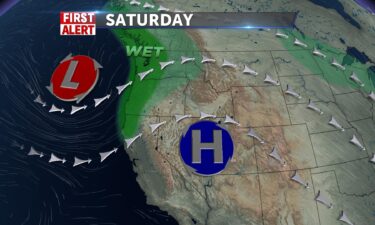
High pressure to our south will help to usher in some warmer temps, with highs getting back into the 30’s and 40’s. Saturday is the warm before the…
Continue Reading
By Jason Hanna and Aya Elamroussi, CNN A winter storm passing through the central US is expected to become a more powerful bomb cyclone, threatening…
Continue Reading
By Jason Hanna and Aya Elamroussi, CNN A winter storm passing through the central US is expected to become a more powerful bomb cyclone, threatening…
Continue Reading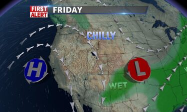
We still have the cold air flow from the north with partly to mostly cloudy skies. We’ll have highs into the 20’s with a few flurries through the…
Continue Reading
By Pedram Javaheri, CNN Meteorologist Tropical Cyclone Gombe is expected to rapidly intensify over the next 24 hours, growing to the equivalent of a…
Continue Reading
By Pedram Javaheri, CNN Meteorologist Tropical Cyclone Gombe is expected to rapidly intensify over the next 24 hours, growing to the equivalent of a…
Continue Reading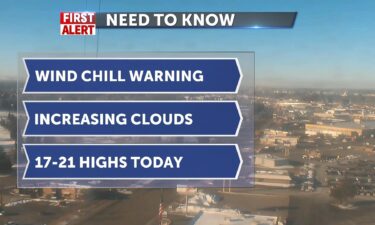
Wind Chill Warning through 9am for northern counties: northern Butte County, Clark County, northern half of Fremont County. We’ve also registered…
Continue Reading
By Aya Elamroussi and Taylor Ward, CNN A strong winter storm is expected to impact a large swath of the US, bringing snow Thursday to the central…
Continue Reading
By Aya Elamroussi and Taylor Ward, CNN A strong winter storm is expected to impact a large swath of the US, bringing snow Thursday to the central…
Continue Reading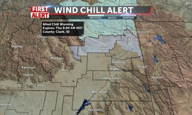
OVERNIGHT: Clearing skies with lows around 0° to -5°, with wind chill values into the sub-zero teens and sub zero 20’s. THURSDAY: Partly to mostly…
Continue Reading
By Caitlin Kaiser and Jennifer Gray, CNN A powerful storm taking shape across the central part of the country will rapidly strengthen into a bomb…
Continue Reading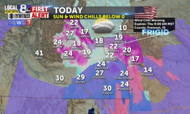
WIND CHILL WARNING IN EFFECT 9 AM THURSDAY… BREEZY NORTHERLY WINDS WILL CREATE SOME ISOLATED BLOWING AND DRIFTING AREAS OF CONCERN TODAY. RECORD…
Continue Reading
By Aya Elamroussi, CNN Firefighters on Wednesday welcomed much-needed rain as a wildfire burning in the Florida Panhandle is threatening areas that…
Continue Reading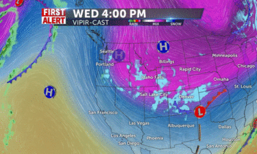
A potent cold front continues its trek through the region from the north. We’ll keep the heavy snow activity into our local mountains, with a few…
Continue Reading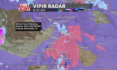
Winter Weather Advisory for the I-15 corridor today through tomorrow morning, from Rupert to Island Park and Winter Storm Warning for our eastern…
Continue Reading
By Kelly McCleary, CNN About 75,000 homes and businesses in the Northeast were without power early Tuesday after a line of strong storms brought…
Continue Reading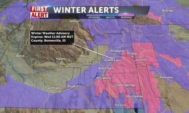
A potent cold front will move into the region Tuesday. We’ll see gusty winds and snow showers for Tuesday. Widespread snowfall begins Tuesday…
Continue Reading
By Jennifer Gray and Judson Jones, CNN meteorologists In this day and age, most of us no longer listen for a tornado siren, instead we listen for the…
Continue Reading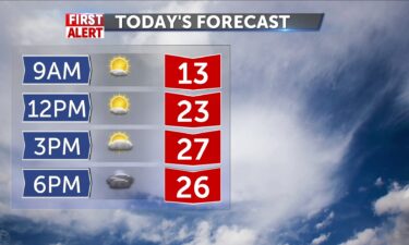
We will have a mostly sunny morning leading to a mostly cloudy late afternoon and evening. Snow showers will look to come into the region possibly…
Continue Reading
By Travis Caldwell, Dakin Andone, Judson Jones and Amir Vera, CNN More than 75 million people from Atlanta to Philadelphia faced the threat of severe…
Continue Reading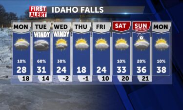
Mostly sunny conditions will be present for tomorrow for the entire region with no chances of any…
Continue Reading
By Jennifer Gray and Judson Jones, CNN meteorologists In this day and age, most of us no longer listen for a tornado siren, instead we listen for the…
Continue Reading
By Andy Rose and Melissa Alonso, CNN Seven people, including two children, died in a series of tornadoes that ripped through multiple counties near…
Continue Reading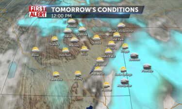
We will look for more of the same pattern for today continuing into tomorrow. We will see snow showers in most regions except the Snake River Plain…
Continue Reading
By Allison Chinchar, CNN Meteorologist March may mean the arrival of spring, but Mother Nature doesn’t always get that memo. This…
Continue Reading
By Allison Chinchar, CNN Meteorologist March may mean the arrival of spring, but Mother Nature doesn’t always get that memo. This…
Continue Reading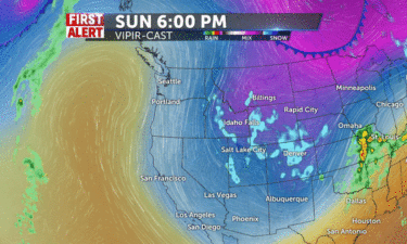
An area of low pressure to our south, will deliver a chance of wet weather and gusty winds this weekend. Another storm arrives for the middle of next…
Continue Reading
By Tom Sater and Monica Garrett, CNN It’s been a soggy week for the Pacific Northwest, as another powerful atmospheric river unloaded fierce…
Continue Reading
By Tom Sater and Monica Garrett, CNN It’s been a soggy week for the Pacific Northwest, as another powerful atmospheric river unloaded fierce…
Continue Reading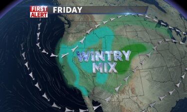
Cloudy conditions settle in with dense fog and visibility to 1/4 mile for Idaho Falls and nearby valley locations. Temperatures cool today back to…
Continue Reading
OVERNIGHT: Mostly cloudy with winds at 5-10 MPH, overnight lows into the mid 20’s. FRIDAY: A slight chance of snow and rain with mostly cloudy skies,…
Continue Reading
By Judson Jones and Monica Garrett, CNN Five crashes, two of which killed three people, occurred along a stretch of I-95 in Volusia County, Florida,…
Continue Reading
By Allison Chinchar, CNN Meteorologist March in the Midwest usually brings to mind snow, ice, and bitter cold temperatures, but this weekend, thanks…
Continue Reading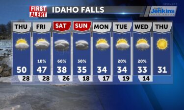
High pressure to our south, with stormy weather to our north through Montana and north Idaho. Overnight, look for mostly cloudy skies and a slight…
Continue Reading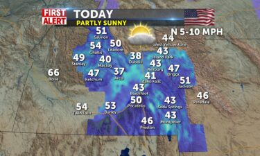
A partly sunny day in the region with light northerly winds 5-10mph. Highs for the valley in the low 40’s, near 50 in Pocatello. 51 in Jackson and…
Continue Reading
By Caitlin Kaiser and Stephanie Elam, CNN Winter is California’s wet season, but a discouraging snow survey performed on Tuesday, along with an…
Continue Reading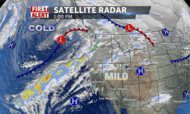
High pressure to our south, moving in mild air and pushing back on showers to our north. OVERNIGHT: Mostly cloudy with lows into the mid 20’s and a…
Continue Reading
By Caitlin Kaiser and Stephanie Elam, CNN Winter is California’s wet season, but a discouraging snow survey performed on Tuesday, along with an…
Continue Reading
CNN Editorial Research Here’s some background information about wildfires. About Wildfires are sometimes called “wildland fires.”…
Continue Reading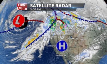
A northwest system moving to our north will deliver some scattered rain and snow showers. A southwestern flow will push in warmer temperatures into…
Continue Reading
By Jennifer Gray, CNN Meteorologist Spring starts Tuesday, but If you Google the word spring, it responds with March 20. You have NOT gone through a…
Continue Reading
By Haley Brink, CNN meteorologist An “extreme” atmospheric river is hitting the Pacific Northwest, bringing the threat of avalanches and…
Continue Reading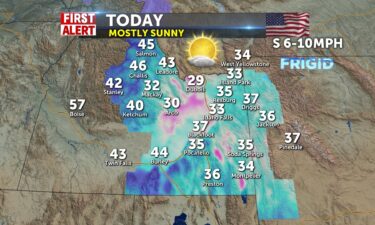
A river of moisture positioned above the Salmon area and the panhandle of Idaho make for wintry conditions today and some shower chances for the…
Continue Reading
By Haley Brink, CNN meteorologist An “extreme” atmospheric river is hitting the Pacific Northwest, bringing the threat of avalanches and…
Continue Reading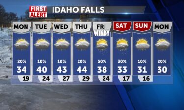
We will start the day with partly to mostly sunny skies throughout the region in the morning with mostly cloudy skies and some isolated snow showers…
Continue Reading
By Haley Brink, CNN meteorologist A category 4 out of 5 atmospheric river is forecast to bring heavy rain, river flooding and snow to the Pacific…
Continue Reading
By Allison Chinchar, CNN Meteorologist Heat waves are the deadliest weather disaster in the US. They account for nearly 150 fatalities per year, more…
Continue Reading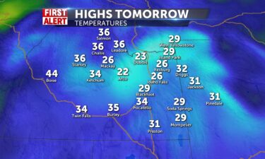
We look to have chances for light isolated snow showers in central ID in the upper Snake River Plain by Island…
Continue Reading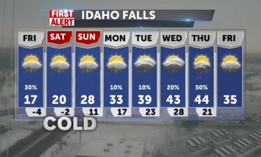
The last of the snow pass through this morning especially in the southern highlands and lower valley with cold wind chills just below zero. Winds…
Continue Reading
By Jay Croft, Haley Brink and Aya Elamroussi, CNN A winter storm that brought heavy snow and ice to parts of the Northeast on Friday is beginning to…
Continue Reading
By Jay Croft, Haley Brink and Aya Elamroussi, CNN A winter storm that brought heavy snow and ice to parts of the Northeast on Friday is beginning to…
Continue Reading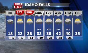
Besides a stray light snow shower for western WY in the morning hours, we should see only mostly cloudy skies throughout the day tomorrow without any…
Continue Reading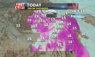
A dusting of snow with today’s system and Snake River Plain viewers can look for 1 to 3 inches. Winds SW 5-10 throughout the day. High 16-24 from…
Continue Reading
By Jay Croft, Haley Brink and Aya Elamroussi, CNN A winter storm that brought heavy snow and ice to parts of the Northeast on Friday is beginning to…
Continue Reading
By Aya Elamroussi, CNN A far-reaching winter storm was expected to bring dangerous ice to roads in parts of the South and Midwest on Thursday before…
Continue Reading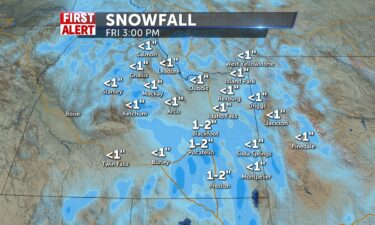
Tomorrow will be a snow day for us. The snow showers will start in central ID in the early morning hours, move into the valleys for around noon, and…
Continue Reading
By Caitlin Kaiser and Judson Jones, CNN As the second storm of the week sweeps across the US, clashing temperatures will cause dangerous winter…
Continue Reading
By Caitlin Kaiser and Judson Jones, CNN As the second storm of the week sweeps across the US, clashing temperatures will cause dangerous winter…
Continue Reading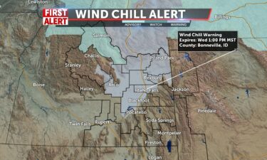
Low pressure to the south may send some showers into the southeastern highlands today, while northerly winds drop more arctic air into play with wind…
Continue Reading
OVERNIGHT: Partly cloudy with a chance of snow. Lows around -1° to -6°, with wind chills into the sub-zero teens, NE winds at 15-25 MPH. WEDNESDAY:…
Continue Reading
By Judson Jones, CNN Meteorologist For some, it may still feel 10 to 20 degrees above average today, maybe even tomorrow. But cold air will take over…
Continue Reading
By Judson Jones, CNN Meteorologist For some, it may still feel 10 to 20 degrees above average today, maybe even tomorrow. But cold air will take over…
Continue Reading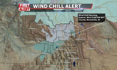
An area of low pressure continues to slide to the southwest, with a few leftover snow showers and cold air from the north. OVERNIGHT: A chance of…
Continue Reading
By Jennifer Gray, CNN Meteorologist Beginning today, a series of winter storms will impact the northern tier of the country, mainly from the northern…
Continue Reading
By Jennifer Gray, CNN Meteorologist Beginning today, a series of winter storms will impact the northern tier of the country, mainly from the northern…
Continue Reading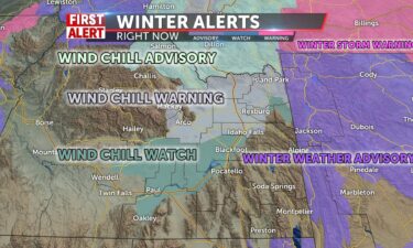
Cloudy with scattered snow showers today as a slow moving front passes by the upper highlands. Highs in the mid-to-upper 20’s with SW Winds 5-15+,…
Continue Reading
FORT HALL, Idaho (KIFIF) – A powerline caused some traffic early Monday morning near Fort Hall. Police and firefighters both responded to the downed…
Continue Reading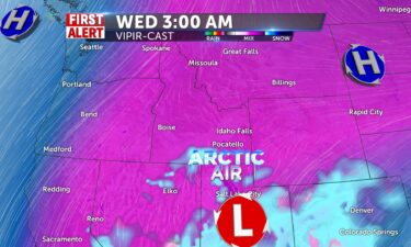
The arctic cold will be within our region starting on Tuesday with temperatures decreasing even more during the…
Continue Reading
By Allison Chinchar, CNN Meteorologist After a mild end to the weekend for many states, Old Man Winter will make a comeback as we start off the new…
Continue Reading
By Allison Chinchar, CNN Meteorologist After a mild end to the weekend for many states, Old Man Winter will make a comeback as we start off the new…
Continue Reading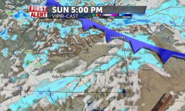
Snow showers will be present for most of the region at some point in the day…
Continue Reading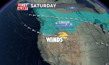
Mostly sunny skies for Saturday with highs into the 40’s for the Snake River Plain. Winds at 10-25 MPH increasing clouds into Sunday. For our Sunday,…
Continue Reading