
Rare, late-season nor’easter brings heavy April snow to the Northeast
By Jennifer Gray, CNN meteorologist After four weeks of severe weather in the South, it was a sure sign we were well into spring. Then suddenly,…
Continue Reading
By Jennifer Gray, CNN meteorologist After four weeks of severe weather in the South, it was a sure sign we were well into spring. Then suddenly,…
Continue Reading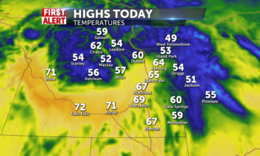
Partly to mostly cloudy skies will be present across the region today with no chances for any rain or…
Continue Reading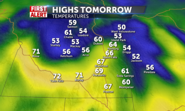
We will have sunshine and partly cloudy skies out for the entire day tomorrow and there should be no chances for any rain or snow across our…
Continue Reading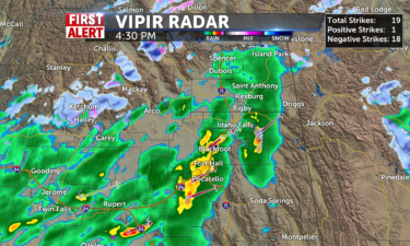
Partly cloudy skies will be seen across the region for…
Continue Reading
By Allison Chinchar, CNN Meteorologist Storm systems will make for a messy holiday weekend across most of the United States, with a soggy start to…
Continue Reading
By Allison Chinchar, CNN Meteorologist Storm systems will make for a messy holiday weekend across most of the United States, with a soggy start to…
Continue Reading
By Paradise Afshar, CNN Residents in New Mexico are being urged to be mindful of air quality safety because of the spread of wildfires throughout the…
Continue Reading
By Paradise Afshar, CNN Residents in New Mexico are being urged to be mindful of air quality safety because of the spread of wildfires throughout the…
Continue Reading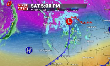
Our next storm front arrives from the southwest Saturday. Friday night, we’ll see a few isolated snow showers and gusty winds, with lows into the mid…
Continue Reading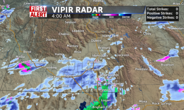
Isolated snow showers will be present today. The morning hours will have these showers present everywhere except for central ID. Once we move into…
Continue Reading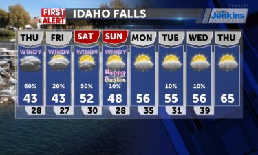
OVERNIGHT: Rain and snow with a slight chance of thunderstorms. Lows into the upper 20’s for the Snake River Plain. FRIDAY: Partly sunny with highs…
Continue Reading
By Allison Chinchar, CNN Meteorologist From Montana to Michigan, Easter eggs could be covered in snow this weekend, and it will be a soggy start to…
Continue Reading
Snow showers this morning with overcast conditions and light winds with slick roads and some fog possible. Allow extra time for travel and low beam…
Continue Reading
By Aya Elamroussi, CNN After a tornado packing 165 mph winds rolled through Bell County, Texas, Tuesday, JudyLynn Hughes began sifting through what…
Continue Reading
By Aya Elamroussi and Chris Boyette, CNN Two people have died in the McBride Fire raging in southern New Mexico that has scorched more than 5,000…
Continue Reading
Our un-settled weather continues with scattered snow showers expected for Wednesday night into Thursday. OVERNIGHT: A chance of snow with mostly…
Continue Reading
A break from continuous showers today and less wind. Some sun will join us and you may need your sunglasses on occasion. It is still chilly with…
Continue Reading
By Aya Elamroussi, Caitlin Kaiser and Amir Vera, CNN The National Weather Service confirmed Wednesday the tornado that injured 23 in Bell County,…
Continue Reading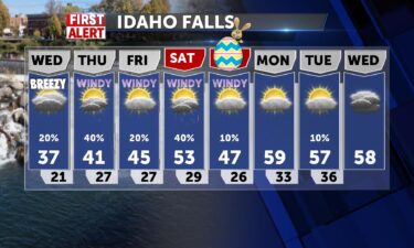
Slightly warmer weather for Wednesday with some isolated snow shower and breezy winds. Another storm arrives this Thursday, with scattered snow/rain…
Continue Reading
By Jennifer Gray, CNN Meteorologist and Steve Almasy, CNN A storm system stretching up the midsection of the United States had people in several…
Continue Reading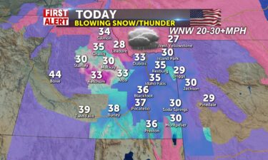
Patchy blowing snow and gusty winds 30+mph from the WNW and highs in the mid 30’s will make today feel like a winter wonderland. Wind chills will be…
Continue Reading
IDAHO FALLS, Idaho (KIFI) – Salmon school district 291 is closed today (April 12th) due to extreme weather conditions. The Central Idaho Mountain…
Continue Reading
By Jennifer Gray, CNN Meteorologist and Steve Almasy, CNN A storm system stretching up the midsection of the United States had people in several…
Continue Reading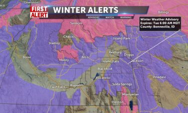
MONDAY NIGHT: Scattered snow and rain with a few thunderstorms. Lows into the mid to lower 20’s with winds at 15-25 MPH, gusts 30-40 MPH. We could…
Continue Reading
By Caitlin Kaiser and Judson Jones, CNN Following an explosive month of dangerous fire conditions, the Southern Plains are under extreme fire risk…
Continue Reading
By Steve Almasy, Brandon Miller and Chris Boyette, CNN A storm system lashing states from Oklahoma into the Midwest brought tornadoes and hail to…
Continue Reading
By Judson Jones and Rachel Ramirez, CNN The residents of Portland, Oregon, woke up to a rare April sight on Monday: a blanket of fresh, white snow.…
Continue Reading
CNN Editorial Research Here is a look at the 2022 Atlantic hurricane season. Past coverage of the 2021 and 2020 hurricane season and the latest…
Continue Reading
By Jennifer Gray, CNN meteorologist You may have heard of atmospheric rivers impacting the West Coast. We had several notable ones this year that…
Continue Reading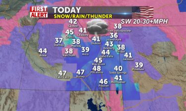
Winter weather advisories for counties along the I-15 corridor into mountain areas. Rain/snow will continue into this afternoon and early…
Continue Reading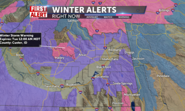
Scattered snow showers and very gusty winds will look to provide blowing snow conditions during most of the day Monday for the entire…
Continue Reading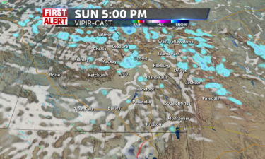
Isolated snow showers will sweep across the region tomorrow with more chances for receiving these isolated showers across central ID and western…
Continue Reading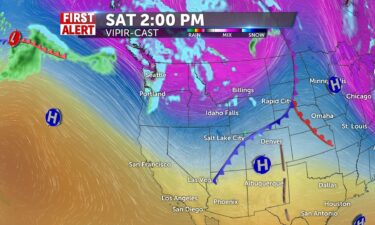
WIND ADVISORY REMAINS IN EFFECT FROM 11 PM FRIDAY EVENING TO 9 PM SATURDAY. WHAT…West-southwest winds 20 to 30 MPH with gusts up to 50 MPH…
Continue Reading
High pressure releases its grip on our area and flattens and opens gateway for more moving air and a cold front to push in here for tonight. It will…
Continue Reading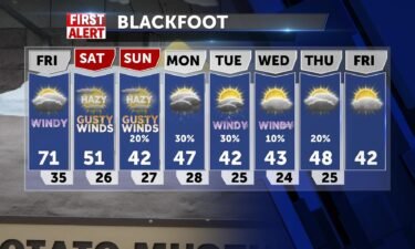
An approaching cold front from the west, will drive in warmer temps and gusty winds ahead of the front. We’ll see dropping temperatures for this…
Continue Reading
By Caitlin Kaiser and Jennifer Gray, CNN After two consecutive years of exhausting the hurricane name list, forecasters are predicting 19 named…
Continue Reading
By Caitlin Kaiser and Jennifer Gray, CNN After two consecutive years of exhausting the hurricane name list, forecasters are predicting 19 named…
Continue Reading
As high pressure eases to the south and east, another frontal boundary dashes into Idaho by Friday morning to the west and increasing cloudiness and…
Continue Reading
By Aya Elamroussi, CNN After dozens of tornadoes rolled through the South, another storm system is threatening to deliver powerful winds and possibly…
Continue Reading
By Aya Elamroussi, CNN After dozens of tornadoes rolled through the South, another storm system is threatening to deliver powerful winds and possibly…
Continue Reading
High pressure will build in through the next couple of days. Warmer temperatures will take hold before another storm arrives this Saturday afternoon.…
Continue Reading
You want some nicer weather? More sun and less wind today, only in the 40’s for most of us. We start in the 20’s with a slight wind chill and temps…
Continue Reading
By Jason Hanna and Dave Hennen, CNN The Southeast is again seeing severe weather Wednesday, including heavy rain and tornadoes — even as the…
Continue Reading
We’re seeing the winds calm just a bit heading into Wednesday, with colder temperatures behind the recent cold front. There’s a slight chance of rain…
Continue Reading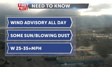
Cold air after the frontal boundary from yesterday will continue to make for windy conditions today. Snake River Plain will experience 25-35 mph…
Continue Reading
By Jason Hanna and Kelly McCleary, CNN Strong storms sweeping through the South have left at least two people dead as the severe weather dropped…
Continue Reading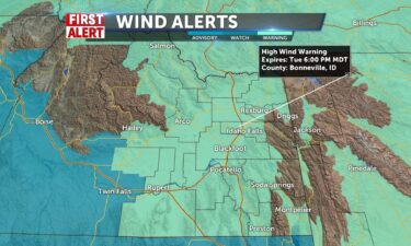
HIGH WIND WARNING REMAINS IN EFFECT UNTIL 6 PM MDT TUESDAY WHAT…West winds 30 to 45 mph with gusts up to 60 mph.WHERE…All of the Snake River…
Continue Reading
By Jennifer Gray, CNN As we enter our third week in a row with the potential for severe weather, it’s starting to feel a bit like a broken…
Continue Reading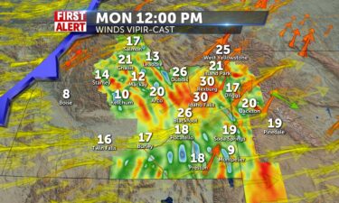
HIGH WIND WARNING REMAINS IN EFFECT FROM NOON TODAY TO 6 PM TUESDAY… * WHAT…West-southwest winds sustained at 30 to 40 MPH with gusts of 50 to 60…
Continue Reading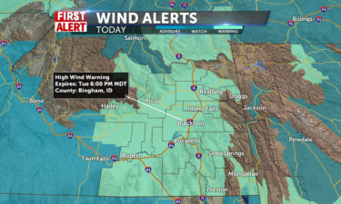
We will be having one of the most windy days of the year possible for tomorrow with sustained winds expected to be between 30-45 mph for the valleys…
Continue Reading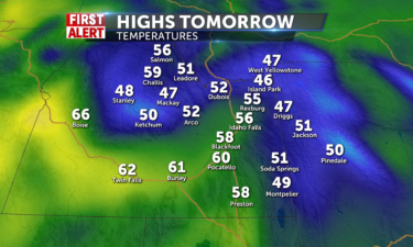
Winds will look to be slight breezes between 5-10 mph throughout…
Continue Reading
By Allison Chinchar, CNN Meteorologist As March came to an end, so, too, did Hector. At least until warmer, more favorable weather returns. Nearly…
Continue Reading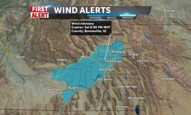
A couple of systems are taking aim to the region this weekend and early next week. A Wind Advisory has been issued for Saturday. Another cold front…
Continue Reading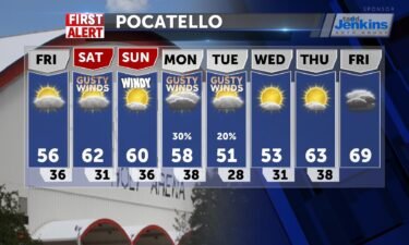
OVERNIGHT: Some scattered snow and rain with partly cloudy skies. Breezy with winds at 10-15 MPH, with gusts at 20-25 MPH. FRIDAY: Mostly sunny with…
Continue Reading
By Caitlin Kaiser and Brandon Miller, CNN This month has seen more tornadoes in the US than any March on record following this week’s severe…
Continue Reading
By Jason Hanna and Melissa Alonso, CNN Two people are dead and two others are hurt after a tornado struck in the Florida Panhandle on Thursday…
Continue Reading
By Aya Elamroussi and Dakin Andone, CNN A wildfire burning near the Great Smoky Mountains National Park in Sevier County, Tennessee, has grown to…
Continue Reading
By Jason Hanna and Melissa Alonso, CNN Two people are dead and two others are hurt after a tornado struck in the Florida Panhandle on Thursday…
Continue Reading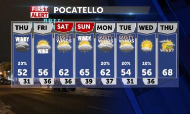
A cold front moving the region will deliver some moisture and gusty winds to our region. Another system passing through Montana this weekend, will…
Continue Reading
By Judson Jones, Gregory Lemos, Caroll Alvarado and Eric Levenson, CNN A powerful storm ripped through Springdale, Arkansas, early Wednesday as part…
Continue Reading
By Judson Jones, Gregory Lemos, Caroll Alvarado and Eric Levenson, CNN A powerful storm ripped through Springdale, Arkansas, early Wednesday as part…
Continue Reading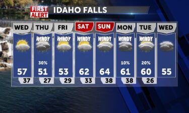
We have a weak ridge of high pressure pushing back in from the south for Wednesday. With that high pressure we’ll see warmer temps into the 50’s and…
Continue Reading
By Rachel Ramirez, CNN Only a few months into 2022 and it’s already a dreadful year for wildfires. More than 14,781 separate wildfires have…
Continue Reading
By Monica Garrett, CNN A significant wildfire outbreak is likely Tuesday across the southern High Plains, according to the Storm Prediction Center,…
Continue Reading
By Jennifer Gray, CNN Exactly one week after the Deep South faced a deadly tornado outbreak, another round of severe weather is taking shape in the…
Continue Reading
By Jennifer Gray, CNN Exactly one week after the Deep South faced a deadly tornado outbreak, another round of severe weather is taking shape in the…
Continue Reading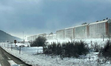
A trough slides through and we’ll see cold rain/wintry scattered showers across the east and western Wyoming. Don’t rule out some thunderstorm…
Continue Reading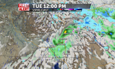
The rain and snow showers will continue to be isolated and stick around for much of the day on…
Continue Reading
By Caitlin Kaiser and Angela Fritz, CNN Scientists were shocked this month when a research station in Antarctica reported extraordinarily warm…
Continue Reading
By Jennifer Gray, CNN It’s been less than a week since deadly storms impacted the Deep South, and once again we are looking at the potential…
Continue Reading
By Jamiel Lynch and Emma Tucker, CNN An evacuation order has been lifted for people living near the site of an avalanche in Alaska, but officials…
Continue Reading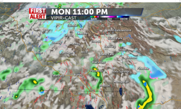
Clouds will be building throughout the day as we start with partly cloudy skies and end up with mostly cloudy to cloudy skies by the nighttime hours…
Continue Reading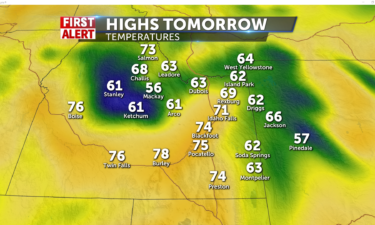
High temperatures will increase into tomorrow beating possible record highs in the process by getting up to the…
Continue Reading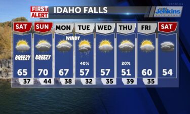
Under the trough that has come through, cloudiness is in play, with continued warm S/SW winds 5-15mph, keeping temperatures higher than they have…
Continue Reading
By Sara Smart and Amanda Watts, CNN An avalanche measuring between 60 to 80 feet deep and 300 to 400 feet wide has cut off nearly 100 houses in…
Continue Reading
By Aya Elamroussi, CNN Three bodies were found Thursday in a submerged vehicle, authorities said, after a powerful storm dumped record rain amounts…
Continue Reading
By Tom Sater, CNN Meteorologist You may have heard of the proverb ‘March comes in like a lion and out like a lamb.’ Well, the last…
Continue Reading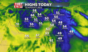
We should see mostly sunny to partly cloudy skies across our region today with no chances for any rain or…
Continue Reading
By Aya Elamroussi, CNN After a tornado roared through Arabi, Louisiana, Tuesday with 136 mph winds, the walls and roof of Angel Hahn’s house…
Continue Reading
By Aya Elamroussi, CNN After a tornado roared through Arabi, Louisiana, Tuesday with 136 mph winds, the walls and roof of Angel Hahn’s house…
Continue Reading
By Jennifer Gray, CNN meteorologist UN Secretary-General António Guterres announced a plan Wednesday to ensure every single person on the planet has…
Continue Reading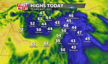
We should expect partly cloudy skies today with no chances for any rain or…
Continue Reading
By Kelly McCleary, CNN The storm system that spawned deadly tornadoes across Texas and Louisiana this week will continue to push east Wednesday,…
Continue Reading
By Jason Hanna and Derek Van Dam, CNN Workers and residents were picking through remnants of homes and other debris in the New Orleans area after at…
Continue Reading
By Steve Almasy, CNN A large, deadly tornado battered parts of the New Orleans area on Tuesday night, with damage reported in Arabi and the Lower…
Continue Reading
By Kelly McCleary, CNN The storm system that spawned deadly tornadoes across Texas and Louisiana this week will continue to push east Wednesday,…
Continue Reading
By Steve Almasy, Holly Yan and Taylor Ward, CNN A storm system that on Monday brought 25 tornadoes to Texas, including two that may have damaged…
Continue Reading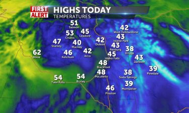
Mostly sunny to partly cloudy skies will be found across the region with no chances of…
Continue Reading
By Steve Almasy, Holly Yan and Taylor Ward, CNN A storm system that on Monday brought 25 tornadoes to Texas, including two that may have damaged…
Continue Reading
By Joe Sutton and Claudia Dominguez, CNN A severe storm that slammed a Texas city caused significant damage to two schools on Monday.…
Continue Reading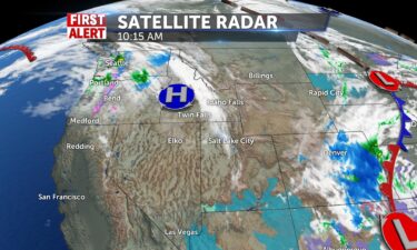
Temperatures begin to warm up this week with 50’s by mid week, and mid-60’s by weekend. High pressure drifts over the gem State and we’ll see light…
Continue Reading
By Judson Jones, CNN meteorologist The Storm Prediction Center (SPC) chooses its words carefully. And when they say, “A regional severe weather…
Continue Reading
Temperatures begin to warm up this week with 50’s by mid-week, and mid-60’s by the weekend.…
Continue Reading
By Caitlin Kaiser and Allison Chinchar, CNN Earlier this year an underwater volcano erupted in Tonga, triggering a widespread tsunami. While…
Continue Reading
By Allison Chinchar, CNN Meteorologist A “substantial severe weather event — including potential for significant tornadoes —…
Continue Reading
By Allison Chinchar, CNN Meteorologist A “substantial severe weather event — including potential for significant tornadoes —…
Continue Reading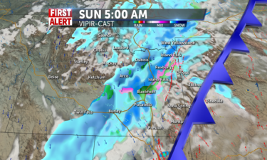
We will see rain showers in the valleys and snow showers in the mountains in the early morning hours. We will then see those showers turn quickly to…
Continue Reading
By Allison Chinchar, CNN Meteorologist The same damaging storm system that rolled across the Southeast on Friday will continue this weekend,…
Continue Reading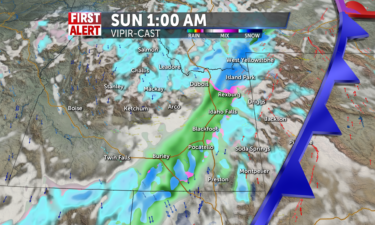
We have sunshine with partly cloudy skies for tomorrow with no chances of snow or rain for most of the day. We are expecting snow showers to start on…
Continue Reading
By Aya Elamroussi, Monica Garrett and Judson Jones, CNN Severe storms across the Southeast are causing injuries and damage with strong winds, hail…
Continue Reading