
Cold and Clear after the Storm
Storm activity is thinning out as we begin the new week. We’ll see a few snow showers Monday, with increasingly clear and cold conditions over the course of the next couple days.
Continue Reading Storm activity is thinning out as we begin the new week. We’ll see a few snow showers Monday, with increasingly clear and cold conditions over the course of the next couple days.
Continue Reading
Colder air moves in after some rain/snow today. Lows in the single digits, near or below 0 in Rexburg by Tuesday night. Snow chances fade until next weekend. The Groundhog, ha! Jeff Roper, First Alert Weather
Continue Reading Snow mixed with rain overtake the area into Sunday, ahead of a strong cold front. Windy with temperatures hovering around freezing and into the 40’s for some south of IF make for a dreary Sunday. Colder into Monday and especially at night with below zero lows by early Wednesday. Stay safe during this brief storm.
Continue Reading
Gusty winds will push through Friday night into Saturday. Another system swings in from the northwest on Saturday afternoon with scattered snow and rain showers late Saturday and into Sunday. Saturday, a chance of snow with a mostly cloudy sky. A high into the lower 30’s with Southwest winds 10 to 15 mph, with gusts
Continue Reading Some snow and rain will move into the area with a cold front for your Friday. Greater snow impact is expected later in the weekend.
Continue Reading
A couple of systems take aim at us, the first arrives Friday. We’ll see a slight chance of rain and snow for Friday with gusty winds in the Snake River Plain. Most of the snowfall, will take place in far eastern Idaho, central Idaho and western Wyoming. A second system arrives late Saturday and Sunday
Continue Reading The Upper Snake River Plain will see pockets of freezing fog through the morning hours. Later, the region will enjoy sunshine and very light winds.
Continue Reading
A slight chance of snow Wednesday night with a weak disturbance, otherwise quiet weather for Thursday before a cold front arrives for Friday. A second, stronger system arrives for Sunday. Wednesday night & Thursday morning, patchy freezing fog with a slight chance of snow. low’s around 10° to 15°. Thursday, areas of fog for the
Continue Reading A weather system to our East will drop some snow in the area for your Wednesday, before clearing out and leaving partially cloudy skies by this afternoon.
Continue Reading
We’ll see a slight chance of snow for Tuesday night and Wednesday as moisture wraps in from the Northwest around our ridge of high pressure. Overnight and Wednesday morning, a slight chance of snow from low clouds and fog. Low’s around 5° to 10°. Wednesday, areas of fog, partly cloudy, Slight chance of snow with
Continue Reading Highs will top out in the mid-twenties for the next couple of days, with calm winds and partially cloudy skies. A cold-front will bring chances for storms in Thursday, leading into Valentines day Friday.
Continue Reading
With dropping temperatures overnight, we’ll see some areas of fog developing through the morning hours of Tuesday. There’s some moisture working down from the north as well, which will bring a slight chance of snow to far eastern Idaho and western Wyoming. Not a lot of wind, but just enough wind to knock the wind
Continue Reading Temperatures have dropped on the backside of an active weather system. Expect sunshine this afternoon, but high temperatures will fall short of 30 degrees.
Continue Reading Hope you enjoyed the appearance of sun. It will be a part of your week, with very cold air settling in under high pressure. Check out the overnight lows in our video forecast for tonight. Lows drop another few degrees by Tuesday morning. Highs in the mid 20’s to freezing for Monday. Some wind chills
Continue Reading Scattered showers lingering tonight, but Sunday brings colder temps and dry conditions. Highs in the mid 20’s to near freezing, and lows drop to single digits for most. Mountain showers on Monday, with slight snow chances on the board…with partial clearing and the next real chance for significant snow Friday/Saturday. Jeff Roper, First Alert Weather
Continue Reading
A cold front is moving in from the northwest for Saturday. We’ll see scattered snow/rain showers and gusty winds to get us into Saturday. Heavy snow showers for areas of far eastern Idaho and western Wyoming. After the stormy weather clears by late Saturday, look for frigid temperatures for Sunday and Monday with sunny skies.
Continue Reading We’ll close out the week with continued active weather, though an end to the storms is in sight.
Continue Reading
Keeping with our unsettled flow, a wintry mix remains in the forecast for Friday and Saturday. Expect gusty winds for the next couple of days with dropping temps into Sunday and Monday. With those stronger SW winds, temperatures will warm well above freezing in the Snake River Plain. Friday, Scattered snow and rain showers with
Continue Reading
More scattered snow showers as we head through Thursday, Friday and Saturday. A Winter Weather Advisory has been issued until Friday afternoon for the Snake River Plain. WINTER WEATHER ADVISORY IN EFFECT UNTIL 5 PM MST FRIDAY: WHAT…Snow, moderate to heavy at times. Additional snow accumulations of 2 to 5 inches over the next two
Continue Reading Continued chances for snow will carry the area into the weekend. Watch for warming temperatures, even a chance for rain into the valleys.
Continue Reading
High pressure breaks down for Wednesday allowing for scattered snow showers to take hold. Tuesday night and Wednesday morning, mostly cloudy with a chance of snow showers. Lows close to zero light winds. Low accumulations expected. Wednesday, Scattered snow showers with a cloudy sky. A high into the lower 20’s. Southwest winds 10 to 15
Continue Reading Highs will just be reaching into the teens and low twenties, Tuesday. Expect a warming trend into the weekend, but active weather will accompany the higher temps.
Continue Reading
High pressure builds back in after our latest storm, leading to a cold and sunny Tuesday. Another storm system rolls in Wednesday and will last for the rest of the workweek. Monday night and Tuesday morning, Partly cloudy with a few flurries. Low’s around 0 to -5, wind chill values as low as -10 to
Continue Reading Wind and drifting snow will cause adverse driving conditions throughout the day. Temperatures will continue to drop into a cold day Tuesday.
Continue Reading Winter Weather makes another appearance overnight with 20-25 temps and 2-8″ of snow across the region. Clearing for Tuesday after morning low of 1 below.
Continue Reading
A winter storm arrives Sunday afternoon and continues into Monday. The National Weather Service in Pocatello has issued a Winter Weather Advisory for the Snake River Plain until 8PM Monday. A Winter Storm Warning has been issued for the higher elevations east of the Plain and for Southeast Idaho, along HWY 30 and Interstate 15
Continue Reading A shift in our weather pattern will usher in snow and wind for Sunday, with much colder temperatures for the week ahead.
Continue Reading
Warm before the storm, with highs into the 40’s this Saturday. Snowy Sunday with gusty winds and showers pushing through into Monday. Saturday, areas of fog for the early morning. Otherwise, partly cloudy with highs close to 40°. Light winds from the south. Increasing clouds overnight into Sunday. Sunday, Scattered snow showers in the afternoon
Continue Reading We’ll see overcast skies throughout the day Friday, but otherwise calm conditions. Temperatures will be well above average for your Saturday, with just partially cloudy skies.
Continue Reading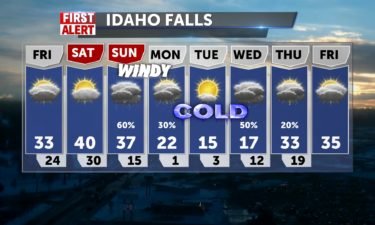
Relatively quiet weather with areas of fog overnight. From that fog, we could see a few flurries. Mostly cloudy skies with a few mountain snow showers for Friday. We’re still on track to see a cold front push in for Sunday, with rain and snow. Friday, Slight chance of snow, mostly cloudy with highs into
Continue Reading Stormy weather is clearing after a cold front pushed through overnight. Expect calm winds and a little sunshine for this afternoon.
Continue Reading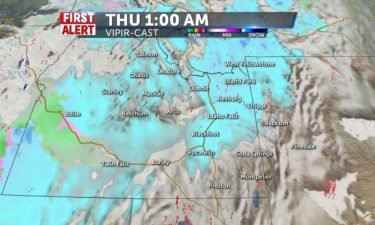
A fast moving system rolls in late Wednesday and Thursday morning with scattered snow showers. The snow quickly clears by midday Thursday with a slight chance of snow on Friday. A cold front will arrive this weekend with warming temps for Saturday before the front arrives. Rain and snow showers for Sunday, with dropping temperatures
Continue Reading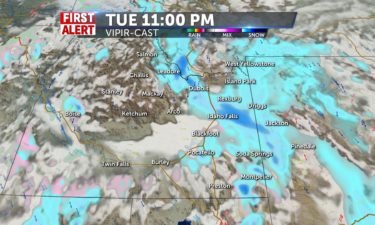
More snow showers possible late Tuesday with a convergence zone forming in the Upper Snake River Plain. Heavy snow possible in the upper valley and Eastern Highlands. This will continue overnight into a bit of Wednesday. Special Weather Statement from the National Weather Service: Periods of snow will continue into Wednesday morning in the Upper
Continue Reading A cold front will bring active weather to the region throughout the day, Tuesday. Several inches of snow is expected Northward into the Snake River Plain, with more rain expected toward Pocatello.
Continue Reading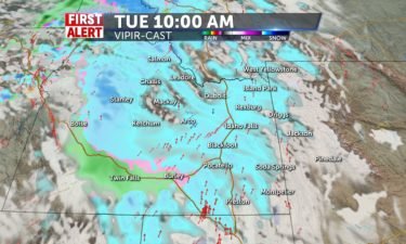
Another wave of snow and rain showers are on the way for Tuesday. The wintry mix could drop in a couple of inches of snowfall with highs into the mid 30’s. Gusty winds are also with us, with gusts 20-30 mph. Tuesday, snow and rain showers with highs into the mid 30’s. Southwest winds 10
Continue Reading We’ll look ahead to a snowy Tuesday, after much of the area woke up to new snow this morning. Monday and Tuesday will see wind speeds around 15 mph.
Continue Reading Early Morning snow for Monday once temps drop, some accumulation possible for IF north, Driggs. Lows in mid 20’s and another round of snow Tuesday later in the day.
Continue Reading
Patchy fog overnight and into Saturday morning with leftover moisture hanging around from Friday’s snow/rain showers. A brief ridge of high pressure works in for Saturday, with mostly cloudy skies and just some mountain snowfall. Another round of rain and snow will arrive for Sunday and a little bit of Monday. Scattered rain and snow
Continue Reading
Scattered rain and snow showers for Friday and Sunday with a couple of systems moving through. Above average temps will lead to melting snow and a wintry mix of showers. Winds will be light at around 10 mph. Friday, a winery mix with rain and snow showers. Highs into the upper 30’s and lower 40’s.
Continue Reading
We’ll see scattered snow and rain showers as a couple of systems push in from the west coast. Temperatures are still looking to be above average with highs above freezing for the Snake River Plain. Our next round of snow, Wednesday night and Thursday morning. could put down an inch of new snowfall by Thursday
Continue Reading Wind speeds will stay into the teens with some gusts beyond 20 mph for today. Snow showers are especially likely into the night time hours.
Continue Reading
Light snow showers with mostly cloudy skies for the rest of this week. The winds will pick up just a bit for Wednesday with a frontal passage. Heavier snow showers are expected in the central and eastern Idaho mountains, with most of the snowfall skipping right over the Plain. We have high pressure to our
Continue Reading Skies will remain mostly cloudy throughout the day, with on and off chances of snow showers. A cold front will bring greater chances for snow tonight, along with elevated wind speeds.
Continue Reading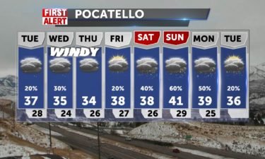
Spotty snow showers late Monday night and into Tuesday with low accumulations expected. This will be an active week of more scattered snow showers and gusty winds, especially after Wednesday. Tuesday, A slight chance of snow for the Snake River Plain, snow likely for areas of far eastern Idaho and Western Wyoming. Highs in the
Continue Reading Highs will extend into the upper 30’s for your Martin Luther King Jr. Day holiday. Snow is expected to pick up tonight.
Continue Reading Cloudy beginning to the week with snow for Jackson by Tuesday. Temperatures will head back to 20’s overnight and freezing to upper 30’s first couple days of the week. Single digits temperatures early Monday morning with wind chills possible at -3. Slight snow chances remain for the week ahead for the Snake River Plain. Stay
Continue Reading No snow until Mid-week in the forecast
Continue Reading 
A cold front is sliding in for this Friday, with gusty winds and scattered snow showers for Friday morning. We’ll see this system clear quickly, with just a few isolated snow showers and flurries for Saturday. Friday, Scattered snow showers for the morning and mid-day, gradually becoming partly cloudy by the afternoon. Highs into the
Continue Reading Clouds will increase throughout the day today, ahead of more snow storms overnight.
Continue Reading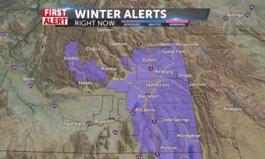
Another storm sweeps into the region starting Thursday for Western and Central Idaho. Eastern Idaho, will start to see some snow early Friday. A Winter Weather Advisory has been issued for snow and gusty winds expected for this Friday. Thursday: Mostly cloudy, with a high into the mid 30’s. Thursday night, we’ll look for snow
Continue Reading Weather conditions will be calming briefly for Wednesday, as another storm system approaches.
Continue Reading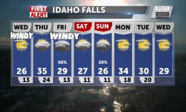
A few snow showers late Tuesday, giving way to clearing, windy and cold weather for Wednesday. Another round of snow arrives late Thursday and Friday, with more gusty winds. Wednesday, staying windy with partly cloudy with highs into the upper 20’s and lower 30’s. A slight chance of snow early in the day. Thursday, Mostly
Continue Reading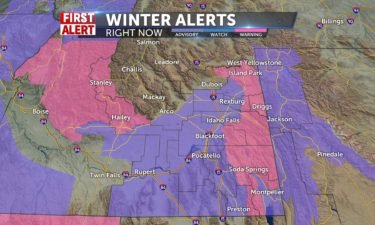
Another round of snow and wind is expected Monday night and Tuesday. We’ll see strong wind gusts overnight into Tuesday morning, which could lead to continued road closures. Partly cloudy on Wednesday, with a weak storm moving into the region Thursday. Monday night, we’ll see scattered snow showers at 1-3″ of new snowfall for the
Continue Reading Winds between 20 and 35 mph will continue to affect travel throughout the region, blowing snow onto roadways. More new snow is expected overnight tonight.
Continue Reading Windy Conditions for Sunday and Monday finalizing this blast of winter. 40% chance of patchy blowing snow , then Tuesday another storm makes headlines with a break Wednesday and snow chances increase for Thursday. The Valley may see 1-5″ of snow by end of weekend, mountains may receive as much as 3 feet. Jeff Roper,
Continue Reading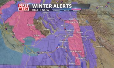
Several Winter storms are poised to hit the area this weekend and the approaching workweek. A Winter Weather Advisory has been issued for the Snake River Plain. WINTER WEATHER ADVISORY REMAINS IN EFFECT FROM 11 PM THIS EVENING TO 11 PM MST SATURDAY… WHAT…Snow, moderate to heavy at times, with blowing and drifting snow possible.
Continue Reading Calm and clear conditions for Friday come just ahead a very active and wintry weekend.
Continue Reading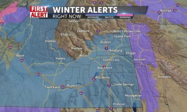
Cold and breezy with a few scattered snow showers Thursday night. Clearing skies for Friday morning with a COLD start to the day. Several significant storm systems start to arrive late Friday night and will continue all the way into the middle of next week. A Winter Storm Watch has been issued for Saturday, which
Continue Reading Winds and continued chances for snow showers will carry us through the day Thursday. Calmer but colder conditions are expected Friday.
Continue Reading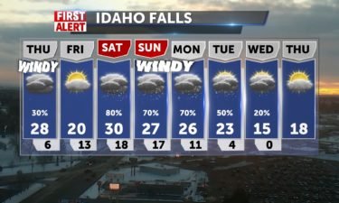
Staying windy with a few rain and snow showers for Thursday. Clearing out for Friday morning, before another snow storm arrives this weekend. Thursday: Gusty winds with A 50 percent chance of snow. Cloudy, with a high into the upper 20’s and lower 30’s. New snow accumulation of less than a half inch possible. Thursday
Continue Reading Above average temperatures will usher some rain into the region, along with snow and wind as a cold front pushes through today.
Continue Reading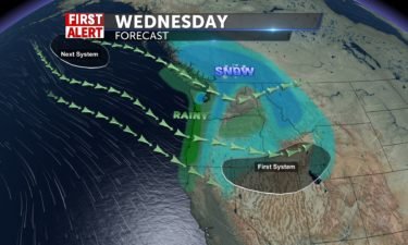
A cold front is moving through for Wednesday with gusty winds, scattered snow and rain showers. Look for highs into the lower to mid 30’s for the Plain. Behind the front, we’ll have dropping temps as we get on the other side of the front. Another storm is moving in for this weekend with more
Continue Reading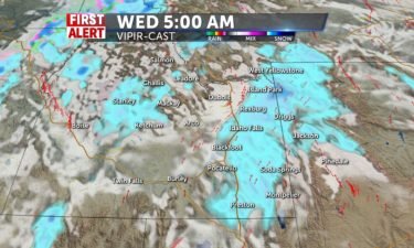
Partly cloudy and breezy with stormy weather on the way for Wednesday and Thursday. We’ll see gusty winds with 1-3″ of new snow possible for the Snake River Plain. This will be an active week of wind and scattered snow showers all the way into the weekend. Tuesday: Windy and Partly cloudy, with a high
Continue Reading Wind speeds beyond 20 mph are expected throughout the Snake River Plain for the next couple of days. Chances for snow pick up throughout the region on Wednesday.
Continue Reading Snow for Sunday – Accumulation of 1-2″ inches possible into the Upper Snake Plain. Windy conditions continue as the next trough pushes across Idaho. Temps range from 20-30 degrees with recipe for snow. Jeff Roper, First Alert Weather @jeffroper FB/IG/Twitter
Continue Reading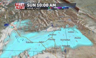
A cold front will arrive this Saturday with gusty winds and snow showers. A second system pushes in for Sunday, with snowfall possible in the Snake River Plain. The Sunday snow could deliver 1-3″ of new snowfall to portions of the mid to lower Snake River Plain. WIND ADVISORY IN EFFECT FROM NOON TO 8
Continue Reading We’ll see calm conditions Friday, with some active weather on the way for the weekend.
Continue Reading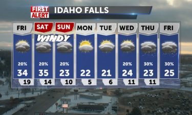
Light snow possible for Friday with partly to mostly cloudy skies overhead for the Snake River Plain and our eastern mountains. A cold front slides in for this weekend with gusty winds and scattered snow showers. Friday, partly to mostly cloudy skies with a slight chance of snow. Highs into the mid 30’s with light
Continue Reading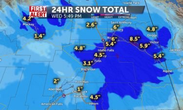
As expected, a winter storm rolled into the region early Wednesday morning. Idaho Falls and Ammon saw anywhere from 4-7″ of fresh snowfall. Most of the heavy snowfall bands have moved off to the east, with pockets of snowfall expected Wednesday evening and Thursday. Local law enforcement and Idaho State Police have responded to numerous
Continue Reading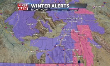
Travel could be difficult at times through Wednesday as another winter storm moves into eastern Idaho and western Wyoming.
Continue Reading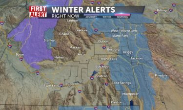
Another Winter storm is on the way for Tuesday night and Wednesday. The National Weather Service has issued Winter Storm Watches for the higher elevations. WINTER STORM WATCH IN EFFECT FROM TUESDAY EVENING THROUGH WEDNESDAY EVENING Including the cities/areas of Island Park, Grace, Soda Springs, Henry, Bone, Wayan, Swan Valley, Victor, Ashton, Tetonia, Driggs, Island
Continue Reading Tuesday will see a chance for snow flurries under mostly cloudy skies, with the storm’s main impact hitting over-night into New Year’s Day.
Continue Reading We’ll start the week under calm conditions, with an impressive storm on the way just in time to hail in the new year!
Continue Reading Partly Sunny tomorrow, with highs in the 20’s after a cold night in the area. Winds NE 5-10, that will make lows feels like temps are around 0 or below. Low: 8 -15 Snow chances increase on New Years Day with 2-4″ accumulation and highs around 30. Chances continue into the first weekend of 2020.
Continue Reading Very frigid temps are here again tonight, with lows from 3-8 degrees, and -11 in Jackson, and wind chills will make it feel as low as -25. Highs rise to the 20’s with snow chances for the Central mountains and Eastern part of the state, as a weak winter system travels north to south. Snowfall
Continue Reading After freezing drizzle and snow flurries Friday, some remaining light snow takes us into Saturday, then Sunday, more moisture drives snow with little accumulation. Slick conditions remain a concern and light breezes take wind chills below zero, with lows in the single digits through Tuesday morning. Another round of winter weather will affect New Year’s
Continue Reading High pressure gives us cloudy conditions to start Friday and lows in the single digits. Highs in the 20’s with a few lingering snow showers into Monday, after a 40% chance of snow Sunday. Warming to normal temps (11/28) as another disturbance kicks up a 50% chance of snow New Years Eve, Tuesday night
Continue Reading The next couple days will see single digit lows, and highs right around 20 degrees.
Continue Reading Storms are calming down into Christmas day. We’ll look for partly cloudy skies and colder temperatures through the rest of the week.
Continue Reading We’ll look at continued chances for some wet holiday weather as we move into Christmas day.
Continue Reading Snow will push through the region tonight, moving into the daytime hours Christmas Eve. Colder temps on the way.
Continue Reading Temperatures will be well above average for your Monday, just ahead of a holiday snow-storm.
Continue Reading Snow chances for Christmas Eve from Jackson to IF @50% with 1-3″ possible for the Snake River Plain. Above average temps with some windy conditions for locations south of Blackfoot Sunday – 25 mph gusts. Highs Sunday 35-43 degrees. Lows return to the teens on Christmas. Jeff Roper, First Alert Weather @jeffroper FB, IG, Twitter
Continue Reading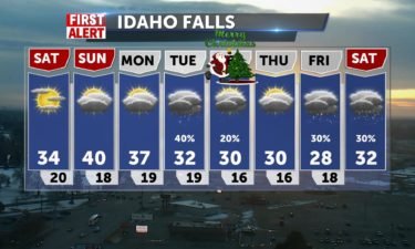
High pressure building over the region will bring us a nice weekend for December with warming temps. A weak system is expected to move in on Monday and Tuesday with some scattered snow showers. Saturday: A few clouds with highs into the mid to upper 30’s in the Snake River Plain. Winds 10-15 mph. Sunday:
Continue Reading The weekend will see some sunshine, and temperatures nearing 40 degrees before we see a cool-down and some storms into next week.
Continue Reading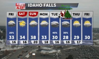
A slight risk of snow moves through the region for Friday, with warming temps for this weekend. Most of the snow will push though Northern Idaho and Montana. Friday: A few snow showers, otherwise mostly cloudy with highs into lower to mid 30’s. Saturday: Partly sunny, with a high into the mid 30’s. Sunday: Mostly
Continue Reading A weak storm system moves over the region for your Thursday and Friday, with very low impact beyond cloudy skies.
Continue Reading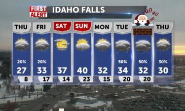
A storm system is moving through the west, with most of the snow and rain favoring Washington, Oregon and Northern Idaho. Southeastern Idaho and Wyoming are not expecting to see much accumulating snowfall. Our temperatures are expected to rise with this western pattern, with highs this weekend close to 40°. Looking ahead, there’s a storm
Continue Reading We started of Wednesday with wind chill factors below zero, but conditions will warm into the weekend, with chances of snow Thursday and Friday.
Continue Reading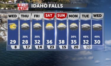
Quiet weather for Wednesday before our next system swings in for Thursday and Friday. Currently, most of the snow is projected to hit mostly into the mountains with scattered snow in the Snake River Plain. Wednesday, Patchy freezing morning fog with mostly sunny skies in the afternoon. Highs into the upper 20’s. Thursday, mountain snow
Continue Reading Tuesday and Wednesday will bring a little more sunshine into the forecast, ahead of storms expected to close out the work week.
Continue Reading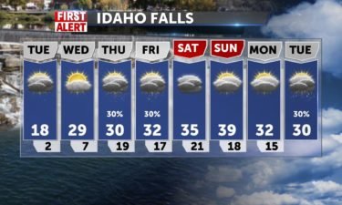
Cold air, patchy fog, low cloud cover for the Plain with a few flurries. We’ll see many low temperatures close to zero, with many spots going sub-zero. Many locations in Central Idaho and Wyoming, will enjoy mainly sunny skies. We’ll see some scattered snow showers for Thursday and Friday. However, this is not a major
Continue Reading
After scattered snow showers pushing through late Sunday, we’ll get some colder air in place to drop temps to single digits and even negatives in Wyoming. Highs in the 20’s into the week and some patchy early morning freezing fog in the valley with snow chances increasing toward next weekend. Thanks for watching, please download
Continue Reading
Scattered snow showers in the forecast to start off the weekend. Clearing as we move into next week, with dropping temperatures. Saturday, we’ll see mostly cloudy skies with a chance of snow. Temperatures into the upper 20’s and lower 30’s. Sunday: Mostly cloudy, with a high into the mid 20’s. A slight chance of snow
Continue Reading Expect morning fog as a possibility through the first half of the work week. Otherwise calm conditions are expected between now and some Wednesday into Thursday when some snow storms hit the area.
Continue Reading Low Clouds and some patchy fog start the week. We’ll have an overcast Monday – highs from around 30-46, teens overnight from IF to mountains, before another storm from the Pacific brings shower chances back. This last round of snow posted 10″ in Island Park and fresh snow in Jackson. We’ll have a big drop
Continue Reading Snow activity will taper out over the weekend, leaving behind a much colder air-mass for next week.
Continue Reading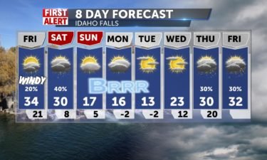
Scattered snow and rain showers for Thursday night and Friday morning. We’ll look for a little clearing in the Plain with partly cloudy skies. We’ll see a risk for more showers on Saturday. Friday: A slight chance of snow and rain. Mostly cloudy, with a high into the mid 30’s. Southwest wind 15 to 20
Continue Reading