Skip to Content

Weather

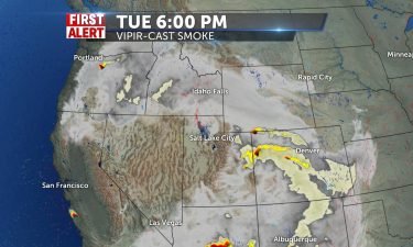
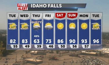
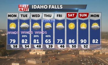
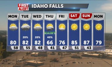
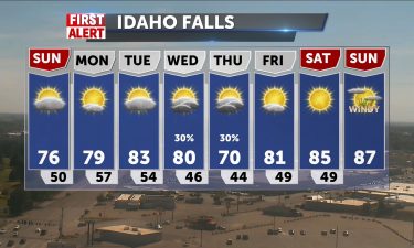
Hot with Smoke & Haze

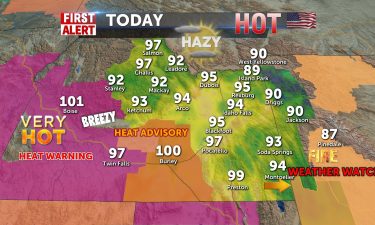
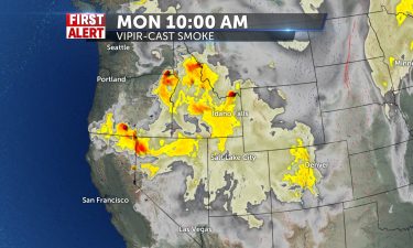
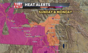
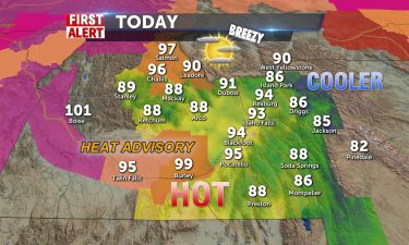
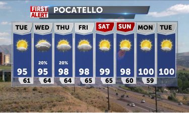
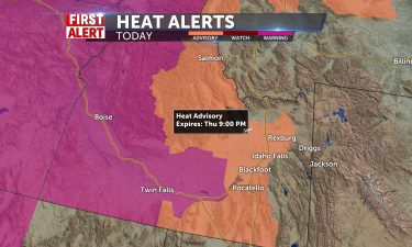
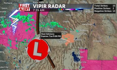
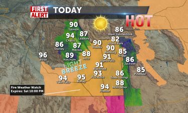
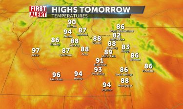
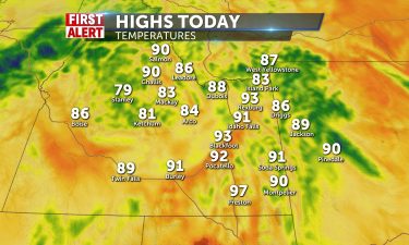
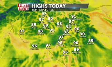
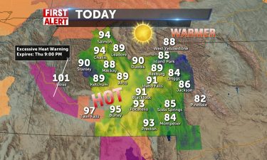
Slightly cooler today with Heat Advisory for the Magic Valley area. Our highs will reach the mid-to-upper 90’s for Idaho Falls and Pocatello, 94-97 through the valley. 90 for mountain communities. Hazy, smoky patches remain across the area and will make things dingy into the afternoon. Light winds shift to the SW 5-10 with windier
Continue Reading

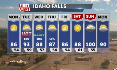
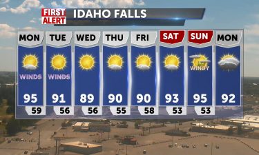
Hazy and Hot to Start the Week

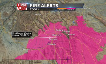
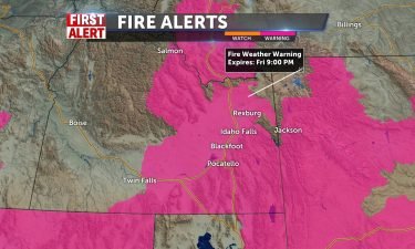
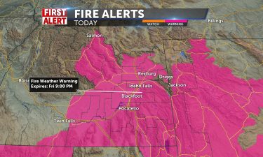
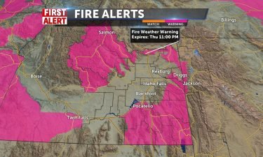
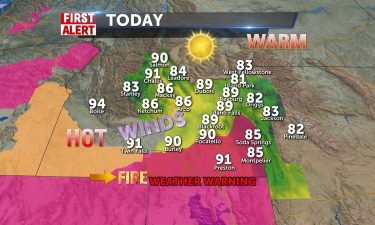
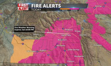
RED FLAG WARNING IN EFFECT FROM NOON TODAY TO 9 PM MDT THIS
EVENING FOR GUSTY WINDS AND LOW RELATIVE HUMIDITY for Fire Weather Zone 410 Upper Snake River
Valley/Idaho Falls BLM, Fire Weather Zone 425 Middle Snake
River Valley/Twin Falls BLM north of the Snake River, Fire
Weather Zone 475 East Salmon River Mountains/Salmon NF and
Fire Weather Zone 476 Lemhi and Lost River Range/Challis NF.

Continue Reading

Hazy Skies Continuing through the Weekend

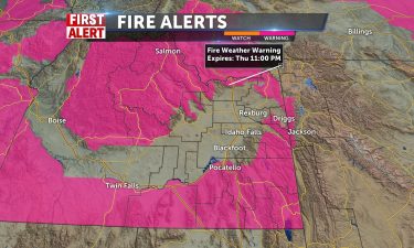
FIRE WEATHER WATCH IN EFFECT FROM SUNDAY AFTERNOON THROUGH
SUNDAY EVENING FOR GUSTY WINDS AND LOW RELATIVE HUMIDITY for Fire Weather Zone 410 Upper Snake River
Valley/Idaho Falls BLM, Fire Weather Zone 425 Middle Snake
River Valley/Twin Falls BLM north of the Snake River, Fire
Weather Zone 475 East Salmon River Mountains/Salmon NF and
Fire Weather Zone 476 Lemhi and Lost River Range/Challis NF

Continue Reading

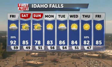
Red Flag Warning Today leading to Another Hot Weekend

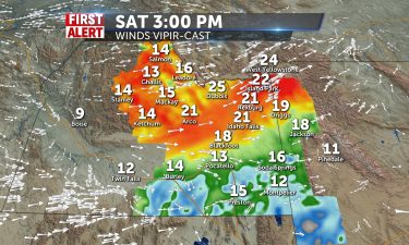
TODAY: There should be mostly sunny skies with no rain chances for much of the area. A slight sprinkle might occur possibly in Yellowstone and the Idaho/Montana border by there, but I still find the chances very slim. Winds will be very breezy today with winds looking to be sustained between 15-25 mph throughout the entire day. High temperatures will get up to the low to mid 90’s today.

Continue Reading

Hot and Windy

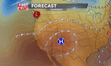
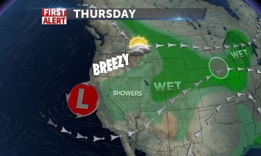
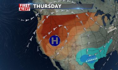
High pressure to our south, low pressure to our north, leading to hot and breezy conditions locally. The National Weather Service has issued Red Flag Warnings for high fire danger with windy and dry conditions. Also, area wildfires in Oregon and northern Idaho will send smoke and haze in this direction. OVERNIGHT: Lows around 60°,

Continue Reading

Fire Weather Alert Day!

RED FLAG WARNING IN EFFECT FROM NOON TO 9 PM MDT TODAY FOR
GUSTY WINDS AND LOW RELATIVE HUMIDITY FOR FIRE WEATHER ZONES 410 Upper Snake River Valley/Idaho Falls BLM,
413 Caribou Range/Caribou NF, 425 Middle Snake River Valley/Twin Falls BLM north of the Snake River, 427 Goose Creek and Raft River Valley/Southern Sawtooth NF/Twin Falls BLM south of the Snake River AND 476 Lemhi and Lost River Range/Challis NF

Continue Reading

More Heat, Fire Dangers

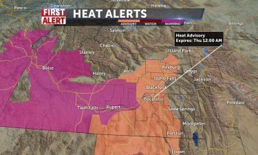
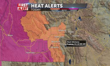
Fire Weather Watch for much of our area, with chances of PM storms/lightning, especially Wednesday, with 40-50mph winds with storms possible. Also, Heat Advisory for a good portion of the valley, from the sight to Preston, including Blackfoot, Pocatello areas. Temperatures headed toward 100 tomorrow after peaking in the mid 90’s today. Lows with continued

Continue Reading

Increasing temperatures, gusty winds

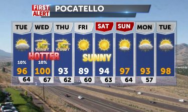
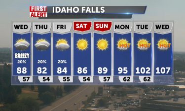
Scattered thunderstorms this evening and tonight. Clearing skies with lows into the mid 50’s. Sunny skies for Tuesday with highs into the lower to mid 90’s, with a slight chance of thunderstorms. Even warmer temperatures are expected for Wednesday, with highs into the upper 90’s. However, we’ll see gusty winds as an area of low

Continue Reading

Thunderstorms threaten 4th of July Plans

AFTERNOON/TONIGHT: Currently, we have lots of isolated thunderstorms across various parts of the region. There is a line of showers currently approaching the Magic Valley from the south, showers located in Central Idaho Mountains by Mackay and Arco, heavy isolated storms located south of Pocatello and north of Preston, light showers off to southwest of

Continue Reading

Red, White & Boom Storm Chances

Still hot and unsettled in the afternoon from lunch to late night with a chance of isolated thunderstorms for us today, mainly in mountain regions, where there is a red flag warning for fire danger. Highs 90-95 in the valley, mid 80’s for mountain communities. Lows will be in the upper 50’s to near 60

Continue Reading

Scattered thunderstorms, hot temps

We’re still looking at hot temps well into the 90’s this week and weekend. An area of low pressure over Utah, will drag in some monsoonal moisture from the south, triggering thunderstorms locally. Overnight: Chance of showers and thunderstorms, gradually clearing overnight. Lows around 60° with gusty winds from the dying thunderstorms. Friday: Highs into

Continue Reading

Above average temps with a thunderstorm risk

Overnight: Lows around 60°, with a slight chance of thunderstorms. Thursday: Highs into the lower 90’s, with isolated showers and thunderstorms after noon. Gusty winds from the passing thunderstorms. Friday: Chance of thunderstorms with highs into the lower to mid 90’s. Saturday: A slight chance of thunderstorms with highs into the mid 90’s. HEAT ADVISORY

Continue Reading

Continued Hot with Slight Storm Chances

Our hot days continue with a reprieve of heat advisories, but remaining toasty in the 90’s for most of us. Mid 80’s into mountain areas/Tetons, parks. Slight chances of pm thunderstorms is included in the forecast today and into the remainder of the week especially into Salmon, and Bear Lake regions today. Long stretch of

Continue Reading

Heat with a few thunderstorms

Highs are expected to be well into the 90’s with a slight risk of afternoon and evening thunderstorms. Overnight: Mostly clear with lows into the upper 50’s to lower 60’s. Wednesday: Mostly sunny with a few isolated thunderstorms for the afternoon and evening. Highs into the mid 90’s for the Snake River Plain. Thursday through

Continue Reading

Heat Advisory for many this week

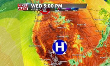
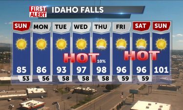
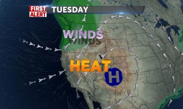
Surging high pressure and a diving jet stream will make for a dome of heat over Washington and Oregon and western Idaho. Heat advisory for our area tomorrow through Thursday night. Temps begin rising from the upper 80’s to 90 today to near 100 by Thursday. Limited scattered storm chances due to heating of the

Continue Reading

Dangerous Heat Wave Ahead

TONIGHT: Mostly Clear skies are expected throughout the night tonight with no rain chances. Winds are expected to be light from 5-15 mph throughout the region. Temperatures should get down to the 50’s in the valleys and 40’s in the mountains. TOMORROW: For tomorrow, we are looking at a day similar to today. We will

Continue Reading

Sunny and Warm for Sunday

TONIGHT: We can expect mostly clear skies throughout tonight with good breezes from the north ranging from 5-20 mph throughout the region. Some gusts could be seen up to 30 mph. Temperatures thus are going to take a dive tonight with most of us seeing lows in the 50’s in the valleys and 40’s in

Continue Reading

Cooler with Scattered Storm Chance

Before the expected heatwave next week, we expect clouds to scattered with a chance of a storm this afternoon and temperatures only in the lower 80’s for the valley. Mountains will see some shower chances dissipate with highs in the low 70’s. Red Flag Alert remains for SE Idaho through tonight. Winds becoming northerly and

Continue Reading

Hot and Windy Tonight

A few storms across the state from a trough pushing through into tonight and Wednesday. Our temps from 92-97 in the valley today will cool to the 80’s to 90 tomorrow with hot winds 20+mph at times. Most storms are for Island Park and SE highland areas and into Western Wyomin by Thursday. It will

Continue Reading

Hot and Hazy for Tuesday

High pressure to our south slowly moving east and a low pressure off the California coast, will send heat in our direction. Overnight into Tuesday morning, look for light winds and lows into the mid 50’s. Hot for Tuesday with highs into the mid to upper 90’s for the Snake River Plain. Winds for Tuesday

Continue Reading

Warming Up To Start the Week

TONIGHT: More Northerly winds are expected, but only between 5-15 mph. These winds should cool down the low temperatures back to the high 40’s in the valleys and maybe even into the 30’s into the mountains. Mostly clear skies should be present throughout the entire night. Rain chances should be diminished once the sun goes

Continue Reading

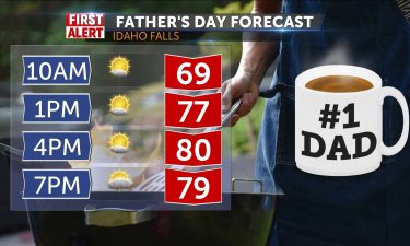
Slightly Cooler Father’s Day

TONIGHT: There is a red flag warning in effect for much of eastern Idaho until 10pm tonight. Low humidity levels, high winds gusting up to 40 mph, and temperatures in the high 80’s and low 90’s are supposed to last until the sun goes down just after 9pm tonight. No rain chances for tonight. Winds

Continue Reading

Warming Into the Weekend

TONIGHT: Cloud cover will continue to be slim into the night tonight as we should expect mostly clear skies with no rain chances. Winds should be anywhere between 5-15 mph and could gust up to about 20 mph. Temperatures cool down a lot tonight with lows into the low 50’s and high 40’s. TOMORROW: More

Continue Reading

Sunny, Dry, and Warming Up

Continued warm and getting warmer into the kickoff of the weekend. Highs today under sunshine – upper 80’s to low 90’s from Idaho Falls to Pocatello. Winds will be shifting more westward from the southwest at 5-15 mph (gusts to 20). Lows in the 50’s and warmer tomorrow with no cloud cover and lower 90’s.

Continue Reading

Wednesday Warm Up

High Pressure maintains the dry, sunny conditions with winds pushing from SW/W over the next couple of days 10-15 mph, gusting to 20-30. Temperatures, while cooler today, will ramp back up to the low to mid 90’s by Saturday. Today will be warm with low 80’s for mountains/parks and mid/upper 80’s for valley communities. Winds

Continue Reading

Sunny with above normal highs

We’ll see breezy conditions with slightly cooler temperatures for Wednesday. We’re going to flatten out the ridge of high pressure, taking our highs into the 80’s for Wednesday. Temps will return back into the 90’s for the late week. OVERNIGHT: Mostly clear with lows into the upper 50’s, with wind gusts 15-25 MPH. WEDNESDAY: Breezy

Continue Reading

BE FIRE ALERT TODAY

TODAY: Fires are currently burning just to the west of Pocatello and south of American Falls.  Fire weather might ramp up today as there will be no help from rain, mostly sunny skies, high temperatures reaching again for the 90’s,and winds being sustained between 15-20 mph throughout the day. TOMORROW: A cold front might skim through our

Continue Reading

Hot and Breezy for Tuesday

High pressure to the south sending heat, low pressure to the northwest sending some wind. OVERNIGHT: Mostly clear with a low around 60°, winds 10-20 MPH, gusts around 25 MPH. TUESDAY: Sunny and hot with highs into the lower 90’s. Breezy, with winds 15-30 MPH. A slight chance of thunderstorms in Central Idaho. WEDNESDAY: Sunny,

Continue Reading

Another Record Heat Day

TODAY: High temperatures could reach record highs again for today as most of the valley’s are looking at temperatures in the mid 90’s and mountainous areas could still get up to 90 today as well. Winds should be 10-20 mph today carrying in more dry, warm air. There is a slim 10% chance of a

Continue Reading

Heat and Sunshine

Temperatures above average for the start of the workweek, with highs well into the mid to upper 90’s for Monday afternoon. A Pacific northwest trough of low pressure will push back on this heat just a bit, enough to lower temperatures slightly. MONDAY: Highs into the mid 90’s with winds 10-15 MPH, Gusts around 25

Continue Reading

Warming Trend Inbound

TODAY: We are beginning to warm up after the cold front that came through yesterday. High temperatures are expected to be in the mid 60’s in the mountains to the low 70’s in the valleys. The winds are also calming down as we only have sustained winds only between 5-10 mph today. Partly Cloudy skies

Continue Reading

Hang On Today

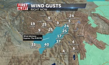
Gusty southwesterly winds from a solid cold front through the morning will create some blustery conditions today, with 15-30 mph wind. Gusts could top 40+ mph. Wind Advisory in effect through mid evening-9pm. High Wind Warning in effect for western/central Wyoming and areas toward Bear Lake. There’s a chance of showers/storms later in the afternoon,

Continue Reading

Major Chill Down

Sunny, Warm, Windy today and low-to-mid 80’s for most of us in the valley and Salmon/Jackson. Mountain villages pop into the mid 70’s and winds will pick up all day/tomorrow SW 15-30+ mph. Wind Advisory for the Snake River Plain tomorrow. Red Flag Warning into southern Idaho. Front takes energy into tomorrow with windy conditions

Continue Reading

Windy and warm for Tuesday

A slow moving area of low pressure in the Northwest, will keep us warm and breezy. That area of low pressure, will get overhead by Thursday. Tuesday: Partly to mostly cloudy with highs into the lower 80’s with winds at 15-30 MPH. A slight chance of thunderstorms for our local mountains. Wednesday: Windy and partly

Continue Reading

Sunny, Windy, Warm

We gather some temperature momentum before another significant change for the region by late Wednesday and Thursday as cooler air and storm chances pop to 40%. The next 3 days will see 80-85 for most of us, upper 70’s in the mountain communities and a slight brisk shower chance for the central mountains overnights. Winds

Continue Reading

Windy and Sunny Sunday Ahead

OVERNIGHT: We have a wind advisory in effect just east of Idaho Falls until 9pm tonight. Most places are currently seeing sustained winds of 20-30 mph with gusts above 40 mph, but wind should die down just slightly tonight with most areas seeing winds between 10-20 mph. Once the sun comes down, the rain showers

Continue Reading

Hot Temps, A Few Thunderstorms

A strong ridge of high pressure is settling in overhead. Highs for Thursday and Friday are expected to reach into the lower 90’s. Tonight, mild lows back into the 50’s with winds around 5 MPH. For your Thursday, mostly sunny with more clouds in the afternoon, highs into the lower 90’s. Southwest winds for Thursday

Continue Reading

More heat for the Week

Strong high pressure means hot dry weather for us for the rest of the work week. Stay cool in the upper 80’s today, closer to 90-91 in Salmon/Pocatello. Upper 70’s for Jackson Hole proper and around 80 in Driggs, light winds SW. Lows at night help reduce heat for afternoons in the valley, however an

Continue Reading

Warming Trend Continues

High pressure over the west, will continue to deliver above average temperatures locally, with highs around 90°. We’ll have a slight chance of mountain thunderstorms, but mainly sunny and winds around 10 MPH, for the Snake River Plain. OVERNIGHT: Partly cloudy with lows into the lower 50’s. WEDNESDAY: Highs into the upper 80’s to lower

Continue Reading

June is Here

Temps keep rising this week, thanks for high pressure. Very dry conditions and light winds and non-stop sun will hike afternoons from the low 80’s today to low 90’s by week’s end. A weak disturbance brings a cool down with some cloudiness by Saturday/Sunday and winds will pick up with highs in the 80’s Saturday

Continue Reading

Warming Trend This Week

An upper level ridge of high pressure continues to spin in from the west. Look for increasing highs into the 80’s and 90’s, with a minor theat of thunderstorms. Cooler air with more thunderstorms and gusty winds will arrive this weekend. OVERNIGHT: Lows into the upper 40’s with a partly cloudy sky. TUESDAY: Partly sunny

Continue Reading

Sunny and Warming Up

Beautiful start to the week with clear morning conditions, light variable winds and a slight morning chill, however we’ll warm up nicely today. High pressure will dominate our forecast and result in ultra warm conditions and above average temperatures all week. Be advised with warm weather and outdoor activity, rivers are still cold and dangerous

Continue Reading
FirstAlert

Beautiful Memorial Day

OVERNIGHT: We should have mostly clear to partly cloudy skies throughout the region tonight with no rain chances at all expected. Temperatures should get down to the 40’s for eastern Idaho, while low temperatures for western Wyoming could reach below 40 into the 30’s. Wind will be 5-10 mph coming from the north. MEMORIAL DAY:

Continue Reading
FirstAlert

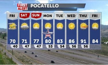
Calm Memorial Weekend

OVERNIGHT: We should expect to see fairly calm conditions with being mostly clear toward the north and mostly cloudy toward the south of the region. Temperatures should get down to around 40 degrees in the Snake River Valley and central Idaho while western Wyoming could get down below freezing again tonight. Winds stay calm and

Continue Reading

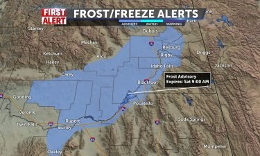
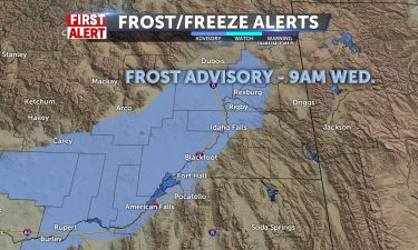
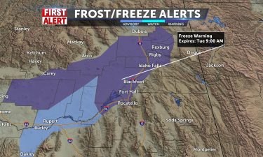
Frost Advisory Saturday Morning

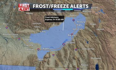
WIND ADVISORY REMAINS IN EFFECT UNTIL 9 PM MDT THIS EVENING……FROST ADVISORY IN EFFECT FROM 4 AM TO 9 AM MDT SATURDAY… WHAT…For the Frost Advisory, temperatures as low as 33 to 37degrees are anticipated, especially in outlying areas northwestof American Falls Reservoir. For the Wind Advisory, southwestwinds 2 to 35 mph with gusts up

Continue Reading

Windy Friday

An area of low pressure with a cold front will move through the region for Friday. We’ll see just a few thunderstorms possible near Yellowstone NP, Island Park and mountains near the Montana and Wyoming state lines. OVERNIGHT: Partly cloudy, with a low around 47. South wind 10 to 15 MPH, with gusts as high

Continue Reading

Isolated Storms, Wind, and Frost Tonight

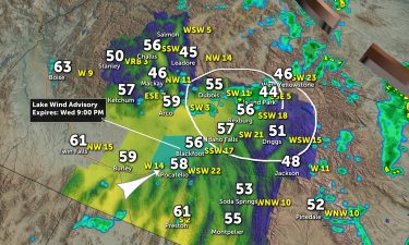
Scattered shower/storm chances linger this afternoon with gusty winds. Highlands see better risk of isolated storms, but chances remain for the rest of the day for the I-15 corridor. Lake Wind Advisory for American Falls Reservoir with continued gusty winds from the SW. Highs in the low to mid 60’s. Sunny and warmer tomorrow. Memorial

Continue Reading

Scattered thunderstorms and gusty winds

An area of low pressure is working through the region, with cooler highs for Wednesday, along with scattered showers and gusty winds. OVERNIGHT: Chance of showers and mountain snow with a low in the Plain around 45°. Winds 15-25 MPH, with higher gusts possible. WEDNESDAY: Chance of showers with gusty winds. A possible thunderstorm with

Continue Reading

Late Storm Chances

More clouds into the day with shower/storm chances to 50% by later. Clouds will probably prohibit the lunar eclipse of the blood flower moon overnight, 2-5am. Highs today in the mid to upperf 60’s and 70 in Pocatello. Winds SW 5-15/G20 and heavier around small thunderstorms, with small hail possible. Mountain snow chances continue into

Continue Reading

Wind Advisory, Chance of Thundershowers

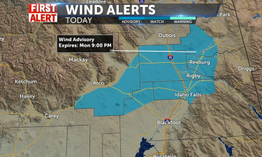
Scattered showers and thunderstorms for Monday afternoon with a wind advisory issued by the National Weather Service. WIND ADVISORY IN EFFECT FROM NOON TODAY TO 9 PM MDT THISEVENING… WHAT…Southwest winds 25 to 35 mph with gusts up to 45 mphexpected.WHERE…Mud Lake, INL, Craters of the Moon NM, Idaho Falls,Rexburg, and St. Anthony.WHEN…From noon today

Continue Reading

Stormy and Chilly

Southerly Flow continues from Lake Tahoe with showers in most viewing communities this morning. Snow in mountains likely and storms likely 70% especially along state lines into afternoon and night. The valley will receive a break from high risk showers tomorrow, which will allow for some sun, with 30% chance of storms. Low will slide

Continue Reading

Cool temps and scattered thunderstorms

An area of low pressure is slowly moving south, dropping in cooler temps and scattered showers for Friday and this weekend. OVERNIGHT: A chance of showers, partly cloudy with lows into the upper 30’s. Winds 15-25 MPH. FRIDAY: Mostly cloudy with a chance of showers and thunderstorms. Highs into the mid 60’s Winds around 10-15

Continue Reading

Windy with Storm Chances

Unsettled conditions bring increased winds SW 15-20/30mph gusts with mainly mountain storm chances today and highs only in the mid 60’s. 60% chance of storms tomorrow with consistent temps, a little break on Saturday and even cooler, 50’s, on Sunday with better storm chances, 60%. Some sun mixed with clouds today and slight shower chances

Continue Reading

Thunderstorm threat with cooler temps

An area of low pressure is moving through the northwest heading south. This will drop our highs back into the 60’s with scattered thunderstorms and showers. OVERNIGHT: Breezy and a chance of thunderstorms and showers. Overnight lows into the mid to lower 40’s. THURSDAY: Chance of showers and thunderstorms. Highs into the mid 60’s. Winds

Continue Reading

Mountain Winter Weather Advisory

Southwestern flow, a meandering low, and cold front approaching will all contribute to showers and storms mainly for the eastern Idaho/western Wyoming. Snow levels dropping from 7000 ft/central mountains to 6000ft closer to the weekend. Highs in mid 70’s today for the valley, lows in the 40’s. Significant temp drop tomorrow as shower chances ramp

Continue Reading

Breezy with a few thunderstorms

An area of low pressure is moving in from the northwest, we’ll increase the threat for thunderstorms and see cooler temperatures for Thursday and Friday. OVERNIGHT: Partly clear with lows into the upper 40’s. Winds 15-20 MPH. WEDNESDAY: A chance of afternoon thunderstorms, breezy and highs close to 75°. THURSDAY: Mostly cloudy in the afternoon

Continue Reading

Clouds, then Sun/Winds & Warmer

Breezy into Thursday afternoon W 10-20+ with a cold front and scattered shower chances are light. Warm, 75-79, upper 60’s for Jackson. Mild night/clouds with lows in the 40’s/50’s. Continued warm tomorrow upper 70’s with highland storms/winds. Saturday brings 30% chance of storms for Idaho, 60% chance for Jackson. Temperatures drop to upper 60’s for

Continue Reading

Sunny Warmth, Breezy, some clouds

We’ll see 70 around today with breezes from the SW 10-15/G20, Idaho Falls around 67 and 61 in Jackson. We’re trending to even warmer conditions tomorrow, upper 70’s. Clouds move in tonight and lows will be milder than recent evenings, mid 40’s. Look for further cloudiness into weekend with a 30-40% chance of scattered storms

Continue Reading

Partly Sunny with a mtn. storm chance

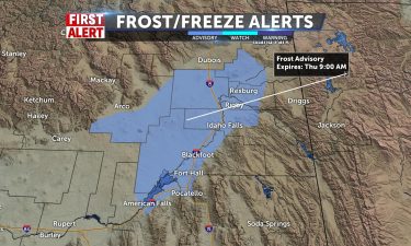
Some showers/storms possible for eastern I-15 into Wyoming for the afternoon with leftover moisture and heating of the day kicking up the activity. Highs around 60 for for the Snake River Plain and lower 50’s for Driggs and Jackson. Winds SW 5-10, gusty around storms 30-40mph. Frost advisory overnight for the upper Snake River Plain,

Continue Reading