Skip to Content

Weather

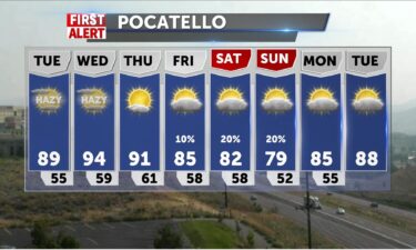
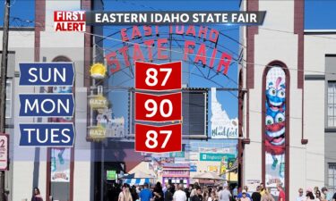
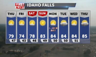
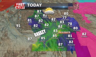
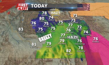
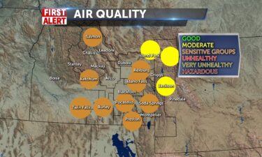
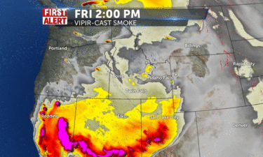
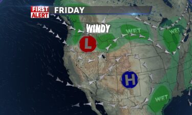
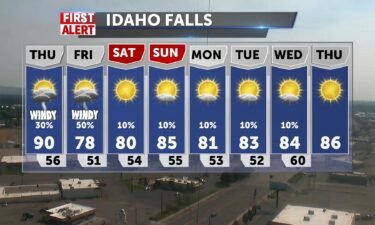
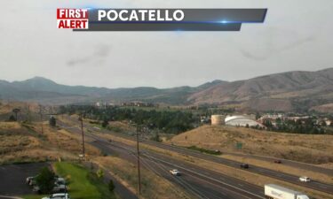
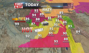
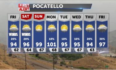
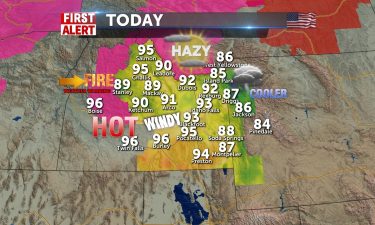
Labor Day Forecast, Warm, Windy, Hazy

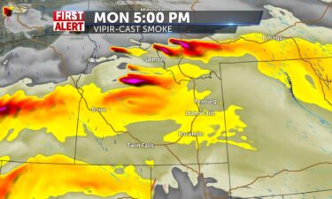
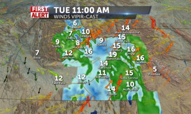
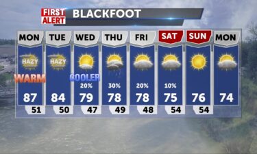
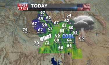
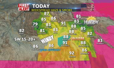
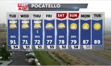
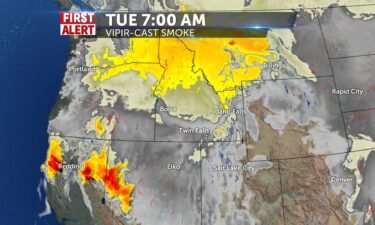
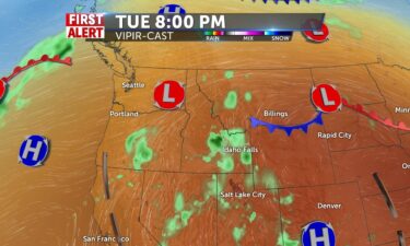
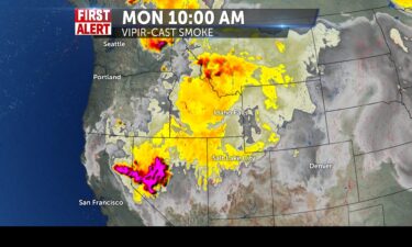
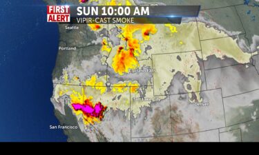
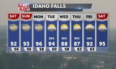
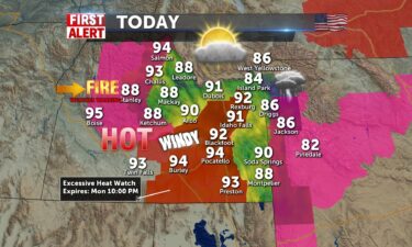
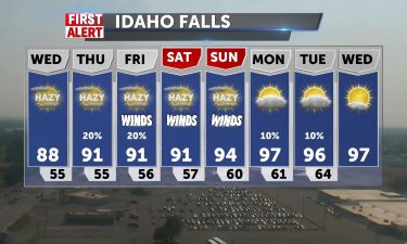
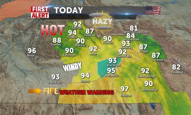
RED FLAG WARNING IN EFFECT FROM NOON TODAY TO 9 PM MDT THIS EVENING FOR GUSTY WINDS AND LOW HUMIDITY FOR IDAHO FIRE WEATHER ​​​​​Widespread haze and warm today. More smoke coverage this afternoon and tonight with gusty winds from a west/southwesterly flow 15-20+mph. Red Flag Warning in effect for the Sun Valley and Snake

Continue Reading
FirstAlert

New Orleans is transporting some residents to shelters as hundreds of thousands remain without power after Hurricane Ida

By Jason Hanna and Travis Caldwell, CNN As hundreds of thousands of Louisiana residents struggle in sweltering conditions and without power six days after deadly Hurricane Ida struck, some are trying their luck elsewhere. New Orleans on Saturday started a shuttle program for electricity-deprived residents wanting to leave, sending them by charter bus from the

Continue Reading
FirstAlert

Mayor describes ‘grief in limbo’ as search continues for 2 friends who were swept away when Ida’s remains unleashed deadly flooding in Northeast

By Aya Elamroussi, CNN Crews continued their search Saturday for two missing childhood friends whom witnesses say were swept into a New Jersey storm drain when Hurricane Ida’s remnants soaked the Northeast with lethal floodwater that killed at least 50 people across the region. Nidhi Rana, 18, and Ayush Rana, 21, are among the six

Continue Reading
FirstAlert

After Ida’s remnants kill dozens in the East, NYC mayor says cities need to prepare differently for increasingly intense storms

By Madeline Holcombe and Jason Hanna, CNN After Ida’s remnants swept through the East Coast and left at least 50 people dead, New York City’s mayor said the extreme rainfall should get everyone “to act very differently” — including expanding expectations for evacuations. “This is a new world,” Mayor Bill de Blasio told CNN on

Continue Reading
FirstAlert

Firefighters battle wildfires, fatigue and Covid-19 as California braces for an extended fire season

By Aya Elamroussi, CNN Firefighters battling a devastating wildfire season in California are exhausted as they face the state’s massive Caldor Fire that has been threatening a popular tourist city for days — and the likelihood of more fires in the weeks ahead. “Firefighters are getting tired, they’re getting drained,” Cal Fire spokesman Dave Lauchner

Continue Reading

Labor Day Weekend Forecast

Winds will be brisk at times SW 10-15 (20+G) as another trough moves through the area to start Friday and give us some fall like temperatures. Sunny conditions with areas of smoke will be with us through Labor Day Monday as temperatures drop today to the lower 70’s. Then high pressure takes over and we

Continue Reading

Labor Day Weekend is looking good

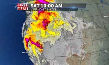
Widespread haze with sunshine and winds NNW 5-15 with gusts beyond 20mph today.Air quality may be of concern for those sensitive. Highs for most around 79, Pocatello will see 80. Mid-to-upper 70’s in the mountains.Clear tonight with some haze around and mid to lower 40’s with S winds, gusting to 20+mph. Thursday begins with morning
Continue Reading

Smoky/Hazy and Windy and Warm

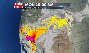
Not a great day to be outdoors for the region. Southwestern winds pull more smoke in from fires to the west and then with low humidity and gusts 20+mph we add a red flag warning for central snake plain and sun valley areas. Highs will be around 85 from Pocatello to Salmon. Lower 80’s near

Continue Reading

Wind and smoke for Tuesday

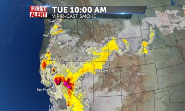
A system will be working in from the northwest. Look for breezy conditions and more smoke drifting through the region. A thunderstorm threat arrives with some southern moisture, later this week. TONIGHT: Smoke and haze with lows into the lower 50’s, with winds 15-25 MPH. TUESDAY: Areas of smoke and haze with highs into the

Continue Reading

Hazy Windy and Warm Today and Tomorrow

Dry, mostly sunny with widespread haze and warm today. More smoke coverage this afternoon and tonight with gusty winds from a southwesterly flow 15-20+mph. Red Flag Warning in effect for the Sun Valley and Snake River Plain through tonight.Highs in the upper 80’s. Low 80’s for mountain communities. We’ll keep this weather pattern through tomorrow

Continue Reading

Smoke and Sun and cooler temps otw

Dry conditions, some clouds and smoky haze over the area are a part of the pattern for today with cooler weather coming. The preview of September like temperatures will last briefly before we head back to the mid-to-upper 80’s. Today will be mostly sunny later with 78-80 degrees by mid-afternoon. Winds from SW 10-15. Tonight

Continue Reading

Thunderstorms expected to continue until early tomorrow morning

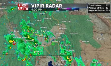
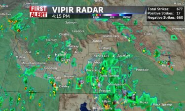
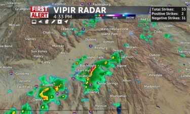
We are currently seeing thunderstorms within most of eastern ID and western WY. More of them are concentrated in southeast ID with a line of heavy rain showers lining up from Malad to Soda Springs and Georgetown all the way up into Jackson, WY. These line of thunderstorms are moving northeast very quickly. There is another line of heavy thunderstorms too from Salmon to Boise which is also moving to the northeast. These rain showers will continue to move quickly and will continue to be in our area until the early morning hours around 2 or 3 am.

Continue Reading

Scattered showers with smoke

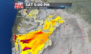
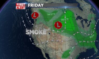
A few isolated showers and thunderstorms for Friday evening with partly cloudy skies. Lows overnight into the upper 40’s. Saturday, another area of low pressure works into the region from the northwest. We’ll also see smoke moving in ahead of this system, out of the southwest. We’ll look for a mixture of smoke and rain

Continue Reading

Chance of rain, areas of smoke

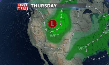
We have an area of low pressure over Idaho, with scattered showers, thunderstorms and cooler temps for tonight and Thursday. This low will move off for Friday, with another area of low pressure arriving from the northwest on Saturday. OVERNIGHT: Mostly cloudy, chance of showers with thunderstorms. Patchy smoke with lows into the upper 40’s.

Continue Reading

Showers and Smoke Today

A continuous track of showers and some thunderstorms over eastern Idaho and a heavier presence of smoke continues. With almost constant showers over the area, some local flooding is possible, and dangerous lightning continues with chance of scattered storms through tomorrow. Highs only in the mid 60’s. Winds will shift NE 5-15 with gusts to

Continue Reading

Cooler temps, scattered showers

We move some of this smoke tonight with a cold front slowly moving through. We’ll see scattered thunderstorms and gusty winds tonight. The scattered showers will continue into Wednesday morning. Another system arrives this Saturday, with more scattered showers. OVERNIGHT: Showers and thunderstorms with partly to mostly cloudy skies. Low’s into the lower 50’s, winds

Continue Reading

Air Quality issues and warm

Smoke remains in the forecast with warm conditions today. An approaching cold front will give us some brief relief with some fast showers and scattered storms for the next few days. Winds will ramp up today SW 20-30mph, and we’ll see showers begin, 30% chance. Clouds, cooler air will take us into the 70’s and

Continue Reading

Hot with Smoke – Air Quality Alert

AN AIR POLLUTION FORECAST AND CAUTION HAS BEEN ISSUED BY THE IDAHO DEPARTMENT OF ENVIRONMENTAL QUALITY… Due to wildfire smoke, the air quality has become unhealthy for sensitive groups in Bonneville, Butte, Clark, Custer, Fremont, Jefferson, Madison, and Teton counties of Idaho. This advisory will remain in effect until air quality has significantly improved. Those

Continue Reading

Idaho DEQ warns of dangerous air quality conditions

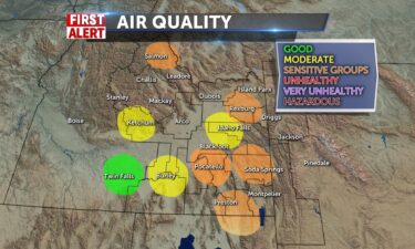
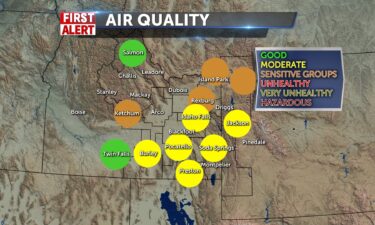
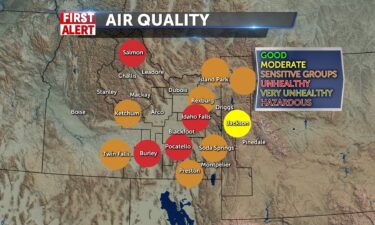
We have many areas currently under unhealthy air quality conditions including the Salmon/Challis National Forest and the Snake River Plain from Idaho Falls to Pocatello. Most of everywhere else within the region is under unhealthy air conditions for sensitive groups only. Only Jackson and most of Western WY is only in moderate air quality conditions. This rush of smoke should continue throughout the night tonight and into tomorrow.

Continue Reading
FirstAlert

The Nation’s Weather

The Nation’s Weather for Friday, August 13, 2021 _____ NATIONAL SUMMARY Steamy air over the Northeast will help to fuel thunderstorms from Missouri to New York state tomorrow as humidity and heat dominate the eastern third of the nation. Thunderstorms from southeastern Missouri to central New York can bring flash flooding and damaging winds to

Continue Reading
FirstAlert

The Nation’s Weather

The Nation’s Weather for Thursday, August 12, 2021 _____ NATIONAL SUMMARY Hot and humid air will continue to spread over the eastern half of the United States tomorrow. High temperatures will likely top out in the triple digits for some cities along the Interstate-95 corridor. A few strong-to-severe thunderstorms will bubble up across New York,

Continue Reading

Dog Days Cool Down

The Idaho Department of Environmental Quality (DEQ) has lifted an Air Pollution Forecast and Caution to notify residents of Bonneville, Teton, Madison, Fremont, Jefferson, Clark, Butte, Lemhi and Custer Counties of improved air quality. Due to improved air quality, BURNING RESTRICTIONS ARE BEING LIFTED. Air quality is currently in the GOOD category and is forecast

Continue Reading

Hot and Hazy

We’ve come out from under monsoonal flow and it will be hot and sunny today, however, we’ll have a smoky haze over the eastern Idaho and western Wyoming region. Some of it becomes thinner later with light winds SW 5-10/variable at times…later in the day. Highs will be in the upper 80’s to 92 in

Continue Reading

Return of the Haze, no storms

A return to calmer weather today with widespread haze for later and highs in the mid to upper 80’s for Tuesday. A gradual warm up into Wednesday as we head back to the 90’s. Monsoonal moisture has exited to Wyoming with a risk of shower for the cowboy state in the nw region, but dry

Continue Reading

Cool with Scattered Storms

We’ve still got a lot of moisture over us and the risk of storms for the day continues, with a flash flood watch in effect for today and tonight for mountain areas, eastern highlands, western Wyoming, and lower Magic Valley areas. Heavy rain is possible with thunderstorms with dangerous lightning. Fast moving storms can occur

Continue Reading

Scattered thunderstorms, flash flooding possible

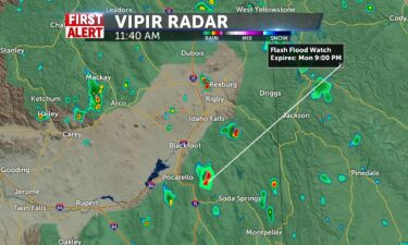
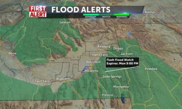
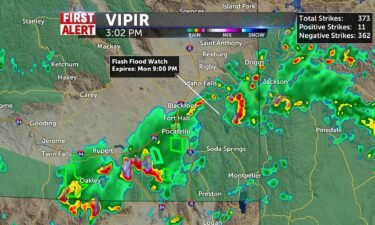
Scattered showers and thunderstorms will continue for Friday evening with some slow moving storms leading to a possible flash flood.FLASH FLOOD WATCH IN EFFECT THROUGH MONDAY EVENING: The National Weather Service in Pocatello has issued a Flash Flood Watch for portions of eastern Idaho and southeastIdaho, including the following areas, in eastern Idaho, Big HoleMountains.

Continue Reading
FirstAlert

Weekend of Storms

Monsoonal moisture in place over the region will help fuel scattered showers and thunderstorms through Monday. Saturation and flooding chances exist and flood watches exist for western Wyoming at this point. Highs remain in the low 90’s today with winds from the NNE gusting to 20mph. Chances increase for tomorrow/Sunday with temperatures dropping to the

Continue Reading

Less smoke, more thunder

Smoke and haze to start Tuesday and moisture begins a push from the south. By the latter part of the day, storms may develop with gusty winds 20-30mph+. Still hot, 30% of isolated storms for most and low 90’s for highs. Lows in the 60’s with passing storms into the evening. Another round of storms

Continue Reading

Heat Advisory Today

Heat Advisory today for Snake River Plain and into the Magic Valley. Highs from 95-98 with areas of smoke today. @JeffRoper has the 8 day forecast now on the air, online, and on our weather app. We have some changes coming in our weather pattern. https://vimeoassets.b-cdn.net/localnews8.com/2021/07/26/First_Monday_Weather_Hot_Hazy.jpg

Continue Reading

Haze and Heat

Areas of smoke today with highs in the low 90’s. Upper 80’s for Jackson. Fire Weather Warning in effect for Salmon and Challis and central mountain areas. Winds will pick up from southwest 10-15mph later. Conditions remain dry and air quality is sub-par for those senstitive to smoke/particles. This forecast will repeat for Pioneer Day

Continue Reading

Still Hot & Hazy with Storms Around

Mostly cloudy, breezes from southwest later 15-25mph, and some showers around to start Friday Eve. Some smoke and haze progressing toward east Idaho and red flag warning in effect to the central and southern zones, and eastern highlands and western wyoming. We keep a chance of storms for the day and night 30%, many isolated

Continue Reading

Smoke with thunderstorms for Thursday

Scattered thunderstorms for Wednesday night and again for Thursday. Overnight: A chance of thunderstorms with lows into the 60’s, along with some gusty winds. Thursday: Partly to mostly cloudy with highs into the lower 90’s for the Snake River Plain. Winds 10-20 MPH, with scattered thunderstorms possible. Friday: Sunny with smoke and haze, highs into

Continue Reading

Upper 80’s for most today

Moisture and heat today may pop a thundershower in our area, especially in the central regions. Winds will be pushing in from the southwest 10-15mph+, gustier around storms, scattered across the region. Highs peaking at 90 in Pocatello and lower 80’s for mountain communities. We head back into the 90’s tomorrow with a slight chance

Continue Reading
FirstAlert

Scattered thunderstorms tonight and Tuesday

Increased moisture from the south will up the thunderstorm risk. We’ll look for daytime highs down slightly with the cloud cover and thunderstorm threat. Overnight, a chance of showers and thunderstorms with gusty winds and lows into the 60’s. Tuesday, chance of showers and thunderstorms for the afternoon and evening. Highs into the upper 80’s

Continue Reading

Hot temps, Chance of thunderstorms

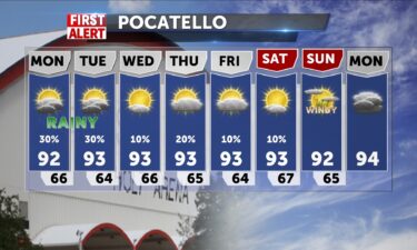
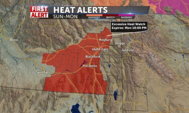
We’ll see increasing temps and a threat for thunderstorms this weekend. Temperatures are looking to close in on 100° for Sunday and Monday with a strong ridge of high pressure over Utah. Saturday, highs into the mid 90’s, with breezy winds in the afternoon and a slight chance of thunderstorms. Sunday and Monday, highs into

Continue Reading

Weekend Heat

Still dry and hot for today with highs gaining momentum and reaching 92-95 in the valley. Mountain towns/parks will reach the mid 80’s. Smoke coverage with hazy conditions ease up with zonal flow from the SW 10-20mph+. Cool overnight in the mid 50’s and 40’s in Jackson with a mid 90’s day tomorrow, before we

Continue Reading

Smoky Sun with Mountain Shower Chances

Still dry and hot for today with highs gaining momentum and reaching 92-95 in the valley. Mountain towns/parks will reach the mid 80’s. Smoke coverage with hazy conditions make air quality lousy and winds will usher in more smoke from SW 10-20mph+. Cool overnight in the mid 50’s and 40’s in Jackson with a cooler

Continue Reading

Cooler with Smoke and Haze

Hot and dry conditions through the region with only a slight chance of a mountain area storm 20%, make the incoming smoke combined with some wind tomorrow, our weather story. Air quality issues for those that are sensitive makes the haze and patchy smoke a concern. We’ll see a cooler day today with highs in

Continue Reading

Hot and Windy Haze Today

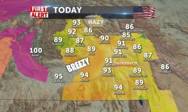
Hot w/Windy Haze Today-Red Flag Warning=fire danger. Lake Wind Advisory- American Falls Reservoir & I-15 corridor-gusts to 30+mph. Highs-upper 80’s to low-mid 90’s. I’ll update you @ thunderstorms risks for upper and eastern highlands and Soda/Jackson at noon. Jeff Roper

Continue Reading

Hot, hazy and windy for Tuesday

High pressure remains parked to our south over Nevada and Utah, with an area of low pressure moving through north Idaho and Montana. We’ll look for winds Tuesday out of the southwest, at 15-25 MPH, with gusts around 30 MPH. Along with the winds for Tuesday, we’ll keep smoky and hazy skies in the forecast,

Continue Reading