
Weather

Mild work week ahead
We’ll cool things down just a few degrees Monday, and see highs into the low 70’s. Expect mid-70’s through Thursday before a cold front slides in ahead of the weekend.
Continue Reading Sunshine through the haze
More warm weather is scheduled throughout the week. High temps could graze low 80’s, Sunday. Widespread 70’s are expected through Friday.
Continue Reading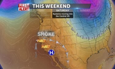
Smoke, above average temperatures
A few clouds tonight, thanks to a system moving through eastern Wyoming, South Dakota and Nebraska. We’ll look for more smoke drifting in from the west thanks to the California wildfires. Saturday, light winds, hazy and mostly sunny. Highs into the upper 70’s to lower 80’s. Sunday, more smoke and haze with highs into the
Continue Reading Weekend Sun
A trough from the north swings by for Friday and brings us a slight decrease in highs, and increase in clouds, but we’re not far from today. It will be more cloudy and low to mid 70’s across the valley. Mountain highs in the low 70’s, but still dry. Air conditions are “Good” in the region
Continue Reading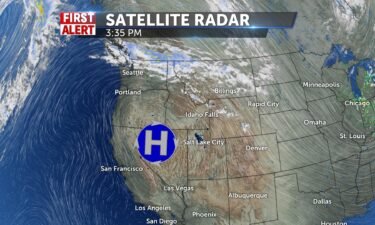
Warm Fall days, Smoke moving in from the west
A strong ridge of high pressure will continue its slow slide south this Friday and Saturday. We’ll still see above average high temperatures with crisp overnight lows into the 30’s. Smoke and haze will push in from the fires burning in California this weekend. For Friday a system is moving through Montana and eastern Wyoming.
Continue Reading Sunny October Kickoff
Ridge of high pressure makes for more sunny conditions today and warming up in the mid to upper 70’s. A trough from the north swings by for Friday and brings us a slight decrease in highs, and increase in clouds, but we’re not far from today. It will be more cloudy and low to mid
Continue Reading
High pressure still in control
Above average high temperatures, with sunny skies in our forecast for this week. Highs for Thursday, will be into the upper 70’s to lower 80’s. Mostly clear skies, with some smoke beginning to drift in from California. For Friday, look for partly cloudy skies as a system moves through eastern Wyoming. Overnight lows will drop
Continue Reading Nice Weather Continues
We’ll let high pressure maintain consistent warmer than average temperatures in the mid to upper 70’s. Light and variable winds with no haze or smoke. Lows in the upper 30’s to low 40’s. This pattern continues for the next 8 days with just a slight drop in temperatures on Friday, and a few clouds.
Continue Reading
Sunny with above average temperatures
High pressure over the western states is intensifying. This is leading to a warming trend as this ridge of high pressure moves into the Great Basin. For Wednesday, we’ll see sunny skies with highs into the upper 70’s to lower 80’s in the Snake River Plain. Light winds around 5-10 MPH. Overnight lows will still
Continue Reading Sunny, Calm, Dry Days
We’ll let high pressure maintain consistent warmer than average temperatures in the mid to upper 70’s. Light and variable winds with no haze or smoke. Lows in the upper 30’s to low 40’s. This pattern continues for the next 8 days with just a slight drop in temperatures on Friday, and a few clouds. Catch
Continue Reading
Frost Advisory for Tuesday morning, sunny skies and light winds
Quiet and sunny weather, with a slow warming trend this week, thanks to high pressure. Tuesday, we’ll look for highs into the lower to mid 70’s, with winds around 5-10 MPH. Overnight lows, will dip down into the upper 20’s to lower 30’s. Throughout this week, high pressure remains, delivering warmer than average temperatures.FROST ADVISORY
Continue Reading
Warm Days, Chilly Nights
High pressure creates WARM afternoons and chilly nights for the next 8 days. After mid 60’s today, continued sun takes our afternoons into the 70’s and consistently dry and sunny. North winds at 7mph today keeps the smoke and haze away, makig for a pleasant clear afternoon and with no cloud cover and cooler air
Continue Reading
Sunday night frost, with warmer days ahead
Portions of the upper Snake River Plain could see a hard frost tonight as temperatures dip into the 20’s in some cases. The lower portions of the plain also on advisory as we look to drop at least into the mid-30’s throughout the region.
Continue Reading
Freeze Warning and Frost Advisory issued for Monday morning
FREEZE WARNING REMAINS IN EFFECT FROM 3 AM TO 10 AM MDTMONDAY WHAT…For the Freeze Warning, sub-freezing temperatures as lowas 27 expected. .WHERE….Mud Lake, INL, Craters of the Moon NM, Idaho Falls,Rexburg, and St. AnthonyWHEN…From 3 AM to 10 AM MDT Monday.IMPACTS…Freeze conditions will kill crops, other sensitivevegetation and possibly damage unprotected outdoor plumbing. PRECAUTIONARY/PREPAREDNESS
Continue Reading
Chance of showers Friday night and Saturday morning
A cold front from the northwest is currently pushing across Idaho and Wyoming. With this front, we’ll see gusty winds and scattered showers. We’ll also see dropping temperatures for this weekend. This wet and windy weather begins to clear late Saturday with mostly sunny skies expected for Sunday. Highs for Saturday will be into the
Continue Reading
Windy Cool Weekend
A couple of cold fronts push across Idaho and create windy and cooler conditions into tonight and the weekend. Wind Advisory for this afternoon and Saturday afternoon. SW 20-30 gusting to near 40mph. Highs today in the low to mid 70’s, upper 60’s in the mountains. Lows in the low 50’s, before cooler air takes
Continue Reading
Wind Advisory for Friday, chance of showers early Saturday
A northwest area of low pressure is moving into the region with a couple of cold fronts. We’ll see dropping temperatures with highs into the lower 70’s for Friday. Highs for Saturday will be into the mid to upper 60’s. Winds will be out of the south and southwest at 15 to 20 MPH, increasing
Continue Reading Gusty Winds & 70’s
Widespread smoke with winds picking up to 23mph, gusting to 40mph this afternoon. Cloud/Sun mix and 75-77 for the Snake River Plain. Upper 60’s for mountains today. Lows in the 50’s. Windy again Friday with cooling temps to the 60’s and mountain moisture with a slight chance of a shower. High pressure creates some clearing
Continue Reading
Wind Advisory issued for Thursday
Gusty winds and smoky skies with an approaching system through the northwest. This cold front will drive in cooler temps for Friday and Saturday. Increasing wind speeds with this cold front are expected Thursday afternoon and evening with gusts around 40 mph. We’ll have a slight chance of showers and thunderstorms, with most of the
Continue Reading Sun and Smoke
Smoke and gusty winds will make for another hazy day around here. Southwest winds gusting up to 25 miles per hour with highs today from 77 in Idaho Fallsto lower 80’s for Pocatello, Chubbuck, and Inkom. Lower 70’s for the parks. More clouds for Salmon with highs close to 80. A few spotty showers showing up
Continue Reading
Windy with more smoke
We’re holding onto above average temperatures for the next couple of days with some breezy winds. A couple of systems moving through the northwest and the high plains are delivering some gusty winds. We’ll see a few isolated showers and thunderstorms for the higher elevations for Thursday and Friday. Also, with these systems, cooler temperatures
Continue Reading Fall has Flung
Warm start for autumn, which arrived at 7:30 this morning. Highs pressure makes this forecast warm today. Highs will be in the lower 80’s for the SRP and upper 70’s for Salmon, lower 70’s for the parks. Winds will shift and pick up later from the SW 15-20 + mph. Overnight lows in the 50’s
Continue Reading Mild weather for the first day of Fall
Expect another 80 degree day, Tuesday. A short wave system will bring breezy conditions by the afternoon with some light scattered shower in the higher elevation areas.
Continue Reading
Last Day of Summer
Happy National Batman Day! After a beautiful, fall-like Sunday, we begin a warm up this week into the upper 70’s and low 80’s. It will be dry and mostly sunny today and clouds move in/out through the week. Average temperature for this time of year is 72, we’ll be above that all week, until a
Continue Reading Temps bounce back above average
High temperatures will bounce back up into the upper 70’s and stay there for most of the work week. Weather will remain mild, with just light winds ahead of cooler days next weekend.
Continue Reading Overnight cold front, rain Saturday
A cold front will sweep into Southeast Idaho by Saturday Morning. Expect rain through the morning hours, gradually clearing out into the afternoon.
Continue Reading
Smoky, Windy Friday, Cold Front Saturday
Gusty winds with more smoke for Friday, before an upper level low pressure system swings in. Late Friday and into Saturday, we’ll see a chance of showers and thunderstorms with dropping temperatures. Before the storm arrives, we’re stuck with gusty winds and very dry conditions. With this wind, the National Weather service has issued a
Continue Reading
More smoke and haze with a pattern change this weekend
Warm and dry conditions will continue for Thursday, before an area of low pressure moves through. We’ll look for gusty winds for Friday, before a cold front pushes through. Look for scattered showers and gusty winds for Saturday. Thursday, Haze and areas of smoke, with a high into the upper 80’s and lower 90’s. Friday,
Continue Reading Hazy Days Continue
The sun is out, but haze and smoke may things tough on air quality and visibility. Highs today will head to the mid 80’s and lows in the 40’s. A break in the haze is expected by weekend but not before we see a chance of storms late Friday and into Saturday with lots of
Continue Reading
Hot and Hazy, Shower Chances late Friday into Saturday
We’re holding onto above average temperatures with high pressure over the west. We’re also still bringing in smoke and haze from the west. We have an Air Quality Alert issued by the Idaho DEQ, until further notice. We’ll begin to see a chance by this Friday and Saturday, with a low pressure system moving in
Continue Reading Warm and Hazy
Unhealthy air quality for many today and warm with highs in the low to mid 80’s and upper 80’s in Pocatello. WSW-5-10mph. Cooler by Saturday with a slight chance of showers, highs in the mid 60’s. Jeff Roper, First Alert Weather
Continue Reading
Hot and hazy with an Air Quality Alert
Hot and hazy with high pressure with us for the start of the workweek. We’ll see highs into the 80’s and lower 90’s with smoke arriving in from the west. We’ll begin to pick up winds and drop in cooler temps, by this weekend, as a system moves through. Tuesday, hazy and breezy with highs
Continue Reading Unhealthy Haze building up
AN AIR POLLUTION CAUTION STATEMENT HAS BEEN ISSUED BY THE IDAHO DEPARTMENT OF ENVIRONMENTAL QUALITY… Due to wildfire smoke, the air quality has become unhealthy for sensitive groups in Bonneville, Butte, Clark, Custer, Fremont, Jefferson, Madison and Teton counties of Idaho. Air quality is expected to fluctuate between UNHEALTHY FOR SENSITIVE GROUPS and UNHEALTHY for
Continue Reading Unhealthy Haze
Sunny, and warm 85-90, but hazy and breezy SW 15-20 gusts. Air quality is currently in the UNHEALTHY FOR SENSITIVEGROUPS*
Continue Reading Continued haze and mild weather
High pressure will keep high temperatures into the 80’s throughout the work week. In the meantime, a Westerly influence in the jet-stream will continue to push smoke from California wildfires into the area.
Continue Reading
Lighthouse Christian off to 2-0 start with win at North Gem.
BANCROFT, Idaho (KIFI/KIDK) – Lighthouse Christian took control of the game early and held control throughout, defeating North Gem 34-12. Next week, the Lions will take on Mackay, who will play their first game of season after a shutdown of their season due to COVID-19. The Cowboys will travel to Rockland in a matchup with
Continue Reading
Warming with more haze
Warm and dry weather for this weekend with smoke from western wildfires. High pressure will warm us into the 80’s this weekend. The forecast looks dry until late next week. Saturday, sunny with smoke and haze, highs into the lower 80’s. Sunday, highs into the mid to upper 80’s with more smoke and haze. Monday,
Continue Reading
Sunny with smoke
Dry and warmer weather with high pressure working back across the region. A bit of a breeze for Friday and Saturday, with more smoke and haze drifting back in. This ridge of high pressure, will shift our upper level winds to the west, in turn, grabbing more of this smoke from fires burning in California
Continue Reading SeptBruary Warm Up
We’ve got a nice long stretch of sunny, dry days ahead as we recover from that tremendous blast of cold air and wind on Monday. Highs stay in the lower 70’s today, mid to upper 70’s tomorrow and finally back to 80’s Saturday and Sunday. Upper 80’s on Monday then dip in temps with a
Continue Reading
Frost Advisory for Thursday morning
Dry weather will continue, with chilly overnight and morning low’s. Light winds and mostly sunny skies are in the forecast for Thursday. We have a slight chance of showers coming through western Wyoming and far eastern Idaho. Winds will pick up for Friday with warming temperatures into the upper 70’s and lower 80’s. The weekend
Continue Reading
Sunny and 70
We’ll take a break from the wind today, as the clean up continues. Clear and dry for a week to come and temps will start the ascension to seasonal norms. @79 for most. IF and Pocatello will hit 70 by 5pm and winds will be N 5-10 with 20 mph gusts. Lows – still chilly,
Continue Reading 
Freeze Warning for Wednesday Morning
The storm system that brought the crazy winds on Labor day, is now slowly moving through Utah. We’re left with breezy conditions and freezing overnight lows. There’s a slight risk of snow and rain showers rotating back through Wyoming and far east Idaho for Thursday. Highs will be slow to recover, but by this weekend,
Continue Reading
Rain, snow showers, gusty winds overnight, clearing Tuesday
A strong northern cold front is making its way through southern Idaho and Wyoming late Labor Day into Tuesday. A High Wind Warning will expire at 11PM Monday night, with gusty winds lasting trough Tuesday with dropping temperatures. Monday night into Tuesday morning, gusty winds with scattered snow and rain showers. Lows into the mid
Continue Reading High Wind Warning
A back-door cold front rams through Idaho this afternoon, bringing high winds, cold air, some possible winter-like showers and mayhem for the night-time hours. Temperatures will hit normal highs around 80 for IF and Pocatello, lows dip into the 30’s. The main problem, besides some rain blowing, are northerly winds up to 50 mph gusting
Continue Reading
Strong winds and cooler temperatures
A back-door cold front slides in from the Northeast, Monday. A high wind warning is in place for the Snake River Plane. Expect sustained winds above 30 mph with gusts beyond 55 mph. Tuesday night will usher in a frost for much of the Snake River Plane.
Continue Reading
Heat Advisory expanded for Saturday, cooling-off next week
An approaching cold front will drive in hot temperatures for Saturday, before the front passes. By Labor Day, we’ll see dropping temps and some scattered thunderstorms to get us trough the week. HEAT ADVISORY NOW IN EFFECT FROM 8 AM TO 9 PM MDT SATURDAY… WHAT…High temperatures of 96 to 101 degrees.WHERE…The Eastern Magic Valley,
Continue Reading
Heat Advisory issued for Saturday
High pressure over the west, delivering warming temperatures and smoke from the fires burning in California. A cold front approaches from the north for this weekend. As this front moves in, we’ll see really warm temperatures with highs into the 90’s and low 100’s. Behind the front, look for dropping temperatures for Sunday and Monday.HEAT
Continue Reading
Record Breaking Heat OTW
Clear, dry, and warm today thanks to high pressure. Winds WSW-5-10 and light. Some haze into Treasure Valley and lower plain and Jackson. Upper 70’s for parks and Jackson. Mid to upper 80’s for most and 90 for Pocatello. High pressure ridges pushes into the region from California to take temps to record highs for
Continue Reading
Warming trend with us for the rest of this week
High pressure delivering dry and overall warm conditions. A dry front is passing through northern Idaho and Montana, bringing breezy winds late Wednesday. We’ll see lower wind speeds for Thursday with sunny skies with highs into the mid to upper 80’s. High pressure ridging continues to build in across the western states this weekend, with
Continue Reading Sunny, Windy, & Warmer
The countdown to Labor Day is on and warmer temperatures will take us to possible record highs on Saturday. 84-87 today with gusty winds from the WSW 15-20 gusting to 30 and then cool overnight in the upper 40’s to mid 50’s. Close to 90 by Friday and dry with 95 for Saturday in Pocatello.
Continue Reading
Warming Trend, Windy Wednesday
A frontal system passing through Montana, will drive gusty winds through our region, this Wednesday afternoon and evening. Otherwise, dry and sunny with a warming trend through the rest of the week. A dry cold front moves in for Saturday afternoon, with highs into the mid to upper 90’s, before the front passes. Dropping highs
Continue Reading

Frost Advisory for Tuesday morning
A cold front is moving through the region, with showers late Monday, coming to an end for Tuesday. We’ll see cold overnight lows with the clearing sky into Tuesday. The National Weather Service has issued a Frost Advisory for portions of the Snake River Plain and Arco Desert. A Freeze Warning has been issued for
Continue Reading
Chilly Rain and Frosty tonight
Very unseasonable weather for today and tonight. Chilly rain for most and then frosty for the SRP and freeze warning for Western Wyoming. 25-30 for the mountains and 40’s overnight in the Valley. Low to mid 60’s rest of the afternoon as rain ends and a crispy, cool night begins. The sun will dry us
Continue Reading Cold, wet Monday, warmer days ahead
High temperatures will hit low to mid-60’s Monday. Expect breezy winds, and scattered showers through the midday.
Continue Reading Wind and cooler temps
Sunday and Monday are the big oddball days in our forecast. 30 mph winds are expected throughout much of the day, Sunday. High temperatures will only hit low to mid-60’s Monday. Temperatures will bounce back by the mid-week.
Continue Reading
Gusty winds scheduled for the weekend
A Red Flag Warning is will come into effect Saturday and Sunday in anticipation of gusty winds. The shift in the weather pattern will bring a cold air mass into the area from the North. Expect highs to top out into the 70’s and 60’s Sunday and Monday.
Continue Reading Patchy Hazy Sunshine & Cooler
Sunny with patchy smoke around the region today – High of 83-86 for the Valley and Salmon. Lows in the 50’s. A couple degrees warmer tomorrow with more sunshine (barring smoke from wildfires). Then Sunday a major cool down with a front through here in the morning. Winds pick up enough for us to a
Continue Reading Warm and clear Friday and Saturday
Storms activity wraps up Thursday night. Plan on sunshine and mild conditions Friday and Saturday, ahead of a cool-down into next week.
Continue Reading Sunny with Scattered Storms
Some sun mixed with scattered mountain storms and cooler air will make a for a nice afternoon for most of us. Highs in the 70’s in the mountains and parks and low to mid 80’s for SRP. Clearing for Friday and the weekend with a major cool down Sunday and Monday. Jeff Roper, First Alert
Continue Reading
Some Sun w/Hazy Storms
Afternoon sunshine with a widespread haze and isolated storm chance today keeps temperatures in the mid 80’s to 90. Low 80’s for the parks and Jackson. 20-30% chance of thundershower later in the day and again tomorrow PM. Winds can be gusty around storms, otherwise a light breeze WSW 5-12 mph. Temps drop to near
Continue Reading Smoky haze with a few thunderstorms in the mix
Another round of thunderstorms is possible Wednesday and Thursday nights. High temperatures into the 80’s will continue through the work week.
Continue Reading

Scattered Storms with more Haze
Moisture flow from the southwest may provide a little relief from smoke and haze, winds will be gusty around storms into late PM. Highs 88-91, lower 80’s in the parks, but temps coming by end of the week will be in the 60’s?!? Play my video forecast anytime online
Continue Reading
Continued haze and scattered storms
High pressure positioned over the Western U.S. will continue to pull in warm temperatures, storms and smoke from the Southwest. Watch for a few evening thunderstorms each day through the midweek.
Continue Reading
Hot, Hazy, COOLER?
More widespread smoke and haze today, with a slight shower chance later. Highs 85-93 with SW winds 5-15+ gusting later. Storm chances increase tomorrow especially for mountains and Jackson and temperatures start to drop more toward seasonal norms @ 80-85. Still issues with air quality in the area, so stay indoors if you are sensitive.
Continue Reading
More Smoke, Isolated Thunderstorms this week
High pressure over the Great Basin for the start of the workweek, will keep us under the influence of smoky skies and scattered thunderstorms. We have a low pressure center over the Pacific Northwest, enhancing our southwest flow. This will lead to warmer temps, with highs into the 90’s, gusty afternoon winds and monsoonal thunderstorms
Continue Reading
Warmer & Smoky Haze
Weekend keeps warming up a couple of degree for Sunday with smoke/haze breezing in from the SW 5-15 mph in the afternoon. Highs in the low to mid 90’s. A trough will help bring moisture and a slight chance of spotty showers Tue/Wed mainly, dropping highs into the upper 80’s to the seasonal normal of
Continue Reading
Warm and smoky this weekend
Warming temperatures with smoke and haze. Saturday, hazy with highs into the lower 90’s. Breezy, with winds 10-15 MPH, gusts up to 25 MPH. Sunday, more smoke and haze with highs into the lower 90’s. Winds 10-15 MPH, gusts up to 25 MPH. AN AIR POLLUTION AND CAUTION STATEMENT HAS BEEN ISSUED BY THEIDAHO DEPARTMENT
Continue Reading Smoke and Haze Continue
Air Quality Alert for our area TFN, smoke from wildfires can create health problems for those with long exposure outdoors. WSW breezes are lighter today 5-13 mph with sunny conditions. Highs may be held back by haze 91-93 from IF to Pocatello. Lower 80s in the Parks. No Rain chances until next week. Temperatures top
Continue Reading
Poor air quality, warmer temps for Friday and this weekend
Smoke and haze will continue to hang over the region, thanks to wildfires burning in California. AN AIR POLLUTION AND CAUTION STATEMENT HAS BEEN ISSUED BY THEIDAHO DEPARTMENT OF ENVIRONMENTAL QUALITY… Due to wildfire smoke, the air quality has become unhealthy forsensitive groups in Bannock, Bingham, Bear Lake, Caribou,Franklin, Power, and Oneida Counties. Due to
Continue Reading Hot & Hazy
Not much rain for us, just haze and smoke widespread across the area. Winds from WSW 15-20 with gusts to 25mph, some clearing by tomorrow and warming to the mid 90’s by Saturday. Highs today 91-94 for the SRP. Upper 80’s with a widespread isolated shower in the mountains. Lows in the mid to upper
Continue Reading
Hot temps and smoke filled skies
A few thunderstorms late Wednesday and Thursday afternoon as the large ridge of high pressure over Utah, shifts to the East. Smoke from wildfires in California, will continue to haze our skies into the near future. Hot and sunny this weekend with dry weather. Thursday, gusty winds with a slight chance of mountain thunderstorms. Highs
Continue Reading
Heat, smoke, gusty winds and a few thunderstorms
High pressure shifting to the east, will bring in breezy conditions and continue to pump in the heat with scattered thunderstorms. We’ll still have some smoke and haze from regional wildfires, keeping a gray sky in the forecast. Thursday, windy with winds 10-20 MPH, partly to mostly cloudy with highs into the mid to upper
Continue Reading
Heat advisory continues, scattered thunderstorms
High pressure is sticking around with scattered thunderstorms and hot temps. A Heat Advisory has been issued through Wednesday. Tuesday, partly cloudy with highs into the 90’s and low 100’s for the Snake River Plain. A slight chance of thunderstorms for the valleys. Scattered thunderstorms for our local mountains. Wednesday, partly cloudy with highs into
Continue Reading HEAT ADVISORY NOW
A heat Advisory is in effect until Wednesday night at 9pm. A dome of high pressure has us locked down for the long haul with 100 degrees today and mid 90’s tomorrow. Not much relief, only a limited spotty mountain shower to cool them down, but otherwise really hot and dry. Light winds SW 5-9.
Continue Reading
Continued heat
A heat advisory remains in place through Tuesday for much of the region. Temperatures are well above average, and a few cities may continue breaking records.
Continue Reading
Heat Advisory issued for Sunday through Tuesday
High pressure over the west, will deliver above average high temperatures to our region. By Sunday, we’ll see a push of monsoonal moisture, which will bring some afternoon thunderstorms, mainly for the high country.A Heat Advisory has been issued by the National Weather Service, “HEAT ADVISORY IN EFFECT FROM NOON SUNDAY TO 9 PM MDT
Continue Reading
Keeping your cool through a heat wave
IDAHO FALLS, Idaho (KIFI/KIDK) – As a high pressure system slides into the area, doctors are warning us to stay safe while keeping our cool. High temperatures will hit 90’s and even triple digits throughout the Northwest. Even Seattle, where 75 is the average August high, is forecast to hit 95 degrees Sunday. Dr. Stephen
Continue Reading Major heat is coming
Temperatures today will be in the low to mid 80’s (below normal slightly) after that dry front kicked up the winds yesterday. Continued breezy today with lots of sunshine. Warming up into the weekend, back into the 90’s with extreme heat and sunny, dry conditions through Thursday. Highs on Monday will be around 100 for
Continue Reading
Breezy for Friday, Heat next week
Staying breezy for Friday, with normal highs. High pressure will build over the western states for this weekend, delivering above average heat locally. Temperatures in the upper 90s to low 100s are possible. Friday, highs into the mid to upper 80’s. Winds 10-20 MPH. Saturday, mostly sunny with highs into the mid 90’s. Sunday &
Continue Reading Heat Wave Ahead
Winds today will gust to 30mph with a red flag warning through evening hours. High temperatures will be 85-91, with lows tonight 45-55. Some breezy, sunny conditions tomorrow as temperatures remain near normal before a 10-12 degree warm up Saturday, Sunday, and Monday. Highs Monday around 100+ degrees. Dry conditions with low humidity make fire
Continue Reading
Windy with near normal temps
A cold front with scattered thunderstorms late Wednesday will move off to the east for Thursday. We’ll keep windy, but mainly dry, conditions through the remainder of the week. Thursday, windy with mostly sunny skies, highs into the mid to upper 80’s. Friday, windy and sunny with highs into the mic 80’s. Saturday, highs into
Continue Reading Windy and Warm
A dry frontal boundary pushed some limited chances of thunderstorms for the mountains into the forecast for the afternoon with a red flag fire warning and gusty winds up to 30-40mph around storms. Highs reach upper 80’s to 91 in Pocatello. Lower 80’s for the parks and Jackson. More wind tomorrow and Friday with dry
Continue Reading Scattered storms with more wind for Wednesday
More wind in the forecast, as a system pushes in from the northwest. We’ll see more gusty winds locally, with some scattered showers and thunderstorms. Temps are expected to drop slightly through the rest of the week behind this system. We’ll bring in the heat for next week, with highs into the mid and upper
Continue Reading Hot, Windy, Dry
Hot & sunny in the lower 90’s. Around 80 in the parks, and 83 in Jax. A dry front will make it’s way through East Idaho into Wednesday with gusty winds and a reprieve from the 90+ degree temps we’ll have today. So back to the mid to upper 80’s for the rest of week
Continue Reading
Wind, Windy and more Wind this week. Thunderstorms possible Tuesday and Wednesday
Dry and windy conditions this week, with a few thunderstorms possible on Wednesday. Temps will drop slightly this week with a dry cold front as we get closer to this weekend. Tuesday, windy with highs into the lower 90’s. A chance of thunderstorms in Idaho’s southern mountains. Wednesday, windy, partly cloudy with a few thunderstorms.
Continue Reading Sunny and Warmer
We’ll start Aug 10th wtih sun and warm up to 86-88. 80 in the parks and 83 in Jax. A dry front will push through late Tuesday and Wednesday with gusty winds and drop temps from 90 on Tuesday back to the mid 80s to upper 80’s for the remainder of the week. Limited mountain
Continue Reading Dry and breezy work week
Monday will see just gentle breezes, but stronger winds Tuesday prompt concern over wildfires. High temps will hover around mid-eighties all week.
Continue Reading More Sunshine
Expect plenty of sunshine through the extended forecast. Wind speeds will hit low to mid teens Sunday afternoon, with mild breezes expected into the work week.
Continue Reading
A windy weekend
A windy weekend, with sunny skies and near normal temperatures. Saturday, highs into the upper 80’s and lower 90’s. Mostly sunny with winds 10-20 MPH, Gusts 20-30 MPH. Sunday, highs into the mid to upper 80’s. Mostly sunny with winds 10-20 MPH, Gusts 20-30 MPH. Monday, mostly sunny with highs into the mid to upper
Continue Reading Great Weather Weekend
A push of cooler air delivers a great weather weekend and a break from oppressive 90’s for a sunny, windy, and warm weekend. Highs 83-85 in the SRP, upper 70’s to low 80’s for the parks, Jackson, Salmon. Minimal storm chance for the next 5-7 days. Nice weekend with dry, but sunny and windy days
Continue Reading
Windy with a few thunderstorms
We’ll see a few thunderstorms late Thursday with gusty winds. A frontal system is moving through the region, delivering gusty winds and dropping temperatures. There’s just a slight chance of thunderstorms for Friday. Friday, highs into the mid to upper 80’s for the Snake River Plain with gusty winds. A slight chance of mountain thunderstorms.
Continue Reading Breezy & Hot Storms
Fire Weather Warning 3-9pm with Thunderstorm winds 40mph into the afternoon. Highs in the low 90’s. 40% chance of isolated and scattered storms from Blackfoot south. Slight chances to the north. Lows around 60. Winds clear us out for Friday and cool down for the weekend with lots of sun and highs 85-88, lower 80’s
Continue Reading
A few thunderstorms, Red Flag Warning issued
A southwest flow is bringing in heat with a few thunderstorms Wednesday evening. Thursday afternoon and evening expect scattered showers and thunderstorms, with a frontal boundary moving through from the northwest. A Red Flag Warning has been issued for Thursday afternoon.Thursday, partly sunny with a high into the lower to mid 90’s. Winds 10-25 MPH.
Continue Reading
Tornado warning canceled
UPDATE 6:23 p.m.: The National Weather Service has canceled the tornado warning.
Continue Reading Hot Today
HOT Today! This will be the hottest day we’ll see for a bit. With a couple of weak waves passing through, hot today and we’ll see a slight chance of thundershowers late tonight and tomorrow and winds picking up from the SW 10-20 into Thursday PM. Highs will peak in the mid to upper 90’s
Continue Reading