Skip to Content

Local Forecast

KIFI Local News 8 and KIDK Eyewitness News 3

Nice Weekend ahead, hang on

Mostly cloudy today with cooler temps in the mid 70’s to 80 in Pocatello. Warmer in Salmon. 67 in Jackson and scattered storms into the afternoon. Clear tonight in the 50’s before a warm up return to the 80’s tomorrow and even warmer with some clouds on Saturday, 85-90. Then cooler and wet intro Sunday

Continue Reading
KIFI Local News 8 and KIDK Eyewitness News 3

It’s getting Hot in Here…

Very little cloud cover and high pressure ridge make for a nice start to a hot afternoon. @90+ for areas south of IF in to Pocatello. Afternoon storms and showers begin to usher in cooler air for tonight and tomorrow, then we take temps in the 70’s. Rebounding back to the 80’s for Friday and

Continue Reading

HOT with Thunderstorms late Wednesday

Very quiet weather for Tuesday evening and early Wednesday morning.Showers and thunderstorms developing Wednesday afternoon and evening, with showers continuing into Thursday. A cold front is dropping in for Thursday, with off and on showers. Before the cold front arrives, highs will reach the upper 80’s and lower 90’s for Snake River Plain communities. After
Continue Reading
KIFI Local News 8 and KIDK Eyewitness News 3

Warming up through tomorrow

Thanks to a ridge of high pressure, we’ve got another super day with warm temps and little wind. It’s dry with only a slight chance for some mountain showers, but I’ll say sunny because temps are from 77-88 from Jackson to Salmon. SRP temps in the mid 80’s and overnight lows get into the 60’s

Continue Reading
KIFI Local News 8 and KIDK Eyewitness News 3

Summer is here

A ridge of high pressure keeps things dry and warmer as we head into the week. 80-82 today and 50’s overnight. Light and variable winds. Mid 80’s tomorrow and approaching 90 by Wednesday. Thundershowers move in for Thursday and we’ll cool back to around 80 to start our weekend. Jeff Roper, First Alert Weather

Continue Reading

Warming up with a few thunderstorms

We’ll see warming temperatures region-wide this weekend, thanks to high pressure. An area of low pressure through the Northwest will usher in some wind and scattered thunderstorms. Sunny and warm weather expected for much of the approaching work week. Saturday, highs into the upper 70’s to the lower 80’s with afternoon and evening thunderstorms. Winds

Continue Reading
KIFI Local News 8 and KIDK Eyewitness News 3

Summer kickoff

We’ve got great weather for Friday leading into the beginning of summer tomorrow afternoon, plus Father’s Day Sunday. Highs in the mid 70’s today, upper 70’s for Saturday with some cloudiness and mtn. showers and 80 by Sunday. Light breezes from the NNE. Jeff Roper, First Alert Weather

Continue Reading

Looking great for Friday

A few thunderstorms late Thursday, giving way to a mainly sunny Friday with warmer temperatures. High pressure over the region, will allow daytime highs getting into the mid 70’s for the Snake River Plain. As we head into the weekend, a Northwest cold front will push into northern Idaho and Montana, delivering gusty winds locally

Continue Reading

Nice Days Ahead

High pressure is dominating our weather for a stretch of days to kick off summer officially, Saturday afternoon at 3:44pm (the longest day of the longest year…lol) 66 TODAY with light winds-N. 40’s tonight and then the warming trend begins. Low to mid 70’s for Friday, with a continued mix of sun/clouds. Showers chance are

Continue Reading
KIFI Local News 8 and KIDK Eyewitness News 3

Wet and Windy, Clearing

High Pressure saves the day later tonight when our lows drop in to the frosty upper 30’s. A frost advisory may show up for early morning. Some sun as we get back to normal with highs in the 60’s, and even warmer headed to Father’s Day weekend and high’s in the mid 80’s! Safe to

Continue Reading
KIFI Local News 8 and KIDK Eyewitness News 3

Tuesday Storms

Increasing clouds today with highs in the 75-80 in the SRP. Stormy weather and heavier winds into tonight and storms scattered through the area to begin Tuesday with 5-15 degree temperature drop, only 62 for the afternoon with scattered storms and mountain snow mixed for some.

Continue Reading

Hot and windy for Friday

Hot and windy for Friday as a cold front approaches from the west. As this front moves in, warmer air from the south will drive our daytime highs close to 90°. The cold front passes for Saturday, with slightly cooler air and very windy weather is expected. A wind advisory has been issued for Saturday.

Continue Reading

Warming up with a few thunderstorms

A few thunderstorms for the afternoon and evening hours with warming daytime highs, thanks to building high pressure over the region. A cold front moves in this weekend, with dropping temperatures and some scattered showers. Thursday, mostly sunny with highs into the lower 80’s. Winds 10-15 MPH, with a few thunderstorms in the afternoon and

Continue Reading
KIFI Local News 8 and KIDK Eyewitness News 3

Great weather ahead until…

Enjoy rising temperatures through Friday, with breezes from the south/southwest 5-15/G20 and temperature today topping the mid 70’s, low 80’s Thursday and approaching 90 for the SRP Friday. Lows in the 40’s/50’s. Saturday and Sunday will bring cooler air with a front and very slight precip chances for the valley, 40% for the mountains and

Continue Reading
KIFI Local News 8 and KIDK Eyewitness News 3

Sunny and Breezy

Good News! We’ve got temperatures on the rise and clearing conditions for a nice stretch of days. Enjoy 60’s, 70’s and 80’s toward 90 today through Friday. Check out the video forecast for your hometown and prep for some weekend showers and cooler temps by Saturday after some showers/storms. No frost but chilly overnight 40’s/50’s.

Continue Reading
KIFI Local News 8 and KIDK Eyewitness News 3

Widespread Chilly Showers

Hang on, we’ll get this nasty weather out of here in a day or two and back to normal. Highs today only in the 50’s. Snow mixed with rain around the region and frosty start to Tuesday, with mornings in the 30’s. Westward flow helps to clear and bring warmer weather by Wed/Thu. Download our

Continue Reading
KIFI Local News 8 and KIDK Eyewitness News 3

Sunny and Windy

Our Forecast is great for outdoors until late Friday and Saturday. Thunderstorms take over the weekend and temperatures drop to the 70’s and 50’s by Sunday. Scattered showers and t-storm chances remain decent through Monday. Winds continue around storms and are clocked at 15-20 mph into Saturday. 30mph gusts are possible. Today: Windy and Sunny

Continue Reading

Warm, Windy and Thunderstorms

We’re still under the influence of warmer than average temperatures with a westerly flow from the jet stream. A storm system is expected to arrive late Friday, with showers moving through this weekend. Thursday, partly cloudy with highs into the lower to mid 80’s. Gusty winds 15-35 MPH with isolated thunderstorms. Friday, increasing clouds, with

Continue Reading
KIFI Local News 8 and KIDK Eyewitness News 3

Windy Week

We’ve got some breezes to escort clouds mixed with sun through the region today tomorrow. SSW 15-25 mph with gusts to 30mph. Highs are cooler than Monday, around 78-81, with cool lows in the 50’s. We rebound to the 80’s tomorrow and closer to 90 by Friday before an approaching front kicks us into storms

Continue Reading
KIFI Local News 8 and KIDK Eyewitness News 3

Sunny Monday

After storms on Sunday, we’ll take sunshine today for the region with highs in the low to mid 80’s. Breezes later with be southwesterly 15-25 mph with gusts of up to 35mph. Central mountains (Salmon) has a chance of passing showers later, but a nice stretch of warm and partly to mostly sunny days continues

Continue Reading

Hot, breezy and a few thundershowers

Feels like summer for Eastern Idaho and Western Wyoming, with highs well into the 90’s for Saturday. We’ll also see a risk for afternoon and evening thunderstorms. The ridge of high pressure over the west, begins to move east for Sunday, allowing for the temperatures to fall slightly. More thunderstorms will begin to show for

Continue Reading

Hot and breezy with a few T-storms

A broad ridge of high pressure is pumping in the heat with highs pushing into the lower 90’s. We’ll also have a few thunderstorms with breezy winds. The ridge begins to shift to the east on Sunday, leading to cooling temperatures. Friday, a slight chance of mountain thunderstorms, with partly cloudy skies for the rest

Continue Reading

Warming Up

High pressure over the west will allow temperatures well above average, with highs into the lower to mid 90’s for Friday and Saturday. Some moisture will wrap in for Friday and Saturday, leading to a thunderstorm risk in our local mountains. Our high pressure begins to break down on Sunday, allowing temperatures to drop back

Continue Reading
KIFI Local News 8 and KIDK Eyewitness News 3

Memorial Day Sunshine

Now that the snow! is leaving us, we’ll see some patchy fog to startwith morning lows in the 30’s. Memorial Day will see sun with some breezy conditions and some late mountain showers. Highs around 70, then we warm up toward 90 by Thursday, with a mix of clouds and sun all week. Memorial Day:

Continue Reading
KIFI Local News 8 and KIDK Eyewitness News 3

Memorial Day Forecast

Now that the snow! is leaving us, we’ll see some patchy fog to startwith morning lows in the 30’s. Memorial Day will see sun with some breezy conditions and some late mountain showers. Highs around 70, then we warm up toward 90 by Thursday, with a mix of clouds and sun all week. Memorial Day:

Continue Reading
KIFI Local News 8 and KIDK Eyewitness News 3

No Snow for Memorial Day

After a strange start to the weekend with some areas receiving 3-4″ of snow early Saturday and record rainfall for IF 0.7″ on Saturday (.45″ 1953), our temperatures will rebound and will head past our norm of 71 for the region by week’s end. While chilly and late showers die out for early Sunday with

Continue Reading

Rain and Snow Showers for Saturday

Still stuck with scattered showers for Friday night and Saturday, as a system exits the region. We’ll look for the possibility of snow showers as well for Saturday morning. More “wrap-around” rain and snow showers, from the east, for most of your Saturday. The exception will be Central Idaho, with just a slight risk of

Continue Reading

Unsettled weather pattern continues

Scattered showers, thunderstorms and gusty winds continue for Wednesday evening with clearing skies for Thursday morning. We’re still under the influence of an upper level low pressure system over the inland northwest. Cold for the overnight lows with numbers back into the 30’s and 40’s. There’s there possibly of snow showers mixed in with the

Continue Reading

More Wind and a few showers for Tuesday

An upper level low is slowly moving through the west this week. We’ll continue to see gusty winds, scattered showers/thunderstorms and cooler temperatures. Tuesday, partly cloudy with highs into the lower 70’s. Winds 15-35 mph. Chance of afternoon and evening showers. Wednesday, A chance of showers and possibly a thunderstorm. Highs into the upper 50’s.

Continue Reading
KIFI Local News 8 and KIDK Eyewitness News 3

Stormy Days are coming

Closer to 80 by Monday PM, gusty winds, especially around scattered storms with major storm chances by mid-week for most. Highs drop to the lower 60’s/upper 50’s by Wednesday and it will continue to be cooler into next weekend, as storm chances continue over the region, all week. Jeff Roper, First Alert Weather

Continue Reading

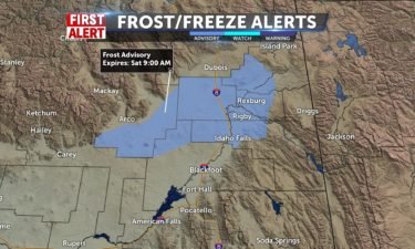
Frost Advisory with sunny skies Saturday

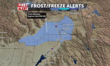
A few showers and gusty winds for Friday evening, with clearing skies into Saturday. With the exiting the system, we’ll have chilly overnight lows. The National Weather Service has issued a Frost Advisory for the Upper Snake River Plain. Another round of stormy weather arrives Monday for central Idaho, with showers Tuesday & Wednesday for

Continue Reading
KIFI Local News 8 and KIDK Eyewitness News 3

Flyover storms and warmer

A chance of t-storms through tonight with lows in the 30’s, but above freezing. Frost Advisory for the northern Snake River Plain. Mix of clouds and sun for Saturday, but dry and warming to 79 by Sunday. Temperature drop next week will take us to the upper 50’s in the afternoon with thunderstorms Wednesday. Be

Continue Reading

Gusty winds and scattered showers

Gusty winds with a few showers will continue Tuesday night. An area of low pressure off the west coast, continues to send scattered showers and gusty winds. As a result, we’ll see below average temperatures for the rest of the week. The low is expected to move through the region on Friday, clearing just in

Continue Reading

Nice weekend ahead

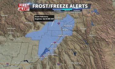
A storm is sweeping through central Wyoming Friday night, dropping in a few showers in far Eastern Idaho and Western Wyoming. We’ll still have some wind overnight into Saturday from this system. A Frost Advisory has been issued for the Snake River Plain for Saturday morning, with lows into the mid 30’s. A great weekend

Continue Reading
KIFI Local News 8 and KIDK Eyewitness News 3

Sunny Stretch OTW

Breezy with some clouds to start Monday, temps still in the 60’s. We’ll hit the upper 60’s and low 70’s by Tue/Wed. A few more clouds with the approach of moutain thundershowers Wed, with a dip in temps Thursday. Next weekend looks nice with dry conditions and temps in the mid to upper 70’s. Jeff

Continue Reading
3KM Baron Model of lightning 4_29_2020

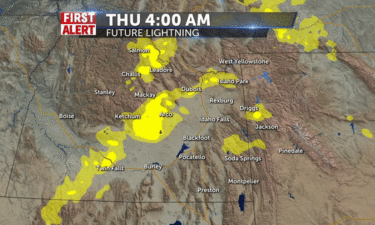
Potential for Severe Weather Thursday

EASTERN IDAHO (KIFI/KIDK) A cold front moving through the region Thursday, will usher in a threat for showers and thunderstorms , with some cells turning severe. Current weather models are showing the increased instability with wind shear, leading to increasing instability. This means some storms could turn to severe status, with hail, strong downdrafts and

Continue Reading
KIFI Local News 8 and KIDK Eyewitness News 3

Saturday night Showers

A small chance of showers scattered over the region tonight with lows from mid 30’s to 50 in Pocatello. Clouds maintain with breezy conditions and highs make for mild afternoons, with highs approaching or at 70. By mid-week, we may reach 80, before we drop back into the 60’s and 70’s with slight shower chances

Continue Reading
First Alert

Cold Front Tonight

Sunshine will dominate the first part of the day, Wednesday. By this afternoon, cloud cover will increase and winds will pick up ahead of a cold front that hits the area tonight. Watch for a few showers this evening, with more wet weather overnight.

Continue Reading