Skip to Content

Weather

Windy with a chance of sun?

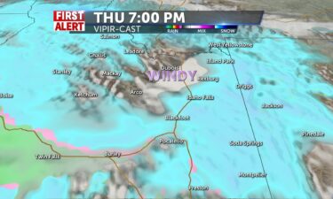
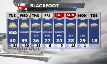
Windy and highs above freezing 37-42 in the 1-15 corridor, limited chances for a rain/snow mix with a shortwave moving through the area. Clouds and snow chances for tonight remain with lows in the 20’s as we are still insulated for precipitation. 1-2″ for mountain areas, plus a wintry mix possible, also morning snow for
Continue Reading

Wintry Weekend Kickoff

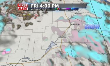
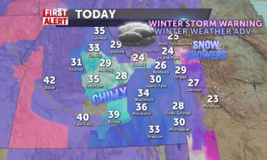
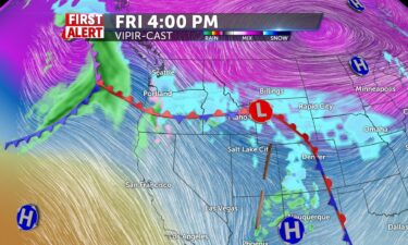
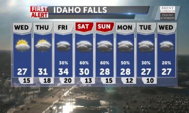
Overnight showers add to our frozen landscape make for a slick beginning to Friday. Scattered showers into the midday continue with southwestern winds 15-20+ at times, taking temps down by 8 degrees or so. Highs 31 in Rexburg to 37 in Pocatello. More snow later tonight with accumulations of 1″+ in Idaho Falls to 4-8″

Continue Reading

Chance of snow with winds for Wednesday

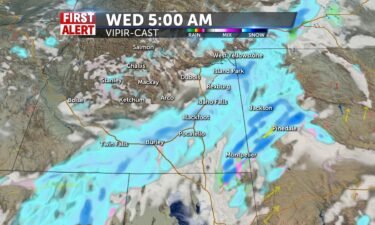
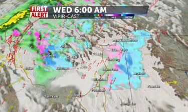
Our cold and wet northwest flow continues for Wednesday. We’ll see colder temperatures over the next couple of days with winds 10-20 MPH. We’ll also see some scattered snow showers for Wednesday. Another potent system moves in Friday morning with accumulating snowfall. Overnight: A chance of snow overnight into Wednesday morning with lows into the

Continue Reading

Winter keeps coming

Storm 3 of 3 in the last 5 days pushes more snow into the valley today and more into the highlands and central mountains tomorrow. Snow showers accompanied with winds 20+ from the SW will make for sloppy and some slick conditions. Highs around 30-32 and winds will drive temperatures above freezing for Blackfoot and

Continue Reading
FirstAlert

Snow showers for Monday

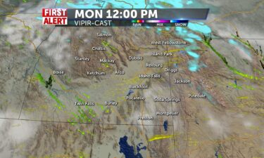
Special Weather Statement from the National Weather Service in Pocatello: Snow to return to southeast Idaho overnight and Monday… Another Pacific storm system will return snow to southeast Idahoovernight tonight. Expect snow to return to the central mountainsafter midnight then spread east through Monday morning. Right nowamounts of 3 to 6 inches are expected in

Continue Reading

Tracking Snow arrival

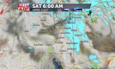
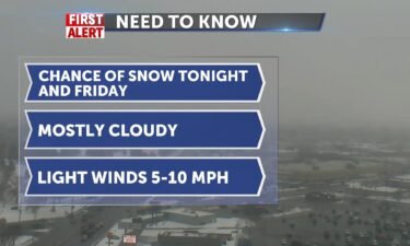
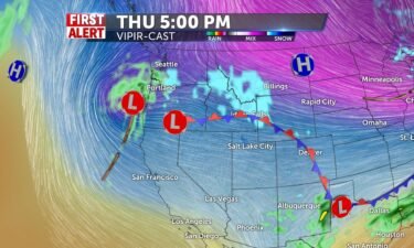
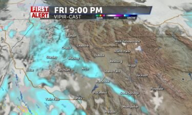
Snow in the mountains, with some rain for the lower Snake, the snow north and east of Pocatello. Winds 10-20+ from the SW, calming tonight, with snow continuing overnight with light accumulation. More snow into late Friday and then continuing Saturday with some accumulations.

Continue Reading

Some Sun and Wind

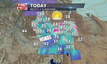
Mid 20’s in the upper highlands today, 32-41 in the SRP and 26 in Jackson. Mountain shower chance exists, partly sunny elsewhere with winds 15-20+ and a cold start to the day. One more day like this tomorrow before storms move our way and some ultra cold air into the weekend. Jeff Roper, First Alert

Continue Reading

Windy and Cold

Windy for Monday and temperatures fall as we get snow chances later in the week. Southeastern highlands begin tuesday with a snow chance and some accumulation. Flakes fly at times while we prep for a blast of cold air this week that lasts into the weekend. Highs drop to the 20’s after mid 30’s Monday

Continue Reading
FirstAlert

Snow is back tonight

Fingers cross for a glimmer of sun between fog and clouds to start today, winds pushing 15-20+ from the southwest. Highs short of freezing and 33 in Pocatello. Ramp up to snow for mountains starting later and into tomorrow morning with accumulations for Soda Springs to West Yellowstone and over to Jackson. 40% chance for

Continue Reading

Snowy and slick to start

Snow and rain with winds of 20+mph, slick spots so be cautious. Some sun may appear later and highs not much past freezing. Lows tonight in the teens. Mountain communities receive more scattered snow into Thursday and Friday and we’ll have cold sunshine into the weekend with dry days. Click on our Question of the

Continue Reading

Scattered snow showers Wednesday

A Pacific storm is moving through the region tonight and Wednesday morning. Expect scattered snow showers early Wednesday, with partly to mostly cloudy skies in the afternoon, with mountain snow showers through the afternoon. Highs in the Snake River Plain will reach into the mid 30’s. Winds will be in the 10-25 MPH range, with

Continue Reading

Groundhog Day = Sun, Snow

Milder temps today with a sun/cloud mix, so you may see YOUR shadow, but a front into evening for the central mountains kicks off the snow for Wednesday for the SRP very early. Northern snow amounts will be good for resorts, but the frosting for the valley will make things messy, slick, and travel less

Continue Reading

Sunny Monday

Mostly sunny today with highs in the mid 30’s @36 for IF, Arco, Mackay. Pocatello will reach lower 40’s with N winds 5-10mph. Tuesday night ushers in shower chances, accumulations for the central mountains and northern/eastern highlands/Jackson just like last time. Overnight/Wednesday morning rain, then snow arrives for the SRP before noon and colder air

Continue Reading

Rain and snow showers for Friday

Mostly cloudy tonight with scattered rain and snow showers. Lows into the upper 20’s to lower 30’s, with winds around 10 MPH. For this Friday, we’re stuck with this un-settled flow of wet weather from the southwest. We’ll look for scattered rain and snow showers for the Snake River Plain, highs into the upper 30’s

Continue Reading

Snow/Rain Continues

More Scattered snow showers and rain with some gusty winds continue into the afternoon. Temperatures in the mid 40’s for the SRP, and low 30’s for mountain areas. Sun Valley and Northern high country and Western Wyoming continue to accumulate snow as more develops into tonight and southeastern highlands get another scoop into tomorrow. Lows

Continue Reading

Snow, Wind blow into SRP

The viewing area gets the snow blast cranked pretty well this afternoon with highs reaching the upper 20’s for mountain areas and lower 30s for the SRP.Winds have already gusted to beyond 60 mph in Twin and 40+mph in Pocatello. Downslope winds will hold back some moisture from Blackfoot south, but we’ll have patchy, blowing

Continue Reading

Snowy and Windy

The viewing area gets the snow blast cranked pretty well by mid-morning into lunch with highs reaching the upper 20’s for mountain areas and lower 30s for the SRP. Winds have already gusted to beyond 40 mph this morning in Pocatello and will blow any patchy snow showers, making travel hazardous and lowering visibility. Rain

Continue Reading

Snow, Rain and Gusty Winds

We’re seeing a steady stream of stormy weather roll in from the west. We’ll start to see snow showers moving through the region, Wednesday morning. Down-slope winds around Pocatello may prevent heavy accumulations of snow. Warmer temperatures Thursday, will lead to more of a rainy snow mix of precipitation. The National Weather Service has issued

Continue Reading
FirstAlert

Snow settles in tonight

Heavy snow for mountain areas of Eastern Idaho Wed/Thur. Accumulations beyond 12″ for Central mountains, High Country and Jackson and 3-5″ for Southeastern Idaho areas. Several inches possible 50% chance for IF north with rain/snow mix for Pocatello south. Winds may dilute shower chances for lower Snake Plain and lead to little accumulation. Winds will

Continue Reading

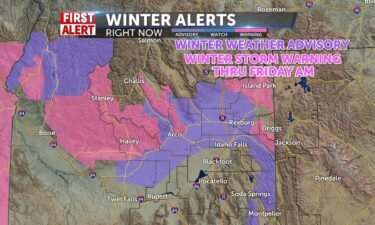
Winter Storm Warnings Issued

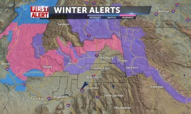
Heavy snow for mountain areas of Eastern Idaho Wed/Thur. Accumulations beyond 12″ for Central mountains, High Country and Jackson and 8″ for Southeastern Idaho areas. Several inches possible 50% chance for IF north with rain/snow mix for Pocatello south. Winds will pick up with this system 25+ mph and make for hazardous road conditions and

Continue Reading

Winter Storm Watch Issued

Western Idaho has already been given notice about a river of moisture that will bring substantial snow amounts for the mountain areas beginning Wednesday through early weekend. Highs today and tomorrow with patchy sun 27-34, with lows remaining bitter cold in the single digits to lower teens. Some flurries and patcy freezing fog remaining in

Continue Reading
FirstAlert

Winter Weather Advisories Continue

THE FOREST SERVICE UTAH AVALANCHE CENTER IN SALT LAKE CITY HASISSUED A BACKCOUNTRY AVALANCHE WATCH. UNTIL 6 AM MST SATURDAY. * AFFECTED AREA…THE WASATCH MOUNTAINS IN SOUTHEAST IDAHOINCLUDING THE BEAR RIVER RANGE. * AVALANCHE DANGER…HIGH AVALANCHE DANGER IS EXPECTED FOR THE WATCH AREA ON SATURDAY. * REASON/IMPACTS…POTENTIAL HEAVY SNOW TONIGHT AND SATURDAY WILLOVERLOAD A VERY

Continue Reading

Southeastern Snow Later

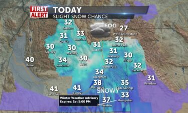
20-30% chances of snow today with patchy fog and winds N-5-10mph. Highs 32-38 from IF to Blackfoot/Pocatello. Winter Weather Advisories for a portion of SE Idaho and Western Wyoming with 6″ of snow into tonight and Saturday for Soda Springs/Montpelier and Pineland areas. Advisory expires Saturday at 5pm. Avalanche watch for the Bear River range.

Continue Reading
FirstAlert

Snow into the Weekend

Some more sun with a mix of clouds to start the day: Light breezes from the north make wind chills serious this morning. We’ll be partly sunny by afternoon 25-33 in the SRP. 30 in Salmon. We’ll adjust low tonight from single digits into the teens as we warm before the storm and bring mountain

Continue Reading
FirstAlert

Patchy Fog/Cloudy Start

Some low clouds and foggy conditions to begin the day, the upper SRP will have to wait till later to burn this off, then decreasing clouds for sun tomorrow. WSW 7mph+ in the mountains, but dry cold air stays put and we’ll see 25-32 today and 5-10 degrees tonight. Next snow chance rolls up toward

Continue Reading

Cold Sunshine is Back

We have cleared out and cold, sunny conditions take over with variable cloudiness through the day and highs in the upper 20’s to near freezing in Salmon. 36 in Pocatello and light winds WSW-6. Some more clouds into the kickoff of the weekend and consistently chilly temps during the day at 29, lows in the

Continue Reading

Wintry Mix & Gusty Winds

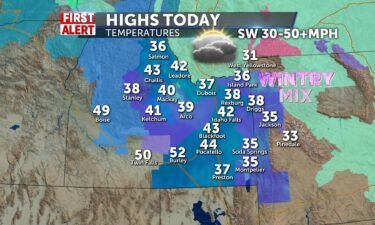
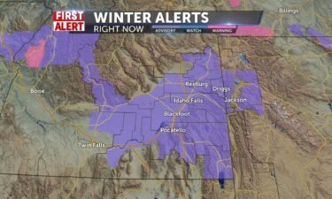
Strong winds accompany the cold front pushing through behind the wintry snow/freezing rain/rain showers scheduled today. SW 35-50+ mph and snow riding along the front into the early afternoon. Highs 35-45. Wind Advisory for the SRP through 5pm. Winter Weather Advisory for Central and Eastern Idaho mountains and Jackson area through 5pm. Back to the

Continue Reading

Rain, Snow, Wind

We’ll warm to 32-25 today with some patchy clouds before a messy cold front with rain/snow mix stirs things up for later tonight and into tomorrow. Gusty winds to 40mph will cross through the SRP with blasts of snow/freezing rain/rain. Highs make it to the 40’s with Winter Weather Advisories for some eastern mountains and

Continue Reading

Cold Start: Snow Wed.

High pressure makes for a cold start and single digits to begin Monday. Partly sunny by midday and 25-32 highs, with N-6 winds. Clouds from the system moving in tomorrow afternoon and evening, with snow for mountains and mixing with rain for some. Looks like a messy Wednesday for the valleys, dust to no accumulations.

Continue Reading

Foggy start, Snow chances tonight

Another weak system pushed through Idaho later today and tonight brings traces of snow for most overnight. Don’t rule out areas of freezing fog and cold air settling in to make the rest of Sat/Sun dry with lows in the teens and singles by Monday morning. High today with cloud/sun mix 28-32, snow flies in

Continue Reading

Morning Snow Showers

A weak trough kicks through to start the day and spread some light snow into the area, traces measured before another trough Friday night and Saturday morning leaving behind 1″-2″ in the SRP. Freezing (32-33) temps with south winds at 6. Foggy conditions with low clouds tonight and into weekend after snow with lows bottoming

Continue Reading
FirstAlert

Sun breaks through

What a difference some sunshine makes! Chilly but sunny this afternoon and temps not much more than freezing. Breezes southwesterly 10-20mph and cold tonight mid-teens. Some fog and slick spots tonight and tomorrow morning and a partly sunny day Wednesday with highs consistently around 30. Jeff Roper, First Alert Weather

Continue Reading

Avalanche Danger

THE GALLATIN NATIONAL FOREST AVALANCHE CENTER IN BOZEMAN HAS ISSUED A BACKCOUNTRY AVALANCHE WARNING. THROUGH 6 AM MST WEDNESDAY. * AFFECTED AREA…THE LIONHEAD AREA NEAR WEST YELLOWSTONE AND CENTENNIAL MOUNTAINS IN EASTERN IDAHO. * AVALANCHE DANGER…THE AVALANCHE DANGER FOR THE WARNING AREA IS RATED HIGH ON ALL SLOPES. * REASON/IMPACTS…RECENT HEAVY SNOW COMBINED WITH WIND

Continue Reading

Snow gives way to sun

After the last of the snow this morning, winds hit 15-25 from the southwest and we’ll have clearing into the midday and afternoon. Temperatures will fall to 32-36 and 40’s into the Magic Valley. 29 in Jackson. Lows tonight will reflect the clearing and drop to the teens and some singles before another shower chance

Continue Reading

Winter Storm Warning

WINTER STORM WARNING REMAINS IN EFFECT FROM 1 PM THIS AFTERNOON TO 11 AM MST TUESDAY… * WHAT…Heavy snow expected. Total snow accumulations of 6 to 12 inches. Winds gusting as high as 45 mph in the Tetonia area. * WHERE…Island Park, Ashton Hill, Targhee Pass, Raynolds Pass, Pine Creek Pass, Wayan, Emigration Pass. Highway

Continue Reading

Snow showers Wednesday and Thursday

We have a couple of weather systems moving in from the west coast with the first round of snowy weather arriving Wednesday afternoon. A heavier snow storm is expected Sunday and Monday. Tuesday night and Wednesday morning, we’ll see areas of freezing fog with flurries and temperatures close to zero. Wednesday afternoon, chance of snow

Continue Reading
FirstAlert

Snowy Saturday

Pacific system brings us chances to accumulate 1-3″ of snow in IF and Pocatello beginnning early tomorrow morning and through the day. A convergence zone may also contribute to additional amounts and mountain snow totals may be at 6-8″ by the end of the event lingering into Sunday. A Winter Weather Advisory has been issued

Continue Reading
FirstAlert

Christmas Forecast

Christmas Eve will bring us ultra cold temperatures in the single digits tonight. Northerly winds around 7 will take wind chills into the sub-zero range and we’ll see more clouds ahead a cold front tomorrow. This will help our temperatures rebound to seasonal averages or beyond by a few degrees into the low 30’s before

Continue Reading
FirstAlert

Snow Day

More snow today with some rain mixed in due to warmer southerly winds, ending for the SRP around drive time with lingering shower chances into tonight for eastern Idaho and western Wyoming. Highs 32-25 and dreary and cloudy. Winds SW 5-10+. Cold air behind the system take us to the teens and 20’s overnight and

Continue Reading

Snow showers for Thursday

A Pacific storm system moves in for Thursday morning, with scattered snow showers and winds into the 10-20 MPH range. We’ll see snow slowly end into Friday with another round of snowy weather arriving this weekend. Thursday, snow showers with highs into the mid 30’s for the Snake River Plain. Winds out of the southwest

Continue Reading

Snow on the way tonight

Some snow/wintry mix today with heavy clouds and light mist/freezing fog making for slick and miserable looking conditions. Highs will be warmer than yesterday 32+ and warmer tomorrow with the system bringing snow and rain tonight. 1-3″ in the SRP, more in the mountains 4-8″. Winds SW 5-10+. It all starts after midnight. Jeff Roper,

Continue Reading

Fog, Clouds and Snow Chances

Foggy conditions and cloudy skies make for a dreary day in the region. Highs will be mid 20’s for most and won’t drop much overnight. You can expect some snow scattered this afternoon with freezing fog icing things up and freezing rain/snow lightly mixing it up today. SW winds 5-10 and slick conditions with better

Continue Reading

More snow showers on the way

Unsettled conditions stick around this week, as more wet weather systems roll in from the Pacific. Our next storm is expected Tuesday afternoon and evening, with another inch possible for the Snake River Plain. A more potent system arrives Thursday with another 2-4″ of new snowfall possible. Thursday, areas of fog in the morning with

Continue Reading